 |
|
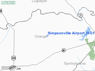
Location & QuickFacts
| FAA Information Effective: | 2008-09-25 |
| Airport Identifier: | VG12 |
| Airport Status: | Operational |
| Longitude/Latitude: | 077-51-58.9800W/38-20-00.4700N
-77.866383/38.333464 (Estimated) |
| Elevation: | 400 ft / 121.92 m (Estimated) |
| Land: | 7 acres |
| From nearest city: | 5 nautical miles NE of Rhoadesville, VA |
| Location: | Orange County, VA |
| Magnetic Variation: | 09W (1995) |
Owner & Manager
| Ownership: | Privately owned |
| Owner: | Randy L Simpson |
| Address: | 29200 Friendship La
Rhoadesville, VA 22542 |
| Phone number: | 540-850-0030 |
| Manager: | Randy L Simpson |
| Address: | 29200 Friendship La
Rhoadesville, VA 22542 |
| Phone number: | 540-850-0030 |
Airport Operations and Facilities
| Airport Use: | Private |
| Wind indicator: | Yes |
| Segmented Circle: | No |
| Control Tower: | No |
| Sectional chart: | Washington |
| Region: | AEA - Eastern |
| Boundary ARTCC: | ZDC - Washington |
| Tie-in FSS: | DCA - Leesburg |
| FSS on Airport: | No |
| FSS Toll Free: | 1-800-WX-BRIEF |
Runway Information
Runway 01/19
| Dimension: | 1900 x 50 ft / 579.1 x 15.2 m |
| Surface: | TURF, Good Condition |
| |
Runway 01 |
Runway 19 |
| Traffic Pattern: | Left | Left |
| Displaced threshold: | 500.00 ft | 0.00 ft |
| Obstruction: | 80 ft trees, 200.0 ft from runway | |
|
Radio Navigation Aids
| ID |
Type |
Name |
Ch |
Freq |
Var |
Dist |
| MSQ | NDB | Nailr | | 351.00 | 10W | 7.5 nm |
| CJR | NDB | Culpeper | | 252.00 | 09W | 11.9 nm |
| IQK | NDB | Louisa | | 382.00 | 09W | 18.8 nm |
| EZF | NDB | Shannon | | 237.00 | 10W | 20.0 nm |
| APH | NDB | A P Hill | | 396.00 | 10W | 29.5 nm |
| LUA | NDB | Caverns | | 245.00 | 09W | 36.0 nm |
| AZS | NDB | Azalea Park | | 336.00 | 08W | 36.4 nm |
| GDX | NDB | Goodwin Lake | | 227.00 | 08W | 37.3 nm |
| LJK | NDB | Ashey | | 280.00 | 09W | 38.3 nm |
| TZ | NDB | Cogan | | 364.00 | 10W | 46.2 nm |
| DC | NDB | Oxonn | | 332.00 | 11W | 47.3 nm |
| VKX | NDB | Potomac | | 241.00 | 10W | 49.5 nm |
| GTN | NDB | Georgetown | | 323.00 | 09W | 50.0 nm |
| CSN | VORTAC | Casanova | 110X | 116.30 | 06W | 18.5 nm |
| GVE | VORTAC | Gordonsville | 103X | 115.60 | 06W | 23.5 nm |
| BRV | VORTAC | Brooke | 092X | 114.50 | 09W | 24.2 nm |
| LDN | VORTAC | Linden | 090X | 114.30 | 06W | 35.1 nm |
| AML | VORTAC | Armel | 082X | 113.50 | 08W | 40.7 nm |
| FAK | VORTAC | Flat Rock | 080X | 113.30 | 06W | 48.4 nm |
| DCA | VOT | Washington National | | 109.40 | | 49.8 nm |
Remarks
- DAYLGT VFR ONLY; BURY OR REMOVE PLINES CROSSING RY; POST SIGN ALERTING VEHICULAR TFC ON ROAD AT END OF RY 19 OF ACFT OPERATING IN AREA; REMOVE TREES END RY 19.
Images and information placed above are from
http://www.airport-data.com/airport/VG12/
We thank them for the data!
| General Info
|
| Country |
United States
|
| State |
VIRGINIA
|
| FAA ID |
VG12
|
| Latitude |
38-20-00.470N
|
| Longitude |
077-51-58.980W
|
| Elevation |
400 feet
|
| Near City |
RHOADESVILLE
|
We don't guarantee the information is fresh and accurate. The data may
be wrong or outdated.
For more up-to-date information please refer to other sources.
|
|


