 |
|
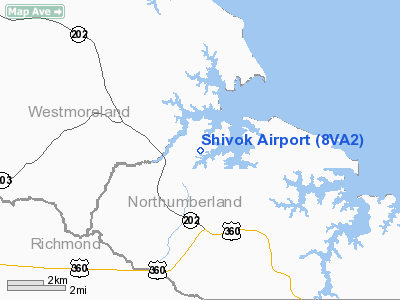
Location & QuickFacts
| FAA Information Effective: | 2008-09-25 |
| Airport Identifier: | 8VA2 |
| Airport Status: | Operational |
| Longitude/Latitude: | 076-33-46.8380W/38-00-32.4680N
-76.563011/38.009019 (Estimated) |
| Elevation: | 22 ft / 6.71 m (Surveyed) |
| Land: | 4 acres |
| From nearest city: | 3 nautical miles N of Callao, VA |
| Location: | Northumberland County, VA |
| Magnetic Variation: | 09W (1985) |
Owner & Manager
| Ownership: | Privately owned |
| Owner: | Ronald J Shivok |
| Address: | P O Box 84, Route 621
Callao, VA 22435 |
| Phone number: | 804-529-6131 |
| Manager: | Ronald J Shivok |
| Address: | P O Box 84, Route 621
Callao, VA 22435 |
| Phone number: | 804-529-6131 |
Airport Operations and Facilities
| Airport Use: | Private |
| Wind indicator: | Yes |
| Segmented Circle: | No |
| Control Tower: | No |
| Sectional chart: | Washington |
| Region: | AEA - Eastern |
| Boundary ARTCC: | ZDC - Washington |
| Tie-in FSS: | DCA - Leesburg |
| FSS Toll Free: | 1-800-WX-BRIEF |
Runway Information
Runway 14/32
| Dimension: | 2300 x 75 ft / 701.0 x 22.9 m |
| Surface: | TURF, Good Condition |
| |
Runway 14 |
Runway 32 |
| Traffic Pattern: | Left | Left |
| Displaced threshold: | 330.00 ft | 0.00 ft |
| Obstruction: | 50 ft trees, 330.0 ft from runway | |
|
Radio Navigation Aids
| ID |
Type |
Name |
Ch |
Freq |
Var |
Dist |
| NHK | NDB | Patuxent | | 400.00 | 10W | 18.3 nm |
| APH | NDB | A P Hill | | 396.00 | 10W | 36.4 nm |
| CGE | NDB | Cambridge | | 355.00 | 10W | 40.5 nm |
| EZF | NDB | Shannon | | 237.00 | 10W | 44.7 nm |
| BDB | NDB | Accomack | | 336.00 | 11W | 44.9 nm |
| LJK | NDB | Ashey | | 280.00 | 09W | 45.7 nm |
| VKX | NDB | Potomac | | 241.00 | 10W | 48.2 nm |
| PXT | VORTAC | Patuxent | 123X | 117.60 | 10W | 18.4 nm |
| HCM | VORTAC | Harcum | 025X | 108.80 | 07W | 34.4 nm |
| BRV | VORTAC | Brooke | 092X | 114.50 | 09W | 42.2 nm |
| OTT | VORTAC | Nottingham | 084X | 113.70 | 10W | 42.8 nm |
| RIC | VORTAC | Richmond | 088X | 114.10 | 09W | 47.1 nm |
| CCV | VORTAC | Cape Charles | 059X | 112.20 | 10W | 48.0 nm |
| HPW | VORTAC | Hopewell | 057X | 112.00 | 06W | 48.6 nm |
| ADW | VOT | Andrews Afb | | 109.60 | | 49.2 nm |
Remarks
- RY 14 DSPLCD 330'; LTR OF AGREEMENT WITH PATUXANT NAS IF OPS PENETRATE RESTRICTED AIRSPACE.
Images and information placed above are from
http://www.airport-data.com/airport/8VA2/
We thank them for the data!
| General Info
|
| Country |
United States
|
| State |
VIRGINIA
|
| FAA ID |
8VA2
|
| Latitude |
38-00-32.468N
|
| Longitude |
076-33-46.838W
|
| Elevation |
22 feet
|
| Near City |
CALLAO
|
We don't guarantee the information is fresh and accurate. The data may
be wrong or outdated.
For more up-to-date information please refer to other sources.
|
|


