 |
|
Shenandoah Valley Rgnl Airport |
| Shenandoah Valley Regional Airport |
| IATA: SHD – ICAO: KSHD – FAA LID: SHD |
| Summary |
| Airport type |
Public |
| Owner |
Shenandoah Valley Regional Airport Comm. |
| Serves |
Staunton / Waynesboro / Harrisonburg |
| Location |
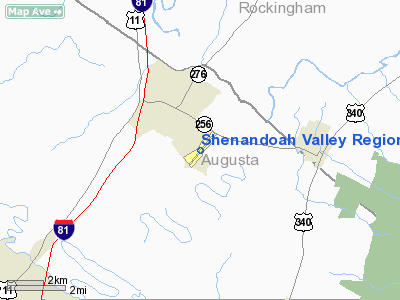
Weyers Cave, Virginia |
| Elevation AMSL |
1,201 ft / 366 m |
| Coordinates |
38°15′50″N 078°53′47″W / 38.26389°N 78.89639°W / 38.26389; -78.89639 |
| Website |
www.FlySHD.com |
| Runways |
| Direction |
Length |
Surface |
| ft |
m |
| 5/23 |
6,002 |
1,829 |
Asphalt |
| Statistics (2006) |
| Aircraft operations |
26,268 |
| Based aircraft |
74 |
| Source: Federal Aviation Administration |
Shenandoah Valley Regional Airport (IATA: SHD, ICAO: KSHD, FAA LID: SHD) is a public airport located in Weyers Cave, 10 miles (16 km) northeast of the central business district of Staunton, in Augusta County, Virginia, United States. It is mostly used for general aviation, but is also served by one commercial airline. Service is subsidized by the Essential Air Service program.
The airport is operated by the Shenandoah Valley Regional Airport Commission, which consists of members from the cities of Staunton, Waynesboro and Harrisonburg, and the counties of Augusta and Rockingham. Facilities and aircraft
Shenandoah Valley Regional Airport covers an area of 433 acres (175 ha) which contains one asphalt paved runway (5/23) measuring 6,002 x 150 ft (1,829 x 46 m).
For the 12-month period ending December 31, 2006, the airport had 26,268 aircraft operations, an average of 71 per day: 91% general aviation, 8% scheduled commercial and 1% military. There are 74 aircraft based at this airport: 68% single engine, 24% multi-engine, 4% helicopters, 3% ultralights and 1% jet aircraft.
Airlines and destinations
| Airlines |
Destinations |
| United Express operated by Colgan Air |
Beckley, Washington-Dulles |
The above content comes from Wikipedia and is published under free licenses – click here to read more.
Location & QuickFacts
| FAA Information Effective: | 2008-09-25 |
| Airport Identifier: | SHD |
| Airport Status: | Operational |
| Longitude/Latitude: | 078-53-47.1596W/38-15-49.8332N
-78.896433/38.263843 (Estimated) |
| Elevation: | 1201 ft / 366.06 m (Surveyed) |
| Land: | 433 acres |
| From nearest city: | 10 nautical miles NE of Staunton/waynesboro/harrisonburg, VA |
| Location: | Augusta County, VA |
| Magnetic Variation: | 07W (1980) |
Owner & Manager
| Ownership: | Publicly owned |
| Owner: | Shenandoah Val Reg Arpt Comm |
| Address: | 77 Aviation Cir.
Weyers Cave, VA 24486 |
| Phone number: | 540-234-8304 |
| Manager: | Gregory W. Campbell |
| Address: | 77 Aviation Cir.
Weyers Cave, VA 24486 |
| Phone number: | 540-234-8304 |
Airport Operations and Facilities
| Airport Use: | Open to public |
| Wind indicator: | Yes |
| Segmented Circle: | No |
| Control Tower: | No |
| Lighting Schedule: | DUSK-DAWN
ACTVT HIRL RY 05/23; MALSR RY 05; REIL RY 23 AND TWY LGTS - CTAF. AT NIGHT HIRL RY 05/23 PRESET LOW INTST. ACTVT MED & HIGH INTST - CTAF. |
| Beacon Color: | Clear-Green (lighted land airport) |
| Landing fee charge: | No |
| Sectional chart: | Washington |
| Region: | AEA - Eastern |
| Boundary ARTCC: | ZDC - Washington |
| Tie-in FSS: | DCA - Leesburg |
| FSS on Airport: | No |
| FSS Toll Free: | 1-800-WX-BRIEF |
| NOTAMs Facility: | SHD (NOTAM-d service avaliable) |
| Certification type/date: | I B S 05/1973
PPR 12 HRS FOR ACR OPNS WITH MORE THAN 30 PSGR SEATS CALL 540-234-8304. |
| Federal Agreements: | NGYH |
Airport Communications
| CTAF: | 123.000 |
| Unicom: | 123.000 |
Airport Services
| Fuel available: | 100LLA |
| Airframe Repair: | MAJOR |
| Power Plant Repair: | MAJOR |
| Bottled Oxygen: | HIGH/LOW |
| Bulk Oxygen: | NONE |
Runway Information
Runway 05/23
| Dimension: | 6002 x 150 ft / 1829.4 x 45.7 m |
| Surface: | ASPH, Good Condition |
| Surface Treatment: | Saw-cut or plastic Grooved |
| Weight Limit: | Single wheel: 75000 lbs.
Dual wheel: 150000 lbs.
Dual tandem wheel: 215000 lbs. |
| Edge Lights: | High |
| |
Runway 05 |
Runway 23 |
| Longitude: | 078-54-10.4276W | 078-53-23.8875W |
| Latitude: | 38-15-26.5245N | 38-16-13.1405N |
| Elevation: | 1174.00 ft | 1201.00 ft |
| Alignment: | 38 | 127 |
| ILS Type: | ILS
| |
| Traffic Pattern: | Left | Left |
| Markings: | Precision instrument, Good Condition | Non-precision instrument, Good Condition |
| Crossing Height: | 60.00 ft | 45.00 ft |
| VASI: | 4-light PAPI on left side | 4-light PAPI on left side |
| Visual Glide Angle: | 3.00° | 3.00° |
| Approach lights: | MALSR | |
| Runway End Identifier: | | Yes |
| Obstruction: | 59 ft pole, 2500.0 ft from runway, 300 ft left of centerline, 38:1 slope to clear | , 50:1 slope to clear
RWY 23 +3' GND 200' FROM THR 320' RIGHT |
|
Radio Navigation Aids
| ID |
Type |
Name |
Ch |
Freq |
Var |
Dist |
| VBW | NDB | Bridgewater | | 241.00 | 07W | 6.8 nm |
| AZS | NDB | Azalea Park | | 336.00 | 08W | 23.5 nm |
| LUA | NDB | Caverns | | 245.00 | 09W | 32.9 nm |
| MSQ | NDB | Nailr | | 351.00 | 10W | 48.1 nm |
| MOL | VOR/DME | Montebello | 100X | 115.30 | 05W | 24.0 nm |
| GVE | VORTAC | Gordonsville | 103X | 115.60 | 06W | 38.2 nm |
| LDN | VORTAC | Linden | 090X | 114.30 | 06W | 48.1 nm |
Images and information placed above are from
http://www.airport-data.com/airport/SHD/
We thank them for the data!
| General Info
|
| Country |
United States
|
| State |
VIRGINIA
|
| FAA ID |
SHD
|
| Latitude |
38-15-49.836N
|
| Longitude |
078-53-47.177W
|
| Elevation |
1201 feet
|
| Near City |
STAUNTON/WAYNESB/HARRISONB
|
We don't guarantee the information is fresh and accurate. The data may
be wrong or outdated.
For more up-to-date information please refer to other sources.
|
|


