 |
|
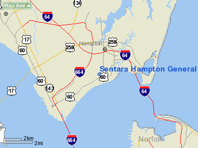
Sentara Hampton General Hospital Heliport |
Location & QuickFacts
| FAA Information Effective: | 2008-09-25 |
| Airport Identifier: | 71VA |
| Airport Status: | Operational |
| Longitude/Latitude: | 076-22-06.8020W/37-00-39.5290N
-76.368556/37.010980 (Estimated) |
| Elevation: | 25 ft / 7.62 m (Estimated) |
| Land: | 0 acres |
| From nearest city: | 0 nautical miles N of Hampton, VA |
| Location: | Hampton County, VA |
| Magnetic Variation: | 09W (1985) |
Owner & Manager
| Ownership: | Privately owned |
| Owner: | Sentara Hampton Gen Hospital |
| Address: | 3120 Victoria Blvd
Hampton, VA 23661 |
| Phone number: | 804-727-7242 |
| Manager: | Carl B. Tweedt |
| Address: | 3120 Victoria Blvd
Hampton, VA 23661 |
| Phone number: | 804-727-7242 |
Airport Operations and Facilities
| Airport Use: | Private
MEDICAL USE. |
| Wind indicator: | Yes |
| Segmented Circle: | No |
| Control Tower: | No |
| Landing fee charge: | No |
| Sectional chart: | Washington |
| Region: | AEA - Eastern |
| Boundary ARTCC: | ZDC - Washington |
| Tie-in FSS: | DCA - Leesburg |
| FSS Toll Free: | 1-800-WX-BRIEF |
Runway Information
Helipad H1
| Dimension: | 40 x 40 ft / 12.2 x 12.2 m |
| Surface: | TURF, |
| Edge Lights: | Medium
NORTH-EAST/SOUTH-WEST LEAD IN LGTS. LGTG CONTROLLED BY ATTENDANT IN HOSPITAL. |
| |
Runway H1 |
Runway |
| Traffic Pattern: | Left | Left |
|
Radio Navigation Aids
| ID |
Type |
Name |
Ch |
Freq |
Var |
Dist |
| PJS | NDB | Henry | | 375.00 | 09W | 9.5 nm |
| FAF | NDB | Felker | | 226.00 | 08W | 14.2 nm |
| PVG | NDB | Portsmouth | | 241.00 | 10W | 14.4 nm |
| EY | NDB | Chesi | | 233.00 | 09W | 24.7 nm |
| RK | NDB | Waley | | 249.00 | 10W | 28.2 nm |
| AKQ | NDB | Wakefield | | 274.00 | 09W | 30.4 nm |
| BDB | NDB | Accomack | | 336.00 | 11W | 43.3 nm |
| LLW | NDB | Woodville | | 254.00 | 10W | 45.1 nm |
| LFI | TACAN | Langley | 070X | | 10W | 4.5 nm |
| NGU | TACAN | Chambers | 048X | | 10W | 6.1 nm |
| NTU | TACAN | Oceana | 113X | | 10W | 19.5 nm |
| ECG | VOR/DME | Elizabeth City | 072X | 112.50 | 07W | 46.2 nm |
| ORF | VORTAC | Norfolk | 116X | 116.90 | 07W | 10.8 nm |
| CCV | VORTAC | Cape Charles | 059X | 112.20 | 10W | 26.9 nm |
| HCM | VORTAC | Harcum | 025X | 108.80 | 07W | 31.0 nm |
| FKN | VORTAC | Franklin | 043X | 110.60 | 09W | 35.7 nm |
| HPW | VORTAC | Hopewell | 057X | 112.00 | 06W | 40.6 nm |
| CVI | VORTAC | Cofield | 093X | 114.60 | 09W | 45.4 nm |
Images and information placed above are from
http://www.airport-data.com/airport/71VA/
We thank them for the data!
| General Info
|
| Country |
United States
|
| State |
VIRGINIA
|
| FAA ID |
71VA
|
| Latitude |
37-00-39.529N
|
| Longitude |
076-22-06.802W
|
| Elevation |
25 feet
|
| Near City |
HAMPTON
|
We don't guarantee the information is fresh and accurate. The data may
be wrong or outdated.
For more up-to-date information please refer to other sources.
|
|


