 |
|
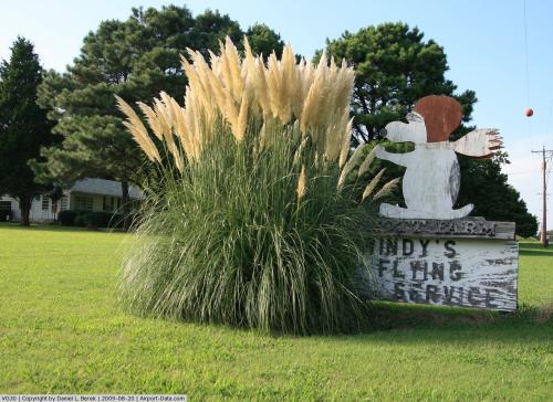 |
(Click on the photo to enlarge) |
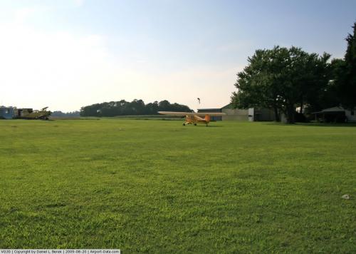 |
(Click on the photo to enlarge) |
Location & QuickFacts
| FAA Information Effective: | 2008-09-25 |
| Airport Identifier: | VG30 |
| Airport Status: | Operational |
| Longitude/Latitude: | 075-58-36.7530W/37-13-37.5020N
-75.976876/37.227084 (Estimated) |
| Elevation: | 33 ft / 10.06 m (Estimated) |
| Land: | 0 acres |
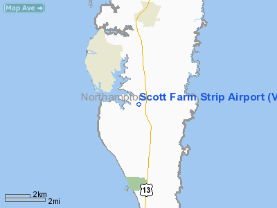
| From nearest city: | 4 nautical miles SE of Cape Charles, VA |
| Location: | Northampton County, VA |
| Magnetic Variation: | 10W (1985) |
Owner & Manager
| Ownership: | Privately owned |
| Owner: | Page Nottingham Scott |
| Address: | 25492 Lankford Hwy
Cape Charles, VA 23310 |
| Phone number: | 757-331-3615 |
| Manager: | Page Scott |
| Address: | 25492 Lankford Hwy
Cape Charles, VA 23310 |
| Phone number: | 757-331-3615 |
Airport Operations and Facilities
| Airport Use: | Private |
| Wind indicator: | Yes |
| Segmented Circle: | No |
| Control Tower: | No |
| Landing fee charge: | No |
| Sectional chart: | Washington |
| Region: | AEA - Eastern |
| Boundary ARTCC: | ZDC - Washington |
| Tie-in FSS: | DCA - Leesburg |
| FSS on Airport: | No |
| FSS Toll Free: | 1-800-WX-BRIEF |
Airport Services
| Airframe Repair: | NONE |
| Power Plant Repair: | NONE |
Runway Information
Runway 10/28
| Dimension: | 2200 x 60 ft / 670.6 x 18.3 m |
| Surface: | TURF, |
| |
Runway 10 |
Runway 28 |
| Traffic Pattern: | Left | Left |
|
Runway 18/36
| Dimension: | 1300 x 60 ft / 396.2 x 18.3 m |
| Surface: | TURF, |
| |
Runway 18 |
Runway 36 |
| Traffic Pattern: | Left | Left |
|
Radio Navigation Aids
| ID |
Type |
Name |
Ch |
Freq |
Var |
Dist |
| BDB | NDB | Accomack | | 336.00 | 11W | 22.3 nm |
| PJS | NDB | Henry | | 375.00 | 09W | 25.4 nm |
| FAF | NDB | Felker | | 226.00 | 08W | 31.2 nm |
| PVG | NDB | Portsmouth | | 241.00 | 10W | 35.0 nm |
| EY | NDB | Chesi | | 233.00 | 09W | 42.4 nm |
| RK | NDB | Waley | | 249.00 | 10W | 49.7 nm |
| LFI | TACAN | Langley | 070X | | 10W | 20.2 nm |
| NGU | TACAN | Chambers | 048X | | 10W | 22.5 nm |
| NTU | TACAN | Oceana | 113X | | 10W | 24.4 nm |
| CCV | VORTAC | Cape Charles | 059X | 112.20 | 10W | 7.3 nm |
| ORF | VORTAC | Norfolk | 116X | 116.90 | 07W | 22.8 nm |
| HCM | VORTAC | Harcum | 025X | 108.80 | 07W | 37.5 nm |
Images and information placed above are from
http://www.airport-data.com/airport/VG30/
We thank them for the data!
| General Info
|
| Country |
United States
|
| State |
VIRGINIA
|
| FAA ID |
VG30
|
| Latitude |
37-13-37.502N
|
| Longitude |
075-58-36.753W
|
| Elevation |
33 feet
|
| Near City |
CAPE CHARLES
|
We don't guarantee the information is fresh and accurate. The data may
be wrong or outdated.
For more up-to-date information please refer to other sources.
|
|


