 |
|
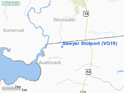
Location & QuickFacts
| FAA Information Effective: | 2008-09-25 |
| Airport Identifier: | VG19 |
| Airport Status: | Operational |
| Longitude/Latitude: | 075-35-30.7360W/37-59-26.4430N
-75.591871/37.990679 (Estimated) |
| Elevation: | 13 ft / 3.96 m (Estimated) |
| Land: | 3 acres |
| From nearest city: | 3 nautical miles W of New Church, VA |
| Location: | Accomack County, VA |
| Magnetic Variation: | 10W (1985) |
Owner & Manager
| Ownership: | Privately owned |
| Owner: | R. L. Sawyer |
| Address: | 4891 Miles Rd
New Church, VA 23415 |
| Phone number: | R. L. SAWYER |
| Manager: | R.l.sawyer |
| Address: | 4891 Miles Rd
New Church, VA 23415 |
| Phone number: | 757-824-4648 |
Airport Operations and Facilities
| Airport Use: | Private |
| Wind indicator: | Yes |
| Segmented Circle: | No |
| Control Tower: | No |
| Landing fee charge: | No |
| Sectional chart: | Washington |
| Region: | AEA - Eastern |
| Boundary ARTCC: | ZDC - Washington |
| Tie-in FSS: | DCA - Leesburg |
| FSS on Airport: | No |
| FSS Toll Free: | 1-800-WX-BRIEF |
Airport Communications
Airport Services
| Airframe Repair: | NONE |
| Power Plant Repair: | NONE |
| Bottled Oxygen: | NONE |
| Bulk Oxygen: | NONE |
Runway Information
Runway 10U/28U
| Dimension: | 1050 x 60 ft / 320.0 x 18.3 m |
| Surface: | TURF, Good Condition |
| |
Runway 10U |
Runway 28U |
| Traffic Pattern: | Left | Left |
|
Runway 17S/35S
| Dimension: | 1660 x 60 ft / 506.0 x 18.3 m |
| Surface: | TURF, Good Condition |
| |
Runway 17S |
Runway 35S |
| Traffic Pattern: | Left | Left |
| Obstruction: | 10 ft tree, 10.0 ft from runway, 30 ft right of centerline, 1:1 slope to clear | 16 ft road, 1:1 slope to clear |
|
Radio Navigation Aids
| ID |
Type |
Name |
Ch |
Freq |
Var |
Dist |
| BDB | NDB | Accomack | | 336.00 | 11W | 27.1 nm |
| OX | NDB | Landy | | 407.00 | 12W | 29.1 nm |
| CGE | NDB | Cambridge | | 355.00 | 10W | 38.9 nm |
| NHK | NDB | Patuxent | | 400.00 | 10W | 42.3 nm |
| SWL | VORTAC | Snow Hill | 071X | 112.40 | 08W | 7.2 nm |
| SBY | VORTAC | Salisbury | 049X | 111.20 | 12W | 21.6 nm |
| PXT | VORTAC | Patuxent | 123X | 117.60 | 10W | 42.2 nm |
| CCV | VORTAC | Cape Charles | 059X | 112.20 | 10W | 43.2 nm |
Remarks
- SEE AIRSPACE LETTER DATED 2/1/93.
Images and information placed above are from
http://www.airport-data.com/airport/VG19/
We thank them for the data!
| General Info
|
| Country |
United States
|
| State |
VIRGINIA
|
| FAA ID |
VG19
|
| Latitude |
37-59-26.443N
|
| Longitude |
075-35-30.736W
|
| Elevation |
13 feet
|
| Near City |
NEW CHURCH
|
We don't guarantee the information is fresh and accurate. The data may
be wrong or outdated.
For more up-to-date information please refer to other sources.
|
|


