 |
|
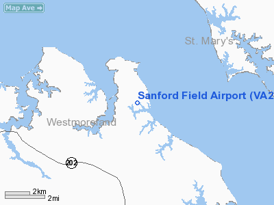
Location & QuickFacts
| FAA Information Effective: | 2008-09-25 |
| Airport Identifier: | VA23 |
| Airport Status: | Operational |
| Longitude/Latitude: | 076-36-48.8480W/38-07-08.4640N
-76.613569/38.119018 (Estimated) |
| Elevation: | 15 ft / 4.57 m (Estimated) |
| Land: | 0 acres |
| From nearest city: | 2 nautical miles SE of Coles Point, VA |
| Location: | Westmoreland County, VA |
| Magnetic Variation: | 09W (1985) |
Owner & Manager
| Ownership: | Privately owned |
| Owner: | George W. Sanford, Jr. |
| Address: | Box 534
Montross, VA 22520 |
| Phone number: | 804-493-8717 |
| Manager: | George W. Sanford, Jr. |
| Address: | Box 534
Montross, VA 22520 |
| Phone number: | 804-493-8717 |
Airport Operations and Facilities
| Airport Use: | Private |
| Wind indicator: | Yes |
| Segmented Circle: | No |
| Control Tower: | No |
| Landing fee charge: | No |
| Sectional chart: | Washington |
| Region: | AEA - Eastern |
| Boundary ARTCC: | ZDC - Washington |
| Tie-in FSS: | DCA - Leesburg |
| FSS on Airport: | No |
| FSS Toll Free: | 1-800-WX-BRIEF |
Airport Services
| Airframe Repair: | NONE |
| Power Plant Repair: | NONE |
Runway Information
Runway 17/35
| Dimension: | 2000 x 60 ft / 609.6 x 18.3 m |
| Surface: | TURF, |
| |
Runway 17 |
Runway 35 |
| Traffic Pattern: | Left | Left |
| Obstruction: | 40 ft pline, 600.0 ft from runway | 40 ft trees, 1200.0 ft from runway |
|
Radio Navigation Aids
| ID |
Type |
Name |
Ch |
Freq |
Var |
Dist |
| NHK | NDB | Patuxent | | 400.00 | 10W | 14.1 nm |
| APH | NDB | A P Hill | | 396.00 | 10W | 33.7 nm |
| CGE | NDB | Cambridge | | 355.00 | 10W | 37.2 nm |
| EZF | NDB | Shannon | | 237.00 | 10W | 40.5 nm |
| VKX | NDB | Potomac | | 241.00 | 10W | 41.2 nm |
| DC | NDB | Oxonn | | 332.00 | 11W | 43.5 nm |
| LJK | NDB | Ashey | | 280.00 | 09W | 46.0 nm |
| ESN | NDB | Easton | | 212.00 | 10W | 48.5 nm |
| DCA | VOR/DME | Washington | 047X | 111.00 | 09W | 48.8 nm |
| PXT | VORTAC | Patuxent | 123X | 117.60 | 10W | 14.3 nm |
| OTT | VORTAC | Nottingham | 084X | 113.70 | 10W | 35.8 nm |
| BRV | VORTAC | Brooke | 092X | 114.50 | 09W | 37.3 nm |
| HCM | VORTAC | Harcum | 025X | 108.80 | 07W | 40.6 nm |
| ADW | VORTAC | Andrews | 078X | 113.10 | 10W | 43.0 nm |
| ADW | VOT | Andrews Afb | | 109.60 | | 42.1 nm |
| DCA | VOT | Washington National | | 109.40 | | 47.9 nm |
Remarks
Images and information placed above are from
http://www.airport-data.com/airport/VA23/
We thank them for the data!
| General Info
|
| Country |
United States
|
| State |
VIRGINIA
|
| FAA ID |
VA23
|
| Latitude |
38-07-08.464N
|
| Longitude |
076-36-48.848W
|
| Elevation |
15 feet
|
| Near City |
COLES POINT
|
We don't guarantee the information is fresh and accurate. The data may
be wrong or outdated.
For more up-to-date information please refer to other sources.
|
|


