 |
|
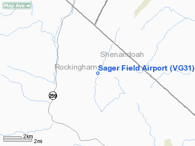
Location & QuickFacts
| FAA Information Effective: | 2008-09-25 |
| Airport Identifier: | VG31 |
| Airport Status: | Operational |
| Longitude/Latitude: | 078-51-50.0900W/38-42-48.4150N
-78.863914/38.713449 (Estimated) |
| Elevation: | 1280 ft / 390.14 m (Estimated) |
| Land: | 0 acres |
| From nearest city: | 7 nautical miles NW of Broadway, VA |
| Location: | Rockingham County, VA |
| Magnetic Variation: | 08W (1985) |
Owner & Manager
| Ownership: | Privately owned |
| Owner: | Preston L. Sager |
| Address: | Rt 2
Broadway, VA 22815 |
| Phone number: | 703-896-1245 |
| Address: |
|
Airport Operations and Facilities
| Airport Use: | Private |
| Wind indicator: | Yes |
| Segmented Circle: | No |
| Control Tower: | No |
| Landing fee charge: | No |
| Sectional chart: | Washington |
| Region: | AEA - Eastern |
| Boundary ARTCC: | ZDC - Washington |
| Tie-in FSS: | DCA - Leesburg |
| FSS on Airport: | No |
| FSS Toll Free: | 1-800-WX-BRIEF |
Airport Services
| Airframe Repair: | NONE |
| Power Plant Repair: | NONE |
Runway Information
Runway NE/SW
| Dimension: | 1500 x 100 ft / 457.2 x 30.5 m |
| Surface: | TURF, |
| |
Runway NE |
Runway SW |
| Traffic Pattern: | Left | Right |
|
Radio Navigation Aids
| ID |
Type |
Name |
Ch |
Freq |
Var |
Dist |
| LUA | NDB | Caverns | | 245.00 | 09W | 18.4 nm |
| VBW | NDB | Bridgewater | | 241.00 | 07W | 21.4 nm |
| TZ | NDB | Cogan | | 364.00 | 10W | 43.4 nm |
| AZS | NDB | Azalea Park | | 336.00 | 08W | 45.3 nm |
| MSQ | NDB | Nailr | | 351.00 | 10W | 47.7 nm |
| RQY | NDB | Randolph County | | 284.00 | 07W | 47.9 nm |
| CJR | NDB | Culpeper | | 252.00 | 09W | 48.5 nm |
| ESL | VOR/DME | Kessel | 045X | 110.80 | 06W | 31.3 nm |
| LDN | VORTAC | Linden | 090X | 114.30 | 06W | 32.0 nm |
| CSN | VORTAC | Casanova | 110X | 116.30 | 06W | 47.0 nm |
Images and information placed above are from
http://www.airport-data.com/airport/VG31/
We thank them for the data!
| General Info
|
| Country |
United States
|
| State |
VIRGINIA
|
| FAA ID |
VG31
|
| Latitude |
38-42-48.415N
|
| Longitude |
078-51-50.090W
|
| Elevation |
1280 feet
|
| Near City |
BROADWAY
|
We don't guarantee the information is fresh and accurate. The data may
be wrong or outdated.
For more up-to-date information please refer to other sources.
|
|


