 |
|
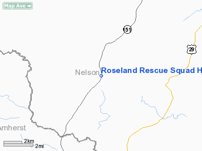
Roseland Rescue Squad Heliport |
Location & QuickFacts
| FAA Information Effective: | 2008-09-25 |
| Airport Identifier: | 6VA6 |
| Airport Status: | Operational |
| Longitude/Latitude: | 078-58-44.0880W/37-45-47.5050N
-78.978913/37.763196 (Estimated) |
| Elevation: | 720 ft / 219.46 m (Estimated) |
| Land: | 0 acres |
| From nearest city: | 0 nautical miles N of Roseland, VA |
| Location: | Nelson County, VA |
| Magnetic Variation: | 08W (1990) |
Owner & Manager
| Ownership: | Privately owned |
| Owner: | Roseland Rescue Squad, Inc. |
| Address: | P O Box 39
Roseland, VA 22967 |
| Phone number: | 804-277-5911 |
| Manager: | George W Gunter |
| Address: | P O Box 5
Roseland, VA 22967 |
| Phone number: | 804-277-5558 |
Airport Operations and Facilities
| Airport Use: | Private |
| Wind indicator: | Yes |
| Segmented Circle: | No |
| Control Tower: | No |
| Lighting Schedule: | PHONE REQ
FOR PERIMETER LGTS CALL 804-263-4242. |
| Sectional chart: | Washington |
| Region: | AEA - Eastern |
| Boundary ARTCC: | ZDC - Washington |
| Tie-in FSS: | DCA - Leesburg |
| FSS Toll Free: | 1-800-WX-BRIEF |
Runway Information
Helipad H1
| Dimension: | 30 x 30 ft / 9.1 x 9.1 m |
| Surface: | CONC, |
| Edge Lights: | Non-standard lighting system
NSTD PERIMETER LGTS; NOT K-961. |
| |
Runway H1 |
Runway |
| Traffic Pattern: | Left | Left |
| Obstruction: | 35 ft tree, 300.0 ft from runway | |
|
Radio Navigation Aids
| ID |
Type |
Name |
Ch |
Freq |
Var |
Dist |
| AZS | NDB | Azalea Park | | 336.00 | 08W | 26.4 nm |
| LY | NDB | Bojar | | 385.00 | 08W | 32.6 nm |
| FVX | NDB | Farmville | | 367.00 | 07W | 35.7 nm |
| VBW | NDB | Bridgewater | | 241.00 | 07W | 36.2 nm |
| MOL | VOR/DME | Montebello | 100X | 115.30 | 05W | 10.2 nm |
| LYH | VORTAC | Lynchburg | 029X | 109.20 | 05W | 32.9 nm |
| GVE | VORTAC | Gordonsville | 103X | 115.60 | 06W | 42.0 nm |
Remarks
- PRVDD OPNS CONDUCTED IN VFR ONLY AND YOU COORDINATE YOUR OPNS WITH FLATWOODS PR ARPT TO ESTABLISH TRAFFIC PATTERN COMPATIBLE FOR BOTH OPNS.
Images and information placed above are from
http://www.airport-data.com/airport/6VA6/
We thank them for the data!
| General Info
|
| Country |
United States
|
| State |
VIRGINIA
|
| FAA ID |
6VA6
|
| Latitude |
37-45-47.505N
|
| Longitude |
078-58-44.088W
|
| Elevation |
720 feet
|
| Near City |
ROSELAND
|
We don't guarantee the information is fresh and accurate. The data may
be wrong or outdated.
For more up-to-date information please refer to other sources.
|
|


