 |
|
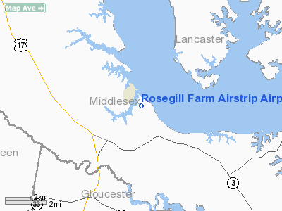
Rosegill Farm Airstrip Airport |
Location & QuickFacts
| FAA Information Effective: | 2008-09-25 |
| Airport Identifier: | 2VA5 |
| Airport Status: | Operational |
| Longitude/Latitude: | 076-33-53.8290W/37-37-50.5040N
-76.564953/37.630696 (Estimated) |
| Elevation: | 32 ft / 9.75 m (Surveyed) |
| Land: | 0 acres |
| From nearest city: | 1 nautical miles E of Urbanna, VA |
| Location: | Middlesex County, VA |
| Magnetic Variation: | 09W (1985) |
Owner & Manager
| Ownership: | Privately owned |
| Owner: | Alfred P. Scott |
| Address: | Po Box 6861
Richmond, VA 23230 |
| Phone number: | 804-353-1713 |
| Address: |
|
Airport Operations and Facilities
| Airport Use: | Private |
| Wind indicator: | Yes |
| Segmented Circle: | No |
| Control Tower: | No |
| Landing fee charge: | No |
| Sectional chart: | Washington |
| Region: | AEA - Eastern |
| Boundary ARTCC: | ZDC - Washington |
| Tie-in FSS: | DCA - Leesburg |
| FSS on Airport: | No |
| FSS Toll Free: | 1-800-WX-BRIEF |
Airport Services
| Airframe Repair: | NONE |
| Power Plant Repair: | NONE |
Runway Information
Runway 01/19
| Dimension: | 2400 x 200 ft / 731.5 x 61.0 m |
| Surface: | TURF, |
| |
Runway 01 |
Runway 19 |
| Traffic Pattern: | Left | Left |
|
Radio Navigation Aids
| ID |
Type |
Name |
Ch |
Freq |
Var |
Dist |
| FAF | NDB | Felker | | 226.00 | 08W | 29.7 nm |
| PJS | NDB | Henry | | 375.00 | 09W | 30.1 nm |
| BDB | NDB | Accomack | | 336.00 | 11W | 36.7 nm |
| NHK | NDB | Patuxent | | 400.00 | 10W | 40.1 nm |
| AKQ | NDB | Wakefield | | 274.00 | 09W | 44.2 nm |
| LJK | NDB | Ashey | | 280.00 | 09W | 44.3 nm |
| APH | NDB | A P Hill | | 396.00 | 10W | 45.3 nm |
| CF | NDB | Pubbs | | 392.00 | 09W | 46.0 nm |
| LFI | TACAN | Langley | 070X | | 10W | 34.2 nm |
| NGU | TACAN | Chambers | 048X | | 10W | 43.7 nm |
| HCM | VORTAC | Harcum | 025X | 108.80 | 07W | 13.0 nm |
| HPW | VORTAC | Hopewell | 057X | 112.00 | 06W | 31.9 nm |
| CCV | VORTAC | Cape Charles | 059X | 112.20 | 10W | 32.0 nm |
| RIC | VORTAC | Richmond | 088X | 114.10 | 09W | 36.8 nm |
| PXT | VORTAC | Patuxent | 123X | 117.60 | 10W | 40.3 nm |
| ORF | VORTAC | Norfolk | 116X | 116.90 | 07W | 47.7 nm |
Images and information placed above are from
http://www.airport-data.com/airport/2VA5/
We thank them for the data!
| General Info
|
| Country |
United States
|
| State |
VIRGINIA
|
| FAA ID |
2VA5
|
| Latitude |
37-37-50.504N
|
| Longitude |
076-33-53.829W
|
| Elevation |
32 feet
|
| Near City |
URBANNA
|
We don't guarantee the information is fresh and accurate. The data may
be wrong or outdated.
For more up-to-date information please refer to other sources.
|
|


