 |
|
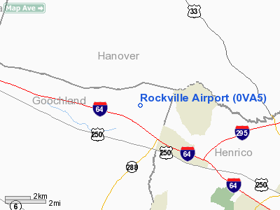
Location & QuickFacts
| FAA Information Effective: | 2008-09-25 |
| Airport Identifier: | 0VA5 |
| Airport Status: | Operational |
| Longitude/Latitude: | 077-39-41.9640W/37-41-39.5220N
-77.661657/37.694312 (Estimated) |
| Elevation: | 280 ft / 85.34 m (Surveyed) |
| Land: | 0 acres |
| From nearest city: | 13 nautical miles NW of Richmond, VA |
| Location: | Goochland County, VA |
| Magnetic Variation: | 08W (1985) |
Owner & Manager
| Ownership: | Privately owned |
| Owner: | Luck Stone Corp. |
| Address: | P.o. Box 29682
23242-0682 |
| Phone number: | 804-784-3335 |
| Manager: | Larry Blackmon |
| Address: | Box 29682
Richmond, VA 23242-0682 |
| Phone number: | 804-784-6361
OR ARPT OFFICE 804-749-3953; 784-3335 |
Airport Operations and Facilities
| Airport Use: | Private |
| Wind indicator: | Yes |
| Segmented Circle: | No |
| Control Tower: | No |
| Landing fee charge: | No |
| Sectional chart: | Washington |
| Region: | AEA - Eastern |
| Boundary ARTCC: | ZDC - Washington |
| Tie-in FSS: | DCA - Leesburg |
| FSS on Airport: | No |
| FSS Toll Free: | 1-800-WX-BRIEF |
Airport Services
| Airframe Repair: | NONE |
| Power Plant Repair: | NONE |
Runway Information
Runway 04/22
| Dimension: | 3900 x 60 ft / 1188.7 x 18.3 m |
| Surface: | ASPH, |
| |
Runway 04 |
Runway 22 |
| Traffic Pattern: | Left | Right |
| Displaced threshold: | 200.00 ft | 200.00 ft |
|
Radio Navigation Aids
| ID |
Type |
Name |
Ch |
Freq |
Var |
Dist |
| LJK | NDB | Ashey | | 280.00 | 09W | 9.9 nm |
| IQK | NDB | Louisa | | 382.00 | 09W | 21.7 nm |
| CF | NDB | Pubbs | | 392.00 | 09W | 23.9 nm |
| APH | NDB | A P Hill | | 396.00 | 10W | 28.5 nm |
| PTB | NDB | Petersburg | | 284.00 | 08W | 34.2 nm |
| EZF | NDB | Shannon | | 237.00 | 10W | 35.8 nm |
| BKT | NDB | Blackstone | | 326.00 | 09W | 38.7 nm |
| FVX | NDB | Farmville | | 367.00 | 07W | 42.3 nm |
| AZS | NDB | Azalea Park | | 336.00 | 08W | 44.9 nm |
| MSQ | NDB | Nailr | | 351.00 | 10W | 47.1 nm |
| FAK | VORTAC | Flat Rock | 080X | 113.30 | 06W | 12.7 nm |
| RIC | VORTAC | Richmond | 088X | 114.10 | 09W | 19.9 nm |
| GVE | VORTAC | Gordonsville | 103X | 115.60 | 06W | 30.2 nm |
| HPW | VORTAC | Hopewell | 057X | 112.00 | 06W | 34.1 nm |
| BRV | VORTAC | Brooke | 092X | 114.50 | 09W | 41.3 nm |
| HCM | VORTAC | Harcum | 025X | 108.80 | 07W | 47.6 nm |
Remarks
- PRVDD TREES, AS INDICATED ON SUBMITTED LAYOUT SKETCH, ARE REMOVED OR LOWERED TO ENSURE PROPER CLEARANCE OF THE ARPT IMAGINARY SFCS AS DEFINED IN FAR PART 77, SECTION 77.25.
Images and information placed above are from
http://www.airport-data.com/airport/0VA5/
We thank them for the data!
| General Info
|
| Country |
United States
|
| State |
VIRGINIA
|
| FAA ID |
0VA5
|
| Latitude |
37-41-39.522N
|
| Longitude |
077-39-41.964W
|
| Elevation |
280 feet
|
| Near City |
RICHMOND
|
We don't guarantee the information is fresh and accurate. The data may
be wrong or outdated.
For more up-to-date information please refer to other sources.
|
|


