 |
|
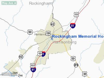
Rockingham Memorial Hospital Heliport |
Location & QuickFacts
| FAA Information Effective: | 2008-09-25 |
| Airport Identifier: | VA47 |
| Airport Status: | Operational |
| Longitude/Latitude: | 078-52-19.0960W/38-26-24.4480N
-78.871971/38.440124 (Estimated) |
| Elevation: | 1360 ft / 414.53 m (Estimated) |
| Land: | 1 acres |
| From nearest city: | 0 nautical miles N of Harrisonburg, VA |
| Location: | Rockingham County, VA |
| Magnetic Variation: | 08W (1985) |
Owner & Manager
| Ownership: | Privately owned |
| Owner: | James Madison University |
| Address: | 235 Cantrell Ave
Harrisonburg, VA 22801 |
| Phone number: | 540-433-4580 |
| Manager: | Dennis Coffman |
| Address: | 235 Cantrell Ave
Harrisonburg, VA 22801 |
| Phone number: | 703-433-4394 |
Airport Operations and Facilities
| Airport Use: | Private
MEDICAL USE. |
| Wind indicator: | Yes |
| Segmented Circle: | No |
| Control Tower: | No |
| Lighting Schedule: | DUSK-DAWN |
| Sectional chart: | Washington |
| Region: | AEA - Eastern |
| Boundary ARTCC: | ZDC - Washington |
| Tie-in FSS: | DCA - Leesburg |
| FSS on Airport: | No |
| FSS Toll Free: | 1-800-WX-BRIEF |
Runway Information
Helipad H1
| Dimension: | 60 x 60 ft / 18.3 x 18.3 m |
| Surface: | MATS,
ROOFTOP. |
| |
Runway H1 |
Runway |
| Traffic Pattern: | Left | Left |
|
Radio Navigation Aids
| ID |
Type |
Name |
Ch |
Freq |
Var |
Dist |
| VBW | NDB | Bridgewater | | 241.00 | 07W | 6.1 nm |
| LUA | NDB | Caverns | | 245.00 | 09W | 24.4 nm |
| AZS | NDB | Azalea Park | | 336.00 | 08W | 30.8 nm |
| MSQ | NDB | Nailr | | 351.00 | 10W | 45.5 nm |
| CJR | NDB | Culpeper | | 252.00 | 09W | 48.0 nm |
| MOL | VOR/DME | Montebello | 100X | 115.30 | 05W | 34.3 nm |
| ESL | VOR/DME | Kessel | 045X | 110.80 | 06W | 47.5 nm |
| LDN | VORTAC | Linden | 090X | 114.30 | 06W | 40.0 nm |
| GVE | VORTAC | Gordonsville | 103X | 115.60 | 06W | 42.5 nm |
| CSN | VORTAC | Casanova | 110X | 116.30 | 06W | 48.8 nm |
Remarks
- SEE AIRSPACE DETERMINATION DTD 07 OCT 1998.
Images and information placed above are from
http://www.airport-data.com/airport/VA47/
We thank them for the data!
| General Info
|
| Country |
United States
|
| State |
VIRGINIA
|
| FAA ID |
VA47
|
| Latitude |
38-26-24.448N
|
| Longitude |
078-52-19.096W
|
| Elevation |
1360 feet
|
| Near City |
HARRISONBURG
|
We don't guarantee the information is fresh and accurate. The data may
be wrong or outdated.
For more up-to-date information please refer to other sources.
|
|


