 |
|
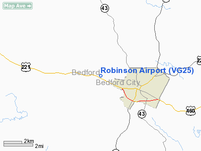
Location & QuickFacts
| FAA Information Effective: | 2008-09-25 |
| Airport Identifier: | VG25 |
| Airport Status: | Operational |
| Longitude/Latitude: | 079-34-19.1200W/37-20-54.5040N
-79.571978/37.348473 (Estimated) |
| Elevation: | 850 ft / 259.08 m (Estimated) |
| Land: | 0 acres |
| From nearest city: | 1 nautical miles W of Bedford, VA |
| Location: | Bedford County, VA |
| Magnetic Variation: | 07W (1985) |
Owner & Manager
| Ownership: | Privately owned |
| Owner: | Jerry W. Mullins |
| Address: | Po Box 908
Salem, VA 24153 |
| Phone number: | 540-537-2406 |
| Manager: | Jerry W. Mullins |
| Address: | Po Box 908
Salem, VA 24153 |
| Phone number: | 540-537-2406 |
Airport Operations and Facilities
| Airport Use: | Private |
| Wind indicator: | No |
| Segmented Circle: | No |
| Control Tower: | No |
| Landing fee charge: | No |
| Sectional chart: | Cincinnati |
| Region: | AEA - Eastern |
| Boundary ARTCC: | ZDC - Washington |
| Tie-in FSS: | DCA - Leesburg |
| FSS on Airport: | No |
| FSS Toll Free: | 1-800-WX-BRIEF |
Airport Services
| Airframe Repair: | NONE |
| Power Plant Repair: | NONE |
Runway Information
Runway 05/23
| Dimension: | 2800 x 100 ft / 853.4 x 30.5 m |
| Surface: | TURF, |
| |
Runway 05 |
Runway 23 |
| Traffic Pattern: | Left | Left |
| Obstruction: | 75 ft pline, 1300.0 ft from runway | |
|
Radio Navigation Aids
| ID |
Type |
Name |
Ch |
Freq |
Var |
Dist |
| LY | NDB | Bojar | | 385.00 | 08W | 16.5 nm |
| VIT | NDB | Vinton | | 277.00 | 06W | 17.2 nm |
| CNQ | NDB | Callahan | | 379.00 | 05W | 28.5 nm |
| TEC | NDB | Tech | | 368.00 | 06W | 40.6 nm |
| UV | NDB | Bales | | 396.00 | 07W | 48.5 nm |
| ODR | VOR | Woodrum | | 114.90 | 06W | 19.5 nm |
| DAN | VOR | Danville | | 113.10 | 06W | 48.2 nm |
| MOL | VOR/DME | Montebello | 100X | 115.30 | 05W | 39.9 nm |
| LWB | VOR/DME | Greenbrier | 107Y | 116.05 | 08W | 49.8 nm |
| LYH | VORTAC | Lynchburg | 029X | 109.20 | 05W | 17.0 nm |
| ROA | VORTAC | Roanoke | 031X | 109.40 | 04W | 23.8 nm |
| SBV | VORTAC | South Boston | 041X | 110.40 | 05W | 48.5 nm |
Remarks
- PERSNL USE ONLY,PRESENT LCTN SINCE 1945.
Images and information placed above are from
http://www.airport-data.com/airport/VG25/
We thank them for the data!
| General Info
|
| Country |
United States
|
| State |
VIRGINIA
|
| FAA ID |
VG25
|
| Latitude |
37-20-54.504N
|
| Longitude |
079-34-19.120W
|
| Elevation |
850 feet
|
| Near City |
BEDFORD
|
We don't guarantee the information is fresh and accurate. The data may
be wrong or outdated.
For more up-to-date information please refer to other sources.
|
|


