 |
|
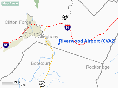
Location & QuickFacts
| FAA Information Effective: | 2008-09-25 |
| Airport Identifier: | 0VA2 |
| Airport Status: | Operational |
| Longitude/Latitude: | 079-46-00.1710W/37-47-47.4640N
-79.766714/37.796518 (Estimated) |
| Elevation: | 1020 ft / 310.90 m (Estimated) |
| Land: | 4 acres |
| From nearest city: | 1 nautical miles E of Iron Gate, VA |
| Location: | Alleghany County, VA |
| Magnetic Variation: | 07W (1985) |
Owner & Manager
| Ownership: | Privately owned |
| Owner: | Paul Strausbaugh |
| Address: | Po Box 69
Clifton Forge, VA 24422 |
| Phone number: | 703-862-7269 |
| Address: |
|
Airport Operations and Facilities
| Airport Use: | Private |
| Wind indicator: | Yes |
| Segmented Circle: | No |
| Control Tower: | No |
| Sectional chart: | Cincinnati |
| Region: | AEA - Eastern |
| Boundary ARTCC: | ZDC - Washington |
| Tie-in FSS: | DCA - Leesburg |
| FSS on Airport: | No |
| FSS Toll Free: | 1-800-WX-BRIEF |
Runway Information
Runway 14/32
| Dimension: | 2000 x 70 ft / 609.6 x 21.3 m |
| Surface: | TURF, |
| |
Runway 14 |
Runway 32 |
| Traffic Pattern: | Right | Left |
|
Radio Navigation Aids
| ID |
Type |
Name |
Ch |
Freq |
Var |
Dist |
| LW | NDB | Bushi | | 346.00 | 06W | 33.3 nm |
| VIT | NDB | Vinton | | 277.00 | 06W | 36.0 nm |
| CNQ | NDB | Callahan | | 379.00 | 05W | 37.2 nm |
| LY | NDB | Bojar | | 385.00 | 08W | 40.7 nm |
| TEC | NDB | Tech | | 368.00 | 06W | 46.6 nm |
| ODR | VOR | Woodrum | | 114.90 | 06W | 30.1 nm |
| LWB | VOR/DME | Greenbrier | 107Y | 116.05 | 08W | 30.0 nm |
| MOL | VOR/DME | Montebello | 100X | 115.30 | 05W | 31.9 nm |
| ROA | VORTAC | Roanoke | 031X | 109.40 | 04W | 30.8 nm |
| LYH | VORTAC | Lynchburg | 029X | 109.20 | 05W | 41.2 nm |
Remarks
- NO OPNS TO/FROM FAC WHEN VR-1756 AND IR-762 IN USE; CTC FSS OR CMDG OFCR, OCEANA NAS BEFORE FLYING IN/OUT.
Images and information placed above are from
http://www.airport-data.com/airport/0VA2/
We thank them for the data!
| General Info
|
| Country |
United States
|
| State |
VIRGINIA
|
| FAA ID |
0VA2
|
| Latitude |
37-47-47.464N
|
| Longitude |
079-46-00.171W
|
| Elevation |
1020 feet
|
| Near City |
IRON GATE
|
We don't guarantee the information is fresh and accurate. The data may
be wrong or outdated.
For more up-to-date information please refer to other sources.
|
|


