 |
|
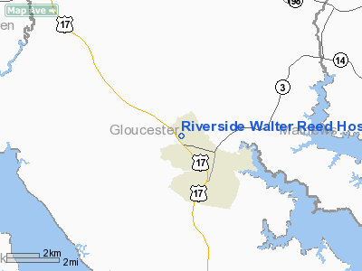
Riverside Walter Reed Hospital Heliport |
Location & QuickFacts
| FAA Information Effective: | 2008-09-25 |
| Airport Identifier: | VA70 |
| Airport Status: | Operational |
| Longitude/Latitude: | 076-32-34.8300W/37-25-18.5400N
-76.543008/37.421817 (Estimated) |
| Elevation: | 75 ft / 22.86 m (Estimated) |
| Land: | 0 acres |
| From nearest city: | 1 nautical miles NW of Gloucester, VA |
| Location: | Gloucester County, VA |
| Magnetic Variation: | 09W (1985) |
Owner & Manager
| Ownership: | Privately owned |
| Owner: | Riverside Halth System.
RIVERSIDE WALTER REED HOSPITAL |
| Address: | Rt 17, Box 1130
Gloucester, VA 23061 |
| Phone number: | 804-693-8800 |
| Manager: | Les Fowlkes |
| Address: | 7519 Hospital Drive
Gloucester, VA 23061 |
| Phone number: | 804-693-8820 |
Airport Operations and Facilities
| Airport Use: | Private
MEDICAL USE. |
| Wind indicator: | Yes |
| Segmented Circle: | No |
| Control Tower: | No |
| Lighting Schedule: | PHONE REQ
FOR PERIMETER LGTS CALL 804-693-8800. |
| Sectional chart: | Washington |
| Region: | AEA - Eastern |
| Boundary ARTCC: | ZDC - Washington |
| Tie-in FSS: | DCA - Leesburg |
| FSS Toll Free: | 1-800-WX-BRIEF |
Runway Information
Helipad H1
| Dimension: | 30 x 30 ft / 9.1 x 9.1 m |
| Surface: | CONC, |
| |
Runway H1 |
Runway |
| Traffic Pattern: | Left | Left |
|
Radio Navigation Aids
| ID |
Type |
Name |
Ch |
Freq |
Var |
Dist |
| FAF | NDB | Felker | | 226.00 | 08W | 17.4 nm |
| PJS | NDB | Henry | | 375.00 | 09W | 17.5 nm |
| AKQ | NDB | Wakefield | | 274.00 | 09W | 34.3 nm |
| BDB | NDB | Accomack | | 336.00 | 11W | 36.6 nm |
| PVG | NDB | Portsmouth | | 241.00 | 10W | 38.9 nm |
| CF | NDB | Pubbs | | 392.00 | 09W | 43.8 nm |
| LJK | NDB | Ashey | | 280.00 | 09W | 49.4 nm |
| RK | NDB | Waley | | 249.00 | 10W | 49.7 nm |
| LFI | TACAN | Langley | 070X | | 10W | 22.0 nm |
| NGU | TACAN | Chambers | 048X | | 10W | 31.6 nm |
| NTU | TACAN | Oceana | 113X | | 10W | 43.3 nm |
| HCM | VORTAC | Harcum | 025X | 108.80 | 07W | 8.2 nm |
| CCV | VORTAC | Cape Charles | 059X | 112.20 | 10W | 26.4 nm |
| HPW | VORTAC | Hopewell | 057X | 112.00 | 06W | 27.9 nm |
| ORF | VORTAC | Norfolk | 116X | 116.90 | 07W | 35.8 nm |
| RIC | VORTAC | Richmond | 088X | 114.10 | 09W | 37.4 nm |
| FKN | VORTAC | Franklin | 043X | 110.60 | 09W | 48.1 nm |
Remarks
Images and information placed above are from
http://www.airport-data.com/airport/VA70/
We thank them for the data!
| General Info
|
| Country |
United States
|
| State |
VIRGINIA
|
| FAA ID |
VA70
|
| Latitude |
37-25-18.540N
|
| Longitude |
076-32-34.830W
|
| Elevation |
75 feet
|
| Near City |
GLOUCESTER
|
We don't guarantee the information is fresh and accurate. The data may
be wrong or outdated.
For more up-to-date information please refer to other sources.
|
|


