 |
|
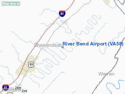
Location & QuickFacts
| FAA Information Effective: | 2008-09-25 |
| Airport Identifier: | VA58 |
| Airport Status: | Operational |
| Longitude/Latitude: | 078-26-40.0000W/38-54-22.0000N
-78.444444/38.906111 (Estimated) |
| Elevation: | 606 ft / 184.71 m (Estimated) |
| Land: | 10 acres |
| From nearest city: | 2 nautical miles SE of Maurertown, VA |
| Location: | Shenandoah County, VA |
| Magnetic Variation: | 09W (1990) |
Owner & Manager
| Ownership: | Privately owned |
| Owner: | Paul L. Miley |
| Address: | Route 1 Box 191
Maurertown, VA 22644 |
| Phone number: | 703-436-8006 |
| Manager: | Paul L. Miley |
| Address: | Route 1 Box 191
Maurertown, VA 22644 |
| Phone number: | 703-436-8006
540-335-8496 |
Airport Operations and Facilities
| Airport Use: | Private |
| Wind indicator: | Yes |
| Segmented Circle: | No |
| Control Tower: | No |
| Sectional chart: | Washington |
| Region: | AEA - Eastern |
| Boundary ARTCC: | ZDC - Washington |
| Tie-in FSS: | DCA - Leesburg |
| FSS on Airport: | No |
| FSS Toll Free: | 1-800-WX-BRIEF |
Runway Information
Runway 14/32
| Dimension: | 2650 x 60 ft / 807.7 x 18.3 m |
| Surface: | TURF, |
| |
Runway 14 |
Runway 32 |
| Traffic Pattern: | Left | Right |
| Obstruction: | 50 ft trees, 1000.0 ft from runway | |
|
Radio Navigation Aids
| ID |
Type |
Name |
Ch |
Freq |
Var |
Dist |
| LUA | NDB | Caverns | | 245.00 | 09W | 12.5 nm |
| TZ | NDB | Cogan | | 364.00 | 10W | 20.6 nm |
| GDX | NDB | Goodwin Lake | | 227.00 | 08W | 28.8 nm |
| CJR | NDB | Culpeper | | 252.00 | 09W | 35.6 nm |
| MSQ | NDB | Nailr | | 351.00 | 10W | 37.1 nm |
| VBW | NDB | Bridgewater | | 241.00 | 07W | 40.5 nm |
| CBE | NDB | Cumberland | | 317.00 | 07W | 46.8 nm |
| ESL | VOR/DME | Kessel | 045X | 110.80 | 06W | 31.9 nm |
| LDN | VORTAC | Linden | 090X | 114.30 | 06W | 11.6 nm |
| CSN | VORTAC | Casanova | 110X | 116.30 | 06W | 31.5 nm |
| MRB | VORTAC | Martinsburg | 058X | 112.10 | 07W | 40.0 nm |
| AML | VORTAC | Armel | 082X | 113.50 | 08W | 45.8 nm |
Remarks
- PRVDD ARPT BE OPERATED DURING DALGT HRS ONLY; NO IFR OPNS BE PERMITTED & A CLEAR 20:1 APCH SFC BE KEPT TO RY 14; CTC U.S. NAVY FOR BRIEFING ON MILITARY OPNS IN MTR TRAVERSING ALONG THE VALLEY IN WHICH YOUR ARPT IS TO BE LCTD.
Images and information placed above are from
http://www.airport-data.com/airport/VA58/
We thank them for the data!
| General Info
|
| Country |
United States
|
| State |
VIRGINIA
|
| FAA ID |
VA58
|
| Latitude |
38-54-22.000N
|
| Longitude |
078-26-40.000W
|
| Elevation |
606 feet
|
| Near City |
MAURERTOWN
|
We don't guarantee the information is fresh and accurate. The data may
be wrong or outdated.
For more up-to-date information please refer to other sources.
|
|


