|
|
| Richmond International Airport |
| IATA: RIC – ICAO: KRIC – FAA LID: RIC
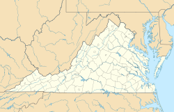
Location of the Richmond International Airport
|
| Summary |
| Airport type |
Public |
| Operator |
Capital Region Airport Commission |
| Serves |
Richmond, Virginia |
| Location |
Sandston, Virginia |
| Elevation AMSL |
167 ft / 50.9 m |
| Coordinates |
37°30′18″N 077°19′10″W / 37.505°N 77.31944°W / 37.505; -77.31944 |
| Website |
www.flyrichmond.com |
| Runways |
| Direction |
Length |
Surface |
| ft |
m |
| 16/34 |
9,003 |
2,744 |
Asphalt |
| 2/20 |
6,607 |
2,014 |
Asphalt |
| 7/25 |
5,326 |
1,623 |
Asphalt |
| Statistics (2006) |
| Aircraft operations |
120,581 |
| Based aircraft |
75 |
| Source: Federal Aviation Administration |
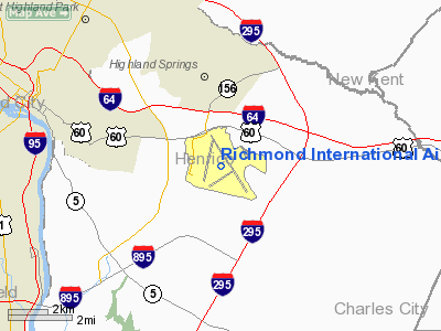
Richmond International Airport (IATA: RIC, ICAO: KRIC, FAA LID: RIC) is a joint civil-military public airport located in Sandston, Virginia, an unincorporated community within Henrico County which is about 5 miles (8 km) east of Richmond.
Richmond International Airport is the busiest airport in central Virginia. The airport is located seven miles (11 km) southeast of Richmond, Virginia's capital. Overview
Eight air carriers currently serve Richmond International Airport with non-stop flights to 21 destinations and connecting flights to destinations worldwide. A record 3.63 million passengers used Richmond International Airport in 2007 with growth expected to continue.
To help accommodate the current and proposed increase in passengers and air service, Richmond International Airport has embarked on a major expansion program. The program has increased the total number of gates, increased parking spaces to 8,000, and created a new terminal roadway and air traffic control tower. It features major renovations of the terminal building including upper level departures and lower level arrivals, the construction of a central utility plant and the widening of the security check points. Construction on the new two-level terminal was completed in spring 2007.
Richmond International Airport also experienced a dramatic increase in cargo activities over the past 10 years. In 2004, Richmond International Airport handled over 114 million pounds of cargo. Cargo services offered at Richmond International Airport include over 100,000 square feet (10,000 m) of warehouse/office space and 1,000,000 square feet (100,000 m) of apron space. The entire airport is designated a Foreign Trade Zone. Because of its central location on the Eastern Seaboard, cargo transit via RIC is on the rise. Goods shipped out of the metropolitan Richmond area can reach 50 % of the U.S. population within 24 hours.
History
The airport was dedicated as Richard Evelyn Byrd Flying Field in 1927 in honor of aviator Richard E. Byrd, brother of Governor of Virginia Harry F. Byrd. Charles Lindbergh attended the dedication ceremony. Although the facility was located in Henrico County, Richmond Mayor John Fulmer Bright was instrumental in the creation of Byrd Field, which was initially owned by the City of Richmond.
It is currently owned and operated by the Capital Region Airport Commission, a state-created governmental agency overseen by representatives of Chesterfield, Hanover, and Henrico Counties and the City of Richmond.
Airport statistics
In 2007, the airport served 3,634,544 passengers, which is a record number of passengers for the airport, representing a 10.3% increase over 2006 figures, and lags about 80,000 passengers behind the next-busiest airport in the state, Norfolk International. This makes RIC the fourth-busiest airport in Virginia (after Washington Dulles, Washington Reagan National, and Norfolk, respectively).
In 2007, US Airways and Delta controlled nearly equal shares of the market, with 24.3% of the total each. AirTran (9.2%) and JetBlue (7.9%) both enjoyed an increase in market share compared to the previous year. Newcomer Skybus represented 1.4% of the market.
Airlines and destinations
| Airlines |
Destinations |
Concourse |
| Air Canada Jazz |
Toronto-Pearson |
A |
| AirTran Airways |
Atlanta, Orlando |
A |
| American Airlines |
Dallas/Fort Worth |
A |
| American Eagle |
Chicago-O'Hare, Miami |
A |
| Continental Airlines |
Houston-Intercontinental |
B |
| Continental Express operated by ExpressJet Airlines |
Cleveland, Houston-Intercontinental, Newark |
B |
| Delta Air Lines |
Atlanta |
B |
| Delta Connection operated by Atlantic Southeast Airlines |
Atlanta |
B |
| Delta Connection operated by Chautauqua Airlines |
Cincinnati/Northern Kentucky |
B |
| Delta Connection operated by Comair |
New York-JFK |
B |
| Delta Connection operated by Compass Airlines |
Minneapolis/St. Paul |
B |
| Delta Connection operated by Pinnacle Airlines |
Atlanta, Detroit, New York-JFK |
B |
| JetBlue Airways |
Boston, Fort Lauderdale, New York-JFK [ends November 1], Orlando |
B |
| United Airlines |
Chicago-O'Hare |
B |
| United Express operated by Trans States Airlines |
Chicago-O'Hare, Washington-Dulles |
B |
| United Express operated by GoJet Airlines |
Chicago-O'Hare, Washington-Dulles |
B |
| US Airways |
Charlotte |
A |
| US Airways Express operated by Air Wisconsin |
Boston, New York-LaGuardia, Philadelphia |
A |
| US Airways Express operated by Chautauqua Airlines |
New York-LaGuardia |
A |
| US Airways Express operated by Piedmont Airlines |
Philadelphia |
A |
| US Airways Express operated by PSA Airlines |
Charlotte, Philadelphia |
A |
| US Airways Express operated by Republic Airlines |
Charlotte, New York-LaGuardia, Philadelphia |
A |
Accidents and incidents
- On 9 July 1978, Douglas C-47A N45873 was damaged beyond repair in a take-off accident. All 42 people on board survived. The aircraft was on a local flight dropping parachutists. The cause of the accident was a jam in the elevator control system.
- In 1996, Eastwind Airlines Flight 517 from Trenton experienced loss of rudder control while on approach to Richmond, however rudder control was regained shortly after and the aircraft landed normally. There was one minor injury.
Virginia Air National Guard
Up until October 2007, the 192d Fighter Wing (192 FW), an Air Combat Command (ACC)-gained unit of the Virginia Air National Guard, maintaned an Air National Guard Station and operated F-16 Fighting Falcon aircraft from the airport. In late 2007, pursuant to BRAC 2005 action, the 192 FW relinquished its F-16C and F-16D aircraft, relocated to Langley AFB (now Joint Base Langley-Eustis), and integrated with the Regular Air Force as an associate unit to the 1st Fighter Wing (1 FW) flying the F-22 Raptor. The former Richmond International Airport Air National Guard Station property was transferred to the Department of the Army in support of Army Reserve and Virginia Army National Guard activities.
The above content comes from Wikipedia and is published under free licenses – click here to read more.
Location & QuickFacts
| FAA Information Effective: | 2008-09-25 |
| Airport Identifier: | RIC |
| Airport Status: | Operational |
| Longitude/Latitude: | 077-19-10.8000W/37-30-18.6000N
-77.319667/37.505167 (Estimated) |
| Elevation: | 167 ft / 50.90 m (Surveyed) |
| Land: | 2500 acres |
| From nearest city: | 6 nautical miles E of Richmond, VA |
| Location: | Henrico County, VA |
| Magnetic Variation: | 09W (1985) |
Owner & Manager
| Ownership: | Publicly owned |
| Owner: | Capital Region Arpt Comm. |
| Address: | 1 Richard E Byrd Terminal Dr
Richmond, VA 23250 |
| Phone number: | 804-226-3000 |
| Manager: | Jon Mathiasen |
| Address: | 1 Richard E Byrd Terminal Dr
Richmond, VA 23250 |
| Phone number: | 804-226-3000 |
Airport Operations and Facilities
| Airport Use: | Open to public |
| Wind indicator: | Yes |
| Segmented Circle: | No |
| Control Tower: | Yes |
| Lighting Schedule: | DUSK-DAWN |
| Beacon Color: | Clear-Green (lighted land airport) |
| Landing fee charge: | Yes |
| Sectional chart: | Washington |
| Region: | AEA - Eastern |
| Boundary ARTCC: | ZDC - Washington |
| Tie-in FSS: | DCA - Leesburg |
| FSS on Airport: | No |
| FSS Toll Free: | 1-800-WX-BRIEF |
| NOTAMs Facility: | RIC (NOTAM-d service avaliable) |
| Certification type/date: | I C S 05/1973 |
| Federal Agreements: | NGHRY |
Airport Communications
Airport Services
| Fuel available: | 100LLA |
| Airframe Repair: | MAJOR |
| Power Plant Repair: | MAJOR |
| Bottled Oxygen: | HIGH/LOW |
| Bulk Oxygen: | NONE |
Runway Information
Runway 02/20
| Dimension: | 6607 x 150 ft / 2013.8 x 45.7 m |
| Surface: | ASPH, Good Condition
LAST 200 FT UNGROOVED CONC. |
| Surface Treatment: | Saw-cut or plastic Grooved |
| Weight Limit: | Single wheel: 125000 lbs.
Dual wheel: 200000 lbs.
Dual tandem wheel: 340000 lbs. |
| Edge Lights: | High |
| |
Runway 02 |
Runway 20 |
| Longitude: | 077-19-46.7667W | 077-19-27.6798W |
| Latitude: | 37-29-55.9452N | 37-30-59.4705N |
| Elevation: | 159.00 ft | 165.00 ft |
| Alignment: | 13 | 127 |
| ILS Type: | LOC/GS
| |
| Traffic Pattern: | Left | Left |
| Markings: | Precision instrument, Good Condition | Precision instrument, Good Condition |
| Crossing Height: | 53.00 ft | 52.00 ft |
| VASI: | 4-box on right side | 4-box on left side |
| Visual Glide Angle: | 3.00° | 3.00° |
| Approach lights: | MALSR | |
| Runway End Identifier: | Yes | Yes |
| Obstruction: | 90 ft pole, 3300.0 ft from runway, 450 ft left of centerline, 34:1 slope to clear | 67 ft tree, 2400.0 ft from runway, 650 ft left of centerline, 33:1 slope to clear |
|
Runway 07/25
| Dimension: | 5326 x 100 ft / 1623.4 x 30.5 m |
| Surface: | ASPH, Good Condition
LAST 200 FT UNGROOVED CONC. |
| Surface Treatment: | Saw-cut or plastic Grooved |
| Weight Limit: | Single wheel: 125000 lbs.
Dual wheel: 200000 lbs.
Dual tandem wheel: 340000 lbs. |
| Edge Lights: | High |
| |
Runway 07 |
Runway 25 |
| Longitude: | 077-19-33.0178W | 077-18-37.2953W |
| Latitude: | 37-29-46.8713N | 37-30-15.1802N |
| Elevation: | 156.00 ft | 159.00 ft |
| Alignment: | 57 | 127 |
| Traffic Pattern: | Left | Left |
| Markings: | Non-precision instrument, Good Condition | Non-precision instrument, Good Condition |
| Crossing Height: | 0.00 ft | 52.00 ft |
| VASI: | | 4-box on left side |
| Visual Glide Angle: | 0.00° | 3.00° |
| RVR Equipment: | | touchdown |
| Runway End Identifier: | | Yes |
| Obstruction: | 54 ft rr, 850.0 ft from runway, 12:1 slope to clear | 67 ft tree, 1934.0 ft from runway, 493 ft right of centerline, 26:1 slope to clear |
|
Runway 16/34
| Dimension: | 9003 x 150 ft / 2744.1 x 45.7 m |
| Surface: | ASPH, Good Condition
LAST 200 FT UNGROOVED CONC. |
| Surface Treatment: | Saw-cut or plastic Grooved |
| Weight Limit: | Single wheel: 125000 lbs.
Dual wheel: 200000 lbs.
Dual tandem wheel: 340000 lbs. |
| Edge Lights: | High |
| |
Runway 16 |
Runway 34 |
| Longitude: | 077-19-24.8792W | 077-18-24.7873W |
| Latitude: | 37-30-59.8918N | 37-29-44.8562N |
| Elevation: | 167.00 ft | 161.00 ft |
| Alignment: | 127 | 127 |
| ILS Type: | ILS
| ILS
|
| Traffic Pattern: | Left | Left |
| Markings: | Precision instrument, Good Condition | Precision instrument, Good Condition |
| Crossing Height: | 56.00 ft | 0.00 ft |
| VASI: | 4-box on left side | |
| Visual Glide Angle: | 3.00° | 0.00° |
| RVR Equipment: | touchdown, midfield, rollout | touchdown, midfield, rollout |
| Approach lights: | MALSR | ALSF2 |
| Centerline Lights: | Yes | Yes |
| Touchdown Lights: | No | Yes |
|
Radio Navigation Aids
| ID |
Type |
Name |
Ch |
Freq |
Var |
Dist |
| CF | NDB | Pubbs | | 392.00 | 09W | 12.1 nm |
| LJK | NDB | Ashey | | 280.00 | 09W | 17.8 nm |
| PTB | NDB | Petersburg | | 284.00 | 08W | 25.6 nm |
| AKQ | NDB | Wakefield | | 274.00 | 09W | 34.9 nm |
| APH | NDB | A P Hill | | 396.00 | 10W | 35.0 nm |
| FAF | NDB | Felker | | 226.00 | 08W | 40.1 nm |
| IQK | NDB | Louisa | | 382.00 | 09W | 40.2 nm |
| BKT | NDB | Blackstone | | 326.00 | 09W | 41.4 nm |
| PJS | NDB | Henry | | 375.00 | 09W | 45.4 nm |
| EZF | NDB | Shannon | | 237.00 | 10W | 46.2 nm |
| RIC | VORTAC | Richmond | 088X | 114.10 | 09W | 0.2 nm |
| HPW | VORTAC | Hopewell | 057X | 112.00 | 06W | 14.4 nm |
| FAK | VORTAC | Flat Rock | 080X | 113.30 | 06W | 24.3 nm |
| HCM | VORTAC | Harcum | 025X | 108.80 | 07W | 29.2 nm |
| FKN | VORTAC | Franklin | 043X | 110.60 | 09W | 49.8 nm |
| LVL | VORTAC | Lawrenceville | 076X | 112.90 | 08W | 49.9 nm |
| BRV | VORTAC | Brooke | 092X | 114.50 | 09W | 50.0 nm |
Remarks
- NO PRACTICE LANDINGS 2200-0700.
- AIR CARRIER APRON CLSD TO UNSKED ACFT WEIGHING UNDER 35000 LBS.
- NO EDGE LGTS ON TWY M & S - REFLECTORS ONLY.
- TWR 245 FT AGL 2.5 NM NW; UNLGTD.
- ATC CLEARANCE REQUIRED FOR PUSHBACKS ONTO MOVEMENT AREAS.
- ALL ACFT WITH WINGSPANS GREATER THAN 118 FT & WHEEL BASES GREATER THAN 59 FT ARE RESTRICTED FM USING TWYS J, K, R (BTN TWY A & FSDO RAMP), S, T (SOUTH OF TWY J), AND V (WEST OR TWY A). TWY M, M1, M2, M3, AND R (WEST OF FSDO) DESIGNATED FOR AFCT WITH WINGSPANS LESS THAN 79 FT.
- TWY T (NORTH OF TWY F) RESTRICTED FM USE BY ACFT WITH WINGSPANS GREATER THAN 118 FT. INTERSECTION REQUIRES JUDGEMENTAL OVERSTEERING.
- TWY A BTN TWY C & TWY E RESTRICTED FM USE BY ACFT WITH WINGSPANS GREATER THAN 171 FT.
- HOLD LINE RY 20 EAST SIDE LCTD ACROSS RY 34 150 FT FM DEP END. HOLD LINE RY 20 WEST SIDE ACROSS TY A & ALSO SERVES AS HOLD LINE FOR RY 16; SIGNAGE INDICATES BOTH RYS.
- FUEL: J8 AT ARNG RAMP ONLY.
- NON-RADIO EQUIPPED VEHICLES CROSSING MIDFIELD TAXIWAYS "C", "E" AND "H" AND DRIVING ON TAXIWAY "L"-SOUTH OF RY 07/25.
- THE FOLLOWING AREAS ARE NOT VISIBLE FROM THE TOWER: PORTIONS OF THE AIR CARRIER APRON; ARMY NATIONAL GUARD ACFT PARKING RAMP.
- (NG) OPR 1300-2130Z TUE-SAT.
- DUE TO THE CLOSE PROXIMITY TO RY 02/20, TAXIWAY UNIFORM SIGNAGE MAY BE BEHIND ACFT, ONCE CLEAR OF RY 02/20.
- BIRD ACTIVITY INVOF ALL RYS & TWYS & INVOF ARPT.
- EXISTED PRIOR TO 1959.
Images and information placed above are from
http://www.airport-data.com/airport/RIC/
We thank them for the data!
| General Info
|
| Country |
United States
|
| State |
VIRGINIA
|
| FAA ID |
RIC
|
| Latitude |
37-30-18.600N
|
| Longitude |
077-19-10.800W
|
| Elevation |
167 feet
|
| Near City |
RICHMOND
|
We don't guarantee the information is fresh and accurate. The data may
be wrong or outdated.
For more up-to-date information please refer to other sources.
|
|