 |
|
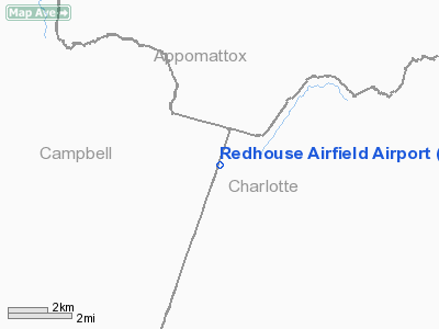
Redhouse Airfield Airport |
Location & QuickFacts
| FAA Information Effective: | 2008-09-25 |
| Airport Identifier: | 7VA5 |
| Airport Status: | Operational |
| Longitude/Latitude: | 078-49-47.0380W/37-11-20.5230N
-78.829733/37.189034 (Estimated) |
| Elevation: | 742 ft / 226.16 m (Estimated) |
| Land: | 40 acres |
| From nearest city: | 1 nautical miles W of Redhouse, VA |
| Location: | Charlotte County, VA |
| Magnetic Variation: | 07W (1985) |
Owner & Manager
| Ownership: | Privately owned |
| Owner: | J. M. Barksdale |
| Address: |
Redhouse, VA 23963 |
| Phone number: | 804-376-2485 |
| Manager: | John Dudley Barksdale |
| Address: |
Redhouse, VA 23963 |
| Phone number: | 804-522-5068 |
Airport Operations and Facilities
| Airport Use: | Private |
| Wind indicator: | Yes |
| Segmented Circle: | No |
| Control Tower: | No |
| Landing fee charge: | No |
| Sectional chart: | Washington |
| Region: | AEA - Eastern |
| Boundary ARTCC: | ZDC - Washington |
| Tie-in FSS: | DCA - Leesburg |
| FSS on Airport: | No |
| FSS Toll Free: | 1-800-WX-BRIEF |
Airport Communications
Runway Information
Runway 09/27
| Dimension: | 1700 x 40 ft / 518.2 x 12.2 m |
| Surface: | TURF, |
| |
Runway 09 |
Runway 27 |
| Traffic Pattern: | Left | Left |
|
Radio Navigation Aids
| ID |
Type |
Name |
Ch |
Freq |
Var |
Dist |
| LY | NDB | Bojar | | 385.00 | 08W | 20.3 nm |
| FVX | NDB | Farmville | | 367.00 | 07W | 21.2 nm |
| BKT | NDB | Blackstone | | 326.00 | 09W | 37.8 nm |
| MBV | NDB | Mecklenburg/dcmsnd | | 356.00 | 08W | 47.7 nm |
| DAN | VOR | Danville | | 113.10 | 06W | 44.5 nm |
| MOL | VOR/DME | Montebello | 100X | 115.30 | 05W | 44.8 nm |
| LYH | VORTAC | Lynchburg | 029X | 109.20 | 05W | 19.9 nm |
| SBV | VORTAC | South Boston | 041X | 110.40 | 05W | 32.1 nm |
| LVL | VORTAC | Lawrenceville | 076X | 112.90 | 08W | 49.8 nm |
Remarks
- PRVDD EAST END OF RWY IS PSND A SUF DISC WEST OF ROUTE 600 TO PRVD PROPER FAR PART 77 CLEARANCES.
Images and information placed above are from
http://www.airport-data.com/airport/7VA5/
We thank them for the data!
| General Info
|
| Country |
United States
|
| State |
VIRGINIA
|
| FAA ID |
7VA5
|
| Latitude |
37-11-20.523N
|
| Longitude |
078-49-47.038W
|
| Elevation |
742 feet
|
| Near City |
REDHOUSE
|
We don't guarantee the information is fresh and accurate. The data may
be wrong or outdated.
For more up-to-date information please refer to other sources.
|
|


