 |
|
Location & QuickFacts
| FAA Information Effective: | 2008-09-25 |
| Airport Identifier: | 28VA |
| Airport Status: | Operational |
| Longitude/Latitude: | 080-31-32.2000W/37-11-05.4560N
-80.525611/37.184849 (Estimated) |
| Elevation: | 1710 ft / 521.21 m (Estimated) |
| Land: | 0 acres |
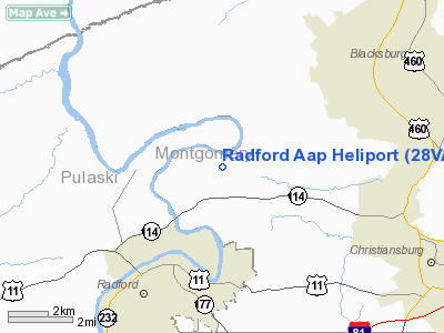
| From nearest city: | 3 nautical miles SS of Radford, VA |
| Location: | Montgomery County, VA |
| Magnetic Variation: | 06W (1985) |
Owner & Manager
| Ownership: | Army owned |
| Owner: | Military-army |
| Address: | Radford Aap
Radford, VA 24141 |
| Manager: | C.o. Ltc C. Curtis |
| Address: | Radford Aap
Radford, VA 24141 |
| Phone number: | 703-639-8711 |
Airport Operations and Facilities
| Airport Use: | Private |
| Wind indicator: | Yes |
| Segmented Circle: | No |
| Control Tower: | No |
| Landing fee charge: | No |
| Sectional chart: | Cincinnati |
| Region: | AEA - Eastern |
| Boundary ARTCC: | ZDC - Washington |
| Tie-in FSS: | DCA - Leesburg |
| FSS on Airport: | No |
| FSS Toll Free: | 1-800-WX-BRIEF |
Runway Information
Helipad H1
| Dimension: | 300 x 300 ft / 91.4 x 91.4 m |
| Surface: | TURF, |
| |
Runway H1 |
Runway |
| Traffic Pattern: | Left | Left |
|
Radio Navigation Aids
| ID |
Type |
Name |
Ch |
Freq |
Var |
Dist |
| TEC | NDB | Tech | | 368.00 | 06W | 6.0 nm |
| CNQ | NDB | Callahan | | 379.00 | 05W | 18.2 nm |
| HLX | NDB | Hillsville | | 269.00 | 06W | 29.1 nm |
| VIT | NDB | Vinton | | 277.00 | 06W | 30.9 nm |
| LW | NDB | Bushi | | 346.00 | 06W | 36.0 nm |
| MK | NDB | Suzze | | 335.00 | 06W | 37.9 nm |
| UV | NDB | Bales | | 396.00 | 07W | 46.2 nm |
| AZW | NDB | Mount Airy | | 223.00 | 07W | 48.3 nm |
| ODR | VOR | Woodrum | | 114.90 | 06W | 27.5 nm |
| RNL | VOR | Rainelle | | 116.60 | 04W | 49.4 nm |
| LWB | VOR/DME | Greenbrier | 107Y | 116.05 | 08W | 41.3 nm |
| PSK | VORTAC | Pulaski | 115X | 116.80 | 06W | 10.7 nm |
| ROA | VORTAC | Roanoke | 031X | 109.40 | 04W | 23.8 nm |
| BLF | VORTAC | Bluefield | 037X | 110.00 | 03W | 32.8 nm |
| BKW | VORTAC | Beckley | 124X | 117.70 | 06W | 45.8 nm |
Images and information placed above are from
http://www.airport-data.com/airport/28VA/
We thank them for the data!
| General Info
|
| Country |
United States
|
| State |
VIRGINIA
|
| FAA ID |
28VA
|
| Latitude |
37-11-05.456N
|
| Longitude |
080-31-32.200W
|
| Elevation |
1710 feet
|
| Near City |
RADFORD
|
We don't guarantee the information is fresh and accurate. The data may
be wrong or outdated.
For more up-to-date information please refer to other sources.
|
|


