|
|
Quantico Mcaf /turner Field Airport |
Coordinates: 38°30′13″N 077°18′18″W / 38.50361°N 77.305°W / 38.50361; -77.305
MCAF Quantico
Turner Field |
 |
| Old MCAS Quantico logo |
| IATA: NYG – ICAO: KNYG – FAA LID: NYG |
| Summary |
| Airport type |
Military |
| Operator |
United States Marine Corps |
| Serves |
Marine Corps Base Quantico |
| Location |
Quantico, Virginia |
| Built |
1919 |
| In use |
1919 - present |
| Commander |
Lt. Col. Brian L. Magnuson as of 31 July 2009 |
| Elevation AMSL |
10 ft / 3 m |
| Website |
quantico.usmc.mil/... |
| Runways |
| Direction |
Length |
Surface |
| ft |
m |
| 2/20 |
4,237 |
1,291 |
Asphalt |
| Sources: Official site and FAA |
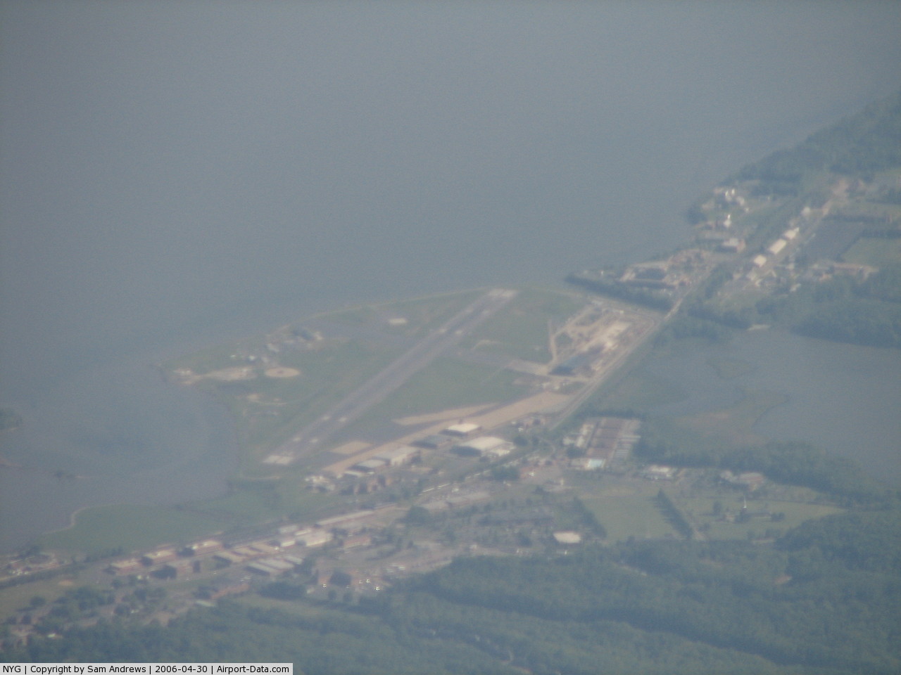
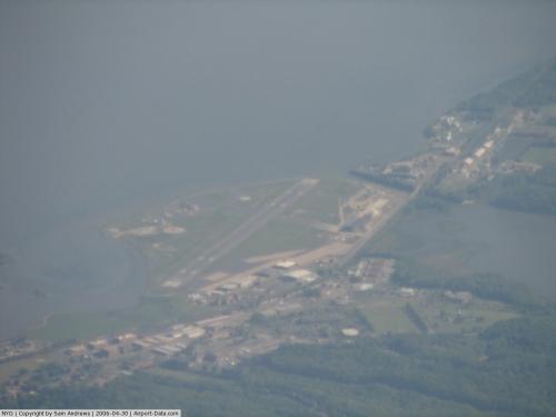
Marine Corps Air Facility Quantico (MCAF Quantico) (ICAO: KNYG, FAA LID: NYG) is a United States Marine Corps airfield located within Marine Corps Base Quantico, Virginia. It was commissioned in 1919 and is currently home to HMX-1, the squadron that flies the President of the United States. The airfield is also known as Turner Field, after Colonel Thomas C. Turner, a veteran Marine aviator and the second director of Marine Corps Aviation, who lost his life in Haiti in 1931. History
Aviation first arrived at Quantico in July 1918, when two kite balloons were flown to spot artillery fire. These forerunners of today's spotter aircraft were soon augmented with the assignment of four seaplanes, which operated from the muddy junction of Chopawamsic Creek and the Potomac River.
In 1919, a flying field was laid out and the land leased to accommodate a squadron returning from World War I combat in Europe. The facility was later named Brown Field, in memory of 2ndLt Walter V. Brown, who lost his life in an early accident at that location. The present site was selected in 1931, when larger and faster planes brought recognition of the limitations and hazards of Brown Field - its single, crosswind runway, bound by trees, hills, swamp, a high tension line and a railroad.
A new airfield was constructed by changing the course and flow of Chopawamsic Creek and reclamation of the marshland from that area. The new facility was named Turner Field.
By 1939, four squadrons — 68 bombers, scout bombers, fighters, transports, utility and observation planes — were based at the airfield. On December 1, 1941, the field was named Marine Corps Air Station Quantico, and placed under operational control of the Commanding General, Marine Barracks.
In 1947, Marine Helicopter Squadron One was established at Quantico to pioneer an entirely new concept in air operation; to evaluate and test, in coordination with the Landing Force development Center, the theory of carrying troops to the battle zone by helicopter.
By the close of the Korean conflict, helicopters had gained permanent acceptance by the military for tactical and logistical support operations. Effective 15 November 1976, MCAS Quantico was re-designated as Marine Corps Air Facility (MCAF), Quantico, Virginia. MCAF Quantico is currently the home of Headquarters Squadron (HqSqn), Marine Helicopter Squadron One (HMX-1), and home to Marine One.
HMX-1, in addition to its tactical development mission, flies the President of the United States and provides helicopter support for the Marine Corps Combat Development Command.
On 1 October 2005, MCAF Quantico was reorganized under the Commanding General, Marine Corps Installations East, headquartered at Marine Corps Base Camp Lejeune, North Carolina.
The above content comes from Wikipedia and is published under free licenses – click here to read more.
 |
(Click on the photo to enlarge) |
Location & QuickFacts
| FAA Information Effective: | 2008-09-25 |
| Airport Identifier: | NYG |
| Airport Status: | Operational |
| Longitude/Latitude: | 077-18-18.1200W/38-30-12.9830N
-77.305033/38.503606 (Estimated) |
| Elevation: | 10 ft / 3.05 m (Estimated) |
| Land: | 0 acres |
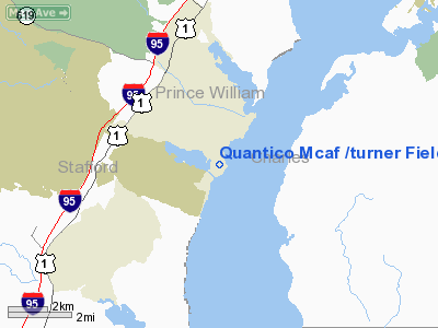
| From nearest city: | 1 nautical miles S of Quantico, VA |
| Location: | Stafford County, VA |
| Magnetic Variation: | 09W (1985) |
Owner & Manager
| Ownership: | Navy owned |
| Owner: | Us Navy |
| Address: | Oceanographic Ofc-code 3142
Washington, DC 20373 |
| Manager: | Commanding Officer |
| Address: | Marine Corps Air Station
Quantico, VA 22134 |
Airport Operations and Facilities
| Airport Use: | Private |
| Segmented Circle: | No |
| Control Tower: | Yes |
| Lighting Schedule: | DUSK-DAWN |
| Beacon Color: | Split-Clear-Green (lighted military airport) |
| Sectional chart: | Washington |
| Region: | AEA - Eastern |
| Boundary ARTCC: | ZDC - Washington |
| Tie-in FSS: | DCA - Leesburg |
| FSS on Airport: | No |
| FSS Toll Free: | 1-800-WX-BRIEF |
| NOTAMs Facility: | DCA (NOTAM-d service avaliable) |
Airport Services
| Fuel available: | A1+ B+ |
| Bottled Oxygen: | NONE |
| Bulk Oxygen: | HIGH |
Runway Information
Runway 02/20
| Dimension: | 4237 x 200 ft / 1291.4 x 61.0 m |
| Surface: | PEM,
RY 02 & 20 GRVD FIRST 1300 FT. |
| Pavement Class: | 51 /R/B/W/T |
| Edge Lights: | High |
| |
Runway 02 |
Runway 20 |
| Longitude: | 077-18-24.8440W | 077-18-11.3950W |
| Latitude: | 38-29-52.7220N | 38-30-33.2440N |
| Elevation: | 9.00 ft | 10.00 ft |
| Alignment: | 15 | 127 |
| Traffic Pattern: | Left | Left |
| VASI: | non-specific system | |
|
Radio Navigation Aids
| ID |
Type |
Name |
Ch |
Freq |
Var |
Dist |
| EZF | NDB | Shannon | | 237.00 | 10W | 15.8 nm |
| DC | NDB | Oxonn | | 332.00 | 11W | 20.5 nm |
| VKX | NDB | Potomac | | 241.00 | 10W | 22.0 nm |
| APH | NDB | A P Hill | | 396.00 | 10W | 25.0 nm |
| CJR | NDB | Culpeper | | 252.00 | 09W | 26.1 nm |
| GTN | NDB | Georgetown | | 323.00 | 09W | 27.0 nm |
| MSQ | NDB | Nailr | | 351.00 | 10W | 28.4 nm |
| GDX | NDB | Goodwin Lake | | 227.00 | 08W | 36.6 nm |
| IQK | NDB | Louisa | | 382.00 | 09W | 39.1 nm |
| GAI | NDB | Gaithersburg | | 385.00 | 09W | 40.6 nm |
| BUH | NDB | Anne Arundel | | 260.00 | 10W | 43.2 nm |
| NHK | NDB | Patuxent | | 400.00 | 10W | 44.5 nm |
| LJK | NDB | Ashey | | 280.00 | 09W | 44.7 nm |
| DCA | VOR/DME | Washington | 047X | 111.00 | 09W | 24.8 nm |
| BRV | VORTAC | Brooke | 092X | 114.50 | 09W | 10.3 nm |
| AML | VORTAC | Armel | 082X | 113.50 | 08W | 27.0 nm |
| ADW | VORTAC | Andrews | 078X | 113.10 | 10W | 27.5 nm |
| CSN | VORTAC | Casanova | 110X | 116.30 | 06W | 27.6 nm |
| OTT | VORTAC | Nottingham | 084X | 113.70 | 10W | 29.0 nm |
| PXT | VORTAC | Patuxent | 123X | 117.60 | 10W | 44.6 nm |
| LDN | VORTAC | Linden | 090X | 114.30 | 06W | 47.2 nm |
| GVE | VORTAC | Gordonsville | 103X | 115.60 | 06W | 49.7 nm |
| DCA | VOT | Washington National | | 109.40 | | 24.2 nm |
| ADW | VOT | Andrews Afb | | 109.60 | | 26.3 nm |
Remarks
- SERVICE LGT: RWY 02 PAPI AND PAR RPI NOT COINCIDENT.
- FUEL: J8.
- TRAN ALERT: NO TRAN MAINT AVBL. REQUIRE QUALIFIED CREW MEMBER TO ASSIST IN COLD REFUELING.
- CAUTION: BIRD HAZ VCNTY RY 02-20 SR-SS. HVY MIGRATORY BIRD ACT OCT-FEB.
- NS ABTMT: THE AREA IN AND AROUND THE QUANTICO CLASS D AIRSPACE IS NOISE SENSITIVE. COPTER TRANSIT QUANTICO CLASS D AIRSPACE AT OR ABV 500' AGL.
- MISC:CAT II CRASH/FIRE RESCUE SVC.
- REMARKS: MCAF QUANTICO HAS NOT PROVISIONS FOR SPACE A PASSENGERS. SPACE A PASSENGER CAN NOT BE ON-LOADED OR OFF-LOADED DUE TO SECURITY ISSUES.
- MISC: MCAF QUANTICO AND R-6608 LIE WITH THE WASHINGTON ADIZ. PILOTS MUST ADHERE TO ADIZ REPORTING PROCEDURES IN BOTH THESE AREAS.
- TWY C CLSD INDEFLY. LIMITED VAL PARKING.
- CUSTOMS/AGTRICULTURE/IMMIGRATION: CSTMS/AG/IMG - AVAILABLE WITH 72 HR PN BY PPR ONLY.
- RSTD: ALL TRAN ACFT 24 HR PPR; OPS CHF DSN 278-2085/2908, C703-784-2085/2908. AFTER 2200Z++ AND ON WEEKEND CALL DSN 278-0920, C703-432-0920, C703-675-4144 FOR PPR.
- RSTD: ALL TAILHOOK ACFT RQR A-GEAR LDG. ADV NOTICE RQR, REQUESTING UNIT MUST COORD WITH MWSS VIA MACF QUANTIC OPS OIC. CLSD FLD OPR NOT AUTH FOR TRAN ACFT.
Images and information placed above are from
http://www.airport-data.com/airport/NYG/
We thank them for the data!
| General Info
|
| Country |
United States
|
| State |
VIRGINIA
|
| FAA ID |
NYG
|
| Latitude |
38-30-06.439N
|
| Longitude |
077-18-19.932W
|
| Elevation |
11 feet
|
| Near City |
QUANTICO
|
We don't guarantee the information is fresh and accurate. The data may
be wrong or outdated.
For more up-to-date information please refer to other sources.
|
|