 |
|
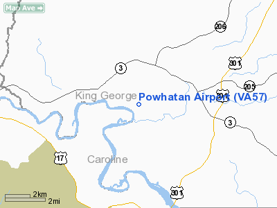
Location & QuickFacts
| FAA Information Effective: | 2008-09-25 |
| Airport Identifier: | VA57 |
| Airport Status: | Operational |
| Longitude/Latitude: | 077-13-08.9220W/38-14-54.4620N
-77.219145/38.248462 (Estimated) |
| Elevation: | 60 ft / 18.29 m (Estimated) |
| Land: | 0 acres |
| From nearest city: | 2 nautical miles SW of King George, VA |
| Location: | King George County, VA |
| Magnetic Variation: | 09W (1985) |
Owner & Manager
| Ownership: | Privately owned |
| Owner: | Achille M. Guest |
| Address: | Powhatan Plantation, Po Box 127
King George, VA 22485 |
| Phone number: | 540-775-4434 |
| Manager: | Wilda Sajous
SECRETARY TO ARCHILLE M. GUEST |
| Address: | Powhatan Plantation, Po Box 127
King George, VA 22485 |
| Phone number: | 540-775-4434 |
Airport Operations and Facilities
| Airport Use: | Private |
| Wind indicator: | Yes |
| Segmented Circle: | No |
| Control Tower: | No |
| Lighting Schedule: | PHONE REQ
|
| Landing fee charge: | No |
| Sectional chart: | Washington |
| Region: | AEA - Eastern |
| Boundary ARTCC: | ZDC - Washington |
| Tie-in FSS: | DCA - Leesburg |
| FSS on Airport: | No |
| FSS Toll Free: | 1-800-WX-BRIEF |
Airport Services
| Airframe Repair: | NONE |
| Power Plant Repair: | NONE |
Runway Information
Runway E/W
| Dimension: | 4888 x 50 ft / 1489.9 x 15.2 m |
| Surface: | ASPH, |
| Edge Lights: | Low |
| |
Runway E |
Runway W |
| Traffic Pattern: | Left | Left |
|
Radio Navigation Aids
| ID |
Type |
Name |
Ch |
Freq |
Var |
Dist |
| APH | NDB | A P Hill | | 396.00 | 10W | 10.9 nm |
| EZF | NDB | Shannon | | 237.00 | 10W | 11.0 nm |
| LJK | NDB | Ashey | | 280.00 | 09W | 31.1 nm |
| DC | NDB | Oxonn | | 332.00 | 11W | 32.4 nm |
| VKX | NDB | Potomac | | 241.00 | 10W | 32.5 nm |
| IQK | NDB | Louisa | | 382.00 | 09W | 33.2 nm |
| CJR | NDB | Culpeper | | 252.00 | 09W | 34.6 nm |
| MSQ | NDB | Nailr | | 351.00 | 10W | 34.6 nm |
| NHK | NDB | Patuxent | | 400.00 | 10W | 38.6 nm |
| GTN | NDB | Georgetown | | 323.00 | 09W | 41.2 nm |
| DCA | VOR/DME | Washington | 047X | 111.00 | 09W | 37.7 nm |
| BRV | VORTAC | Brooke | 092X | 114.50 | 09W | 8.2 nm |
| OTT | VORTAC | Nottingham | 084X | 113.70 | 10W | 35.4 nm |
| ADW | VORTAC | Andrews | 078X | 113.10 | 10W | 37.5 nm |
| CSN | VORTAC | Casanova | 110X | 116.30 | 06W | 38.5 nm |
| PXT | VORTAC | Patuxent | 123X | 117.60 | 10W | 38.7 nm |
| AML | VORTAC | Armel | 082X | 113.50 | 08W | 42.9 nm |
| RIC | VORTAC | Richmond | 088X | 114.10 | 09W | 45.1 nm |
| GVE | VORTAC | Gordonsville | 103X | 115.60 | 06W | 46.4 nm |
| ADW | VOT | Andrews Afb | | 109.60 | | 36.2 nm |
| DCA | VOT | Washington National | | 109.40 | | 36.9 nm |
Remarks
- LGTD BUT UNMRKD BLACK SILO 175' S OF CNTRLN AT RGT ANGLES TO LNDG STRIP. UNLGTD & UNMRKD TREES E NOT IN LINE W/RWY
Images and information placed above are from
http://www.airport-data.com/airport/VA57/
We thank them for the data!
| General Info
|
| Country |
United States
|
| State |
VIRGINIA
|
| FAA ID |
VA57
|
| Latitude |
38-14-54.462N
|
| Longitude |
077-13-08.922W
|
| Elevation |
60 feet
|
| Near City |
KING GEORGE
|
We don't guarantee the information is fresh and accurate. The data may
be wrong or outdated.
For more up-to-date information please refer to other sources.
|
|


