 |
|
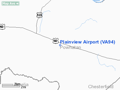
Location & QuickFacts
| FAA Information Effective: | 2008-09-25 |
| Airport Identifier: | VA94 |
| Airport Status: | Operational |
| Longitude/Latitude: | 077-53-28.9950W/37-32-08.5350N
-77.891387/37.535704 (Estimated) |
| Elevation: | 400 ft / 121.92 m (Estimated) |
| Land: | 7 acres |
| From nearest city: | 2 nautical miles SE of Powhatan, VA |
| Location: | Powhatan County, VA |
| Magnetic Variation: | 08W (1985) |
Owner & Manager
| Ownership: | Privately owned |
| Address: |
|
| Manager: | James B. Worsham, Jr. |
| Address: | 3513 Old Buckingham Road
Powhatan, VA 23139 |
| Phone number: | 804-598-4877 |
Airport Operations and Facilities
| Airport Use: | Private |
| Wind indicator: | Yes |
| Segmented Circle: | No |
| Control Tower: | No |
| Landing fee charge: | No |
| Sectional chart: | Washington |
| Region: | AEA - Eastern |
| Boundary ARTCC: | ZDC - Washington |
| Tie-in FSS: | DCA - Leesburg |
| FSS on Airport: | No |
| FSS Toll Free: | 1-800-WX-BRIEF |
Airport Communications
Airport Services
| Airframe Repair: | NONE |
| Power Plant Repair: | NONE |
Runway Information
Runway 07/25
| Dimension: | 1600 x 100 ft / 487.7 x 30.5 m |
| Surface: | TURF, |
| |
Runway 07 |
Runway 25 |
| Traffic Pattern: | Left | Left |
|
Radio Navigation Aids
| ID |
Type |
Name |
Ch |
Freq |
Var |
Dist |
| CF | NDB | Pubbs | | 392.00 | 09W | 24.2 nm |
| LJK | NDB | Ashey | | 280.00 | 09W | 24.2 nm |
| BKT | NDB | Blackstone | | 326.00 | 09W | 25.6 nm |
| FVX | NDB | Farmville | | 367.00 | 07W | 28.3 nm |
| PTB | NDB | Petersburg | | 284.00 | 08W | 28.7 nm |
| IQK | NDB | Louisa | | 382.00 | 09W | 29.2 nm |
| AZS | NDB | Azalea Park | | 336.00 | 08W | 41.2 nm |
| APH | NDB | A P Hill | | 396.00 | 10W | 42.7 nm |
| EZF | NDB | Shannon | | 237.00 | 10W | 48.6 nm |
| FAK | VORTAC | Flat Rock | 080X | 113.30 | 06W | 3.0 nm |
| RIC | VORTAC | Richmond | 088X | 114.10 | 09W | 27.3 nm |
| GVE | VORTAC | Gordonsville | 103X | 115.60 | 06W | 31.3 nm |
| HPW | VORTAC | Hopewell | 057X | 112.00 | 06W | 39.0 nm |
| LVL | VORTAC | Lawrenceville | 076X | 112.90 | 08W | 43.1 nm |
Remarks
Images and information placed above are from
http://www.airport-data.com/airport/VA94/
We thank them for the data!
| General Info
|
| Country |
United States
|
| State |
VIRGINIA
|
| FAA ID |
VA94
|
| Latitude |
37-32-08.535N
|
| Longitude |
077-53-28.995W
|
| Elevation |
400 feet
|
| Near City |
POWHATAN
|
We don't guarantee the information is fresh and accurate. The data may
be wrong or outdated.
For more up-to-date information please refer to other sources.
|
|


