 |
|
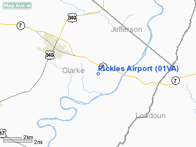
Location & QuickFacts
| FAA Information Effective: | 2008-09-25 |
| Airport Identifier: | 01VA |
| Airport Status: | Operational |
| Longitude/Latitude: | 077-55-30.0000W/39-07-30.0000N
-77.925000/39.125000 (Estimated) |
| Elevation: | 500 ft / 152.40 m (Estimated) |
| Land: | 5 acres |
| From nearest city: | 3 nautical miles SE of Berryville, VA |
| Location: | Clarke County, VA |
| Magnetic Variation: | 09W (1995) |
Owner & Manager
| Ownership: | Privately owned |
| Owner: | Richard D. & Marie T. Newman |
| Address: | 6211 Winnebago Road
Bethesda, MD 20816 |
| Phone number: | 301-229-8488 |
| Manager: | Richard D. & Marie T. Newman |
| Address: | 6211 Winnebago Road
Bethesda, MD 20816 |
| Phone number: | 301-229-8488 |
Airport Operations and Facilities
| Airport Use: | Private |
| Wind indicator: | Yes |
| Segmented Circle: | No |
| Control Tower: | No |
| Sectional chart: | Washington |
| Region: | AEA - Eastern |
| Boundary ARTCC: | ZDC - Washington |
| Tie-in FSS: | DCA - Leesburg |
| FSS Toll Free: | 1-800-WX-BRIEF |
Runway Information
Runway 03/21
| Dimension: | 1500 x 60 ft / 457.2 x 18.3 m |
| Surface: | TURF, |
| |
Runway 03 |
Runway 21 |
| Traffic Pattern: | Left | Left |
|
Radio Navigation Aids
| ID |
Type |
Name |
Ch |
Freq |
Var |
Dist |
| TZ | NDB | Cogan | | 364.00 | 10W | 7.1 nm |
| GDX | NDB | Goodwin Lake | | 227.00 | 08W | 11.2 nm |
| GAI | NDB | Gaithersburg | | 385.00 | 09W | 35.5 nm |
| CJR | NDB | Culpeper | | 252.00 | 09W | 35.8 nm |
| LUA | NDB | Caverns | | 245.00 | 09W | 36.2 nm |
| GTN | NDB | Georgetown | | 323.00 | 09W | 39.2 nm |
| MSQ | NDB | Nailr | | 351.00 | 10W | 40.3 nm |
| DC | NDB | Oxonn | | 332.00 | 11W | 47.2 nm |
| CBE | NDB | Cumberland | | 317.00 | 07W | 49.5 nm |
| FDK | VOR | Frederick | | 109.00 | 08W | 30.9 nm |
| HGR | VOR | Hagerstown | | 109.80 | 07W | 34.6 nm |
| DCA | VOR/DME | Washington | 047X | 111.00 | 09W | 44.5 nm |
| ESL | VOR/DME | Kessel | 045X | 110.80 | 06W | 50.0 nm |
| MRB | VORTAC | Martinsburg | 058X | 112.10 | 07W | 16.1 nm |
| LDN | VORTAC | Linden | 090X | 114.30 | 06W | 20.9 nm |
| AML | VORTAC | Armel | 082X | 113.50 | 08W | 24.3 nm |
| CSN | VORTAC | Casanova | 110X | 116.30 | 06W | 29.2 nm |
| THS | VORTAC | St Thomas | 097X | 115.00 | 07W | 48.6 nm |
| EMI | VORTAC | Westminster | 126X | 117.90 | 08W | 49.3 nm |
| DCA | VOT | Washington National | | 109.40 | | 44.9 nm |
Remarks
- PRVDD VFR DALGT ONLY, SPECIAL ATTENTION EXERCISED BY ACFT OPERATORS OF SIGNIFICANT SLOPE DROPPING FM NORTH, & CLEAR 20:1 APCH/DEP PATH FOR EACH RY.
Images and information placed above are from
http://www.airport-data.com/airport/01VA/
We thank them for the data!
| General Info
|
| Country |
United States
|
| State |
VIRGINIA
|
| FAA ID |
01VA
|
| Latitude |
39-07-30.000N
|
| Longitude |
077-55-30.000W
|
| Elevation |
500 feet
|
| Near City |
BERRYVILLE
|
We don't guarantee the information is fresh and accurate. The data may
be wrong or outdated.
For more up-to-date information please refer to other sources.
|
|


