 |
|
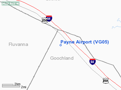
Location & QuickFacts
| FAA Information Effective: | 2008-09-25 |
| Airport Identifier: | VG05 |
| Airport Status: | Operational |
| Longitude/Latitude: | 078-03-26.9970W/37-52-46.5120N
-78.057499/37.879587 (Estimated) |
| Elevation: | 463 ft / 141.12 m (Estimated) |
| Land: | 60 acres |
| From nearest city: | 3 nautical miles NE of Tabscott, VA |
| Location: | Goochland County, VA |
| Magnetic Variation: | 09W (1995) |
Owner & Manager
| Ownership: | Privately owned |
| Owner: | Norman Call |
| Address: | P.o. Box 10
Crozier, VA 23039 |
| Phone number: | 804-784-3797 |
| Manager: | Norman Call |
| Address: | P.o. Box 10
Crozier, VA 23039 |
| Phone number: | 804-457-3987 |
Airport Operations and Facilities
| Airport Use: | Private |
| Segmented Circle: | No |
| Control Tower: | No |
| Sectional chart: | Washington |
| Region: | AEA - Eastern |
| Boundary ARTCC: | ZDC - Washington |
| Tie-in FSS: | DCA - Leesburg |
| FSS on Airport: | No |
| FSS Toll Free: | 1-800-WX-BRIEF |
Runway Information
Runway 08/26
| Dimension: | 2300 x 135 ft / 701.0 x 41.1 m |
| Surface: | TURF, Good Condition |
| |
Runway 08 |
Runway 26 |
| Traffic Pattern: | Left | Left |
| Obstruction: | 50 ft trees, 500.0 ft from runway | 50 ft trees, 500.0 ft from runway |
|
Radio Navigation Aids
| ID |
Type |
Name |
Ch |
Freq |
Var |
Dist |
| IQK | NDB | Louisa | | 382.00 | 09W | 12.7 nm |
| AZS | NDB | Azalea Park | | 336.00 | 08W | 23.2 nm |
| LJK | NDB | Ashey | | 280.00 | 09W | 28.2 nm |
| MSQ | NDB | Nailr | | 351.00 | 10W | 35.3 nm |
| FVX | NDB | Farmville | | 367.00 | 07W | 36.5 nm |
| APH | NDB | A P Hill | | 396.00 | 10W | 36.9 nm |
| EZF | NDB | Shannon | | 237.00 | 10W | 36.9 nm |
| CJR | NDB | Culpeper | | 252.00 | 09W | 40.3 nm |
| CF | NDB | Pubbs | | 392.00 | 09W | 43.7 nm |
| BKT | NDB | Blackstone | | 326.00 | 09W | 45.2 nm |
| MOL | VOR/DME | Montebello | 100X | 115.30 | 05W | 49.8 nm |
| GVE | VORTAC | Gordonsville | 103X | 115.60 | 06W | 9.2 nm |
| FAK | VORTAC | Flat Rock | 080X | 113.30 | 06W | 23.8 nm |
| RIC | VORTAC | Richmond | 088X | 114.10 | 09W | 41.8 nm |
| BRV | VORTAC | Brooke | 092X | 114.50 | 09W | 43.2 nm |
| CSN | VORTAC | Casanova | 110X | 116.30 | 06W | 46.7 nm |
Remarks
- SEE AIRSPACE LETTER DATED APRIL 19, 1993.
Images and information placed above are from
http://www.airport-data.com/airport/VG05/
We thank them for the data!
| General Info
|
| Country |
United States
|
| State |
VIRGINIA
|
| FAA ID |
VG05
|
| Latitude |
37-52-46.512N
|
| Longitude |
078-03-26.997W
|
| Elevation |
463 feet
|
| Near City |
TABSCOTT
|
We don't guarantee the information is fresh and accurate. The data may
be wrong or outdated.
For more up-to-date information please refer to other sources.
|
|


