 |
|
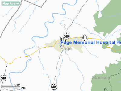
Page Memorial Hospital Heliport |
Location & QuickFacts
| FAA Information Effective: | 2008-09-25 |
| Airport Identifier: | CD27 |
| Airport Status: | Operational |
| Longitude/Latitude: | 078-28-04.0000W/38-39-45.0000N
-78.467778/38.662500 (Estimated) |
| Elevation: | 900 ft / 274.32 m (Estimated) |
| Land: | 0 acres |
| From nearest city: | 2 nautical miles SW of Luray, VA |
| Location: | Page County, VA |
| Magnetic Variation: | 09W (1995) |
Owner & Manager
| Ownership: | Privately owned |
| Owner: | Page Memorial Hospital |
| Address: | 200 Memorial Drive
Luray, VA 22835 |
| Phone number: | 540-743-4561 |
| Manager: | Donald Morgan |
| Address: | 200 Memorial Drive
Luray, VA 22835 |
| Phone number: | 540-743-4561 |
Airport Operations and Facilities
| Airport Use: | Private
MEDICAL USE. |
| Wind indicator: | Yes |
| Segmented Circle: | No |
| Control Tower: | No |
| Lighting Schedule: | RDO-CTL
FOR PERIMETER & FLOOD LGTS CTC 462.950 RCV/467.950 TMT. |
| Sectional chart: | Washington |
| Region: | AEA - Eastern |
| Boundary ARTCC: | ZDC - Washington |
| Tie-in FSS: | DCA - Leesburg |
| FSS on Airport: | No |
| FSS Toll Free: | 1-800-WX-BRIEF |
Runway Information
Helipad H1
| Dimension: | 30 x 30 ft / 9.1 x 9.1 m |
| Surface: | CONC, |
| |
Runway H1 |
Runway |
| Traffic Pattern: | Left | Left |
|
Radio Navigation Aids
| ID |
Type |
Name |
Ch |
Freq |
Var |
Dist |
| LUA | NDB | Caverns | | 245.00 | 09W | 2.2 nm |
| MSQ | NDB | Nailr | | 351.00 | 10W | 29.2 nm |
| VBW | NDB | Bridgewater | | 241.00 | 07W | 29.3 nm |
| CJR | NDB | Culpeper | | 252.00 | 09W | 29.7 nm |
| TZ | NDB | Cogan | | 364.00 | 10W | 31.6 nm |
| GDX | NDB | Goodwin Lake | | 227.00 | 08W | 34.6 nm |
| AZS | NDB | Azalea Park | | 336.00 | 08W | 39.3 nm |
| IQK | NDB | Louisa | | 382.00 | 09W | 48.1 nm |
| ESL | VOR/DME | Kessel | 045X | 110.80 | 06W | 41.7 nm |
| LDN | VORTAC | Linden | 090X | 114.30 | 06W | 16.9 nm |
| CSN | VORTAC | Casanova | 110X | 116.30 | 06W | 28.3 nm |
| GVE | VORTAC | Gordonsville | 103X | 115.60 | 06W | 41.7 nm |
| AML | VORTAC | Armel | 082X | 113.50 | 08W | 49.7 nm |
Remarks
- PRVDD HELICOPTERS WEIGH NO MORE THAN 12500 LBS; PILOTS BE BRIEFED TO AVOID LURAY CAVERNS ARPT TFC PTNS; OVERFLIGHT OF HOMES & SCHOOLS IS AVOIDED; A NOTAM IS FILED WITH LEESBURG FSS 48 HRS PRIOR TO OPNS AT THIS FAC.
Images and information placed above are from
http://www.airport-data.com/airport/CD27/
We thank them for the data!
| General Info
|
| Country |
United States
|
| State |
VIRGINIA
|
| FAA ID |
CD27
|
| Latitude |
38-39-45.000N
|
| Longitude |
078-28-04.000W
|
| Elevation |
900 feet
|
| Near City |
LURAY
|
We don't guarantee the information is fresh and accurate. The data may
be wrong or outdated.
For more up-to-date information please refer to other sources.
|
|


