 |
|
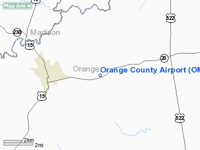
Location & QuickFacts
| FAA Information Effective: | 2008-09-25 |
| Airport Identifier: | OMH |
| Airport Status: | Operational |
| Longitude/Latitude: | 078-02-44.1970W/38-14-49.9790N
-78.045610/38.247216 (Estimated) |
| Elevation: | 465 ft / 141.73 m (Surveyed) |
| Land: | 322 acres |
| From nearest city: | 3 nautical miles E of Orange, VA |
| Location: | Orange County, VA |
| Magnetic Variation: | 09W (1990) |
Owner & Manager
| Ownership: | Publicly owned |
| Owner: | Orange County |
| Address: | P O Box 111
Orange, VA 22960 |
| Phone number: | 540-661-5400 |
| Manager: | Peggy Miles |
| Address: | 19103 Constitution Hwy
Orange, VA 22960 |
| Phone number: | 540-672-2158 |
Airport Operations and Facilities
| Airport Use: | Open to public |
| Wind indicator: | Yes |
| Segmented Circle: | Yes |
| Control Tower: | No |
| Lighting Schedule: | DUSK-DAWN
ACTVT MIRL RY 08/26, REIL & PAPI RYS 08 & 26 - CTAF. |
| Beacon Color: | Clear-Green (lighted land airport) |
| Landing fee charge: | No |
| Sectional chart: | Washington |
| Region: | AEA - Eastern |
| Boundary ARTCC: | ZDC - Washington |
| Tie-in FSS: | DCA - Leesburg |
| FSS on Airport: | No |
| FSS Toll Free: | 1-800-WX-BRIEF |
| NOTAMs Facility: | OMH (NOTAM-d service avaliable) |
| Federal Agreements: | NGY |
Airport Communications
| CTAF: | 122.800 |
| Unicom: | 122.800 |
Airport Services
| Fuel available: | 100LLA+
100LL SELF SERVICE AFTER HOURS |
| Airframe Repair: | MINOR |
| Power Plant Repair: | MINOR |
| Bottled Oxygen: | NONE |
| Bulk Oxygen: | NONE |
Runway Information
Runway 08/26
| Dimension: | 3200 x 75 ft / 975.4 x 22.9 m |
| Surface: | ASPH, |
| Surface Treatment: | Aggregate Friction Seal Coat |
| Weight Limit: | Single wheel: 12000 lbs. |
| Edge Lights: | Medium |
| |
Runway 08 |
Runway 26 |
| Longitude: | 078-03-02.5240W | 078-02-25.9600W |
| Latitude: | 38-14-43.4550N | 38-14-56.4110N |
| Elevation: | 446.00 ft | 465.00 ft |
| Alignment: | 66 | 127 |
| Traffic Pattern: | Left | Left |
| Markings: | Non-precision instrument, Good Condition | Non-precision instrument, Good Condition |
| Crossing Height: | 39.00 ft | 40.00 ft |
| VASI: | 2-light PAPI on left side | 2-light PAPI on left side |
| Visual Glide Angle: | 4.00° | 4.00° |
| Runway End Identifier: | Yes | Yes |
| Obstruction: | 92 ft trees, 2416.0 ft from runway, 374 ft left of centerline, 24:1 slope to clear | 102 ft trees, 2145.0 ft from runway, 199 ft right of centerline, 19:1 slope to clear |
|
Radio Navigation Aids
| ID |
Type |
Name |
Ch |
Freq |
Var |
Dist |
| MSQ | NDB | Nailr | | 351.00 | 10W | 14.1 nm |
| IQK | NDB | Louisa | | 382.00 | 09W | 16.2 nm |
| CJR | NDB | Culpeper | | 252.00 | 09W | 19.2 nm |
| AZS | NDB | Azalea Park | | 336.00 | 08W | 26.5 nm |
| EZF | NDB | Shannon | | 237.00 | 10W | 28.1 nm |
| LUA | NDB | Caverns | | 245.00 | 09W | 33.8 nm |
| APH | NDB | A P Hill | | 396.00 | 10W | 35.4 nm |
| LJK | NDB | Ashey | | 280.00 | 09W | 39.1 nm |
| GDX | NDB | Goodwin Lake | | 227.00 | 08W | 43.7 nm |
| VBW | NDB | Bridgewater | | 241.00 | 07W | 43.8 nm |
| GVE | VORTAC | Gordonsville | 103X | 115.60 | 06W | 14.9 nm |
| CSN | VORTAC | Casanova | 110X | 116.30 | 06W | 25.2 nm |
| BRV | VORTAC | Brooke | 092X | 114.50 | 09W | 33.1 nm |
| LDN | VORTAC | Linden | 090X | 114.30 | 06W | 37.3 nm |
| FAK | VORTAC | Flat Rock | 080X | 113.30 | 06W | 44.4 nm |
| AML | VORTAC | Armel | 082X | 113.50 | 08W | 49.5 nm |
Remarks
Images and information placed above are from
http://www.airport-data.com/airport/OMH/
We thank them for the data!
| General Info
|
| Country |
United States
|
| State |
VIRGINIA
|
| FAA ID |
OMH
|
| Latitude |
38-14-49.979N
|
| Longitude |
078-02-44.197W
|
| Elevation |
465 feet
|
| Near City |
ORANGE
|
We don't guarantee the information is fresh and accurate. The data may
be wrong or outdated.
For more up-to-date information please refer to other sources.
|
|


