 |
|
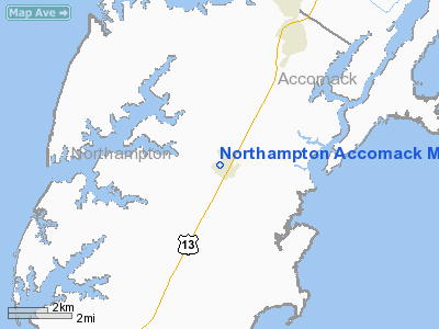
Northampton Accomack Memorial Hospital Heliport |
Location & QuickFacts
| FAA Information Effective: | 2008-09-25 |
| Airport Identifier: | 6VA7 |
| Airport Status: | Operational |
| Longitude/Latitude: | 075-51-50.7500W/37-28-30.4860N
-75.864097/37.475135 (Estimated) |
| Elevation: | 40 ft / 12.19 m (Estimated) |
| Land: | 0 acres |
| From nearest city: | 0 nautical miles N of Nassawadox, VA |
| Location: | Northampton County, VA |
| Magnetic Variation: | 10W (1985) |
Owner & Manager
| Ownership: | Privately owned |
| Owner: | Northampton Mem Hosp |
| Address: |
Nassawadox, VA 23413 |
| Phone number: | 804-442-8000 |
| Address: |
|
Airport Operations and Facilities
| Airport Use: | Private
MEDICAL USE. |
| Wind indicator: | No |
| Segmented Circle: | No |
| Control Tower: | No |
| Landing fee charge: | No |
| Sectional chart: | Washington |
| Region: | AEA - Eastern |
| Boundary ARTCC: | ZDC - Washington |
| Tie-in FSS: | DCA - Leesburg |
| FSS on Airport: | No |
| FSS Toll Free: | 1-800-WX-BRIEF |
Runway Information
Helipad H1
| Dimension: | 75 x 75 ft / 22.9 x 22.9 m |
| Surface: | CONC, |
| |
Runway H1 |
Runway |
| Traffic Pattern: | Left | Left |
|
Radio Navigation Aids
| ID |
Type |
Name |
Ch |
Freq |
Var |
Dist |
| BDB | NDB | Accomack | | 336.00 | 11W | 6.5 nm |
| PJS | NDB | Henry | | 375.00 | 09W | 36.4 nm |
| FAF | NDB | Felker | | 226.00 | 08W | 41.4 nm |
| LFI | TACAN | Langley | 070X | | 10W | 33.3 nm |
| NGU | TACAN | Chambers | 048X | | 10W | 37.8 nm |
| NTU | TACAN | Oceana | 113X | | 10W | 40.0 nm |
| CCV | VORTAC | Cape Charles | 059X | 112.20 | 10W | 10.0 nm |
| ORF | VORTAC | Norfolk | 116X | 116.90 | 07W | 38.6 nm |
| SWL | VORTAC | Snow Hill | 071X | 112.40 | 08W | 39.8 nm |
| HCM | VORTAC | Harcum | 025X | 108.80 | 07W | 40.5 nm |
Remarks
- E111 OBSTN LGTG ON WATER TWR/HOSP FOR NIGHT OPNS. FENCE BTN WALKWAY/LNDG PAD. COORD INGRESS/EGRESS/ALT WITH NORFOLK TWR. FOR EMERG MED USE.
Images and information placed above are from
http://www.airport-data.com/airport/6VA7/
We thank them for the data!
| General Info
|
| Country |
United States
|
| State |
VIRGINIA
|
| FAA ID |
6VA7
|
| Latitude |
37-28-30.486N
|
| Longitude |
075-51-50.750W
|
| Elevation |
40 feet
|
| Near City |
NASSAWADOX
|
We don't guarantee the information is fresh and accurate. The data may
be wrong or outdated.
For more up-to-date information please refer to other sources.
|
|


