 |
|
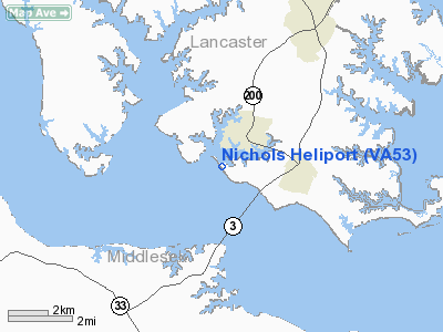
Location & QuickFacts
| FAA Information Effective: | 2008-09-25 |
| Airport Identifier: | VA53 |
| Airport Status: | Operational |
| Longitude/Latitude: | 076-25-58.7400W/37-38-51.1200N
-76.432983/37.647533 (Estimated) |
| Elevation: | 22 ft / 6.71 m (Estimated) |
| Land: | 4 acres |
| From nearest city: | 2 nautical miles SW of White Stone, VA |
| Location: | Lancaster County, VA |
| Magnetic Variation: | 10W (1995) |
Owner & Manager
| Ownership: | Privately owned |
| Owner: | David B Nichols |
| Address: | Rt 659 Po Box 46, 981 Crab Point Rd
White Stone, VA 22578 |
| Phone number: | 804-435-2419 |
| Manager: | David B Nichols |
| Address: | Rt 649 Po Box 46, 981 Crab Point Rd
White Stone, VA 22578 |
| Phone number: | 804-435-2419 |
Airport Operations and Facilities
| Airport Use: | Private |
| Wind indicator: | Yes |
| Segmented Circle: | No |
| Control Tower: | No |
| Sectional chart: | Washington |
| Region: | AEA - Eastern |
| Boundary ARTCC: | ZDC - Washington |
| Tie-in FSS: | DCA - Leesburg |
| FSS Toll Free: | 1-800-WX-BRIEF |
Runway Information
Helipad H1
| Dimension: | 150 x 150 ft / 45.7 x 45.7 m |
| Surface: | TURF, |
| |
Runway H1 |
Runway |
| Traffic Pattern: | Left | Left |
|
Radio Navigation Aids
| ID |
Type |
Name |
Ch |
Freq |
Var |
Dist |
| BDB | NDB | Accomack | | 336.00 | 11W | 30.6 nm |
| PJS | NDB | Henry | | 375.00 | 09W | 31.1 nm |
| FAF | NDB | Felker | | 226.00 | 08W | 31.8 nm |
| NHK | NDB | Patuxent | | 400.00 | 10W | 38.4 nm |
| AKQ | NDB | Wakefield | | 274.00 | 09W | 48.3 nm |
| APH | NDB | A P Hill | | 396.00 | 10W | 49.9 nm |
| LFI | TACAN | Langley | 070X | | 10W | 34.0 nm |
| NGU | TACAN | Chambers | 048X | | 10W | 43.2 nm |
| HCM | VORTAC | Harcum | 025X | 108.80 | 07W | 17.9 nm |
| CCV | VORTAC | Cape Charles | 059X | 112.20 | 10W | 27.5 nm |
| HPW | VORTAC | Hopewell | 057X | 112.00 | 06W | 37.8 nm |
| PXT | VORTAC | Patuxent | 123X | 117.60 | 10W | 38.5 nm |
| RIC | VORTAC | Richmond | 088X | 114.10 | 09W | 43.2 nm |
| ORF | VORTAC | Norfolk | 116X | 116.90 | 07W | 46.8 nm |
Remarks
- PRVDD VFR ONLY, CLEAR 8:1 ENGRESS/EGRESS, VEHICULAR TFC CONTROLLED, APPROPRIATE INGRESS/EGRESS MKGS.
Images and information placed above are from
http://www.airport-data.com/airport/VA53/
We thank them for the data!
| General Info
|
| Country |
United States
|
| State |
VIRGINIA
|
| FAA ID |
VA53
|
| Latitude |
37-38-51.120N
|
| Longitude |
076-25-58.740W
|
| Elevation |
22 feet
|
| Near City |
WHITE STONE
|
We don't guarantee the information is fresh and accurate. The data may
be wrong or outdated.
For more up-to-date information please refer to other sources.
|
|


