|
 |
|
||||
|
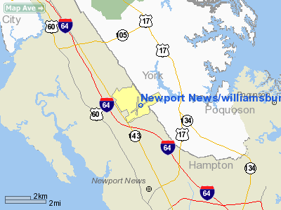
Newport News/Williamsburg International Airport (IATA: PHF, ICAO: KPHF) is an airport located 9 mi (14 km) northwest of downtown Newport News, Virginia, and serves the entire Hampton Roads metropolitan area along with Norfolk International Airport in Norfolk. Newport News/Williamsburg International does not currently handle any international passenger flights, but does service a number of corporate international flights. There are currently two runways (7-25 and 2-20). A third runway (7L-25R) is planned for completion in 2012. HistoryIn 1946, Virginia's General Assembly passed legislation creating the Peninsula Airport Commission (PAC) to determine a location for and establish a new commercial airport to serve the cities of Newport News, Hampton, and Warwick. An agreement was reached with the US War Asset Administration in 1947 to transfer 924 acres (3.7 km²) of the former Camp Patrick Henry, a World War II US Army base, to the PAC as the site for the new airport. A Nike missile air defense base, known as N-85, still exists on the property, though abandoned since the mid-1960s. The airport was originally named Patrick Henry Airport. It was assigned the designator PHF, representing Patrick Henry Field. The first runway built was Runway 2-20, a 3,500-foot (1,100 m) runway, followed by Runway 6-24 (later redesignated as Runway 7-25). Commercial airline service began in November 1949. The airport was serviced by Piedmont Airlines and Capital Airlines. In 1951, the original passenger terminal was damaged by a fire. An upgraded traffic control tower was constructed and began operation and Runway 6-24 was extended to 5,000 feet (1,500 m) for larger four-engine aircraft during 1952. A new passenger terminal was opened in 1955. Between 1952 and the 1970, three other airlines United Airlines, National Airlines, and USAir extended service to the airport. Both runways were extended during this period to their current lengths of 6526 feet (1989 m) Runway 2-20, and 8003 feet (2439 m) Runway 7-25. The airport was renamed "Patrick Henry International Airport" in 1975. A US Customs facility was added to the passenger terminal building to allow international flights (both commercial and corporate) access to the airfield. The airport now consists of 1,800 acres (7.3 km), with most of it in the city of Newport News and part of the airfield with runway 20 in York County. When the United States Congress deregulated the airlines in 1978, many airlines serving Patrick Henry Airport consolidated their southeast Virginia services at other area airports. This resulted in Patrick Henry International Airport losing all jet services. By 1979 the airport only offered small commuter flights to very few destinations. On December 19, 1980, the Daily Press reported a committee authorized by the PAC recommended that the airport change its name to "Newport News/Williamsburg International" to then-Executive Director Mr. White. This change would not take place until almost ten full years later. At the time, the Commission members represented the cities of Newport News, Hampton, Williamsburg, as well as James City County and York County. In 1985, USAir added large jet services from Pittsburgh and Washington, DC. These jet services were pulled in 1995 and the airline's US Airways Express division now serves Philadelphia and Charlotte from the airport. The PAC renamed the facility Newport News/Williamsburg International Airport in September 1990. A new terminal was opened in late 1992. AirTran Airways started service from the airport to Atlanta in 1995, and now also flies to Boston, New York City, and Orlando. In May 2008, AirTran discontinued service to Tampa and replaced it with an additional route to LaGuardia NYC. Delta Connection began service from Newport News/Williamsburg International Airport to Atlanta in February, 2002, and has since had service until recently to Boston. Delta Air Lines maintains one daily mainline roundtrip flight to Atlanta operated by an MD-88 aircraft, but in June 2010 will add a second MD-88 mainline flight. All Delta flights will include first class seating in early 2010, and is increasing to a total of nine departing flights per day. Until the 1990s, part of the original terminal building was named Flight Services Building, and home to the National Weather Service. Weather reports and emergency alerts were broadcast on radio stations and weather frequencies during severe weather right from the airport. When the original control tower was shut down in July 2007 with the opening of the state of the art 147 ft (45 m) tall new tower, it had been the oldest operating control tower on the east coast with continuous service for 55 years. President Barack Obama flew into the Newport News/Williamsburg International Airport on Air Force One (from Andrews Air Force Base) for the first time as President of the United States; he was to attend the U.S. House Democratic Retreat. The airport is the airport of choice for US Presidents who visit the Hampton Roads area, having been visited by Presidents George H.W. Bush, Bill Clinton, and George W. Bush during their terms in office. ExpansionPanoramic view of tower, terminal and parking garageIn light of steady growth at the airport (which breaks its own record for passenger enplanements almost every month), the airport has launched a massive expansion effort. Recently completed were additional parking lots to handle increased rental car fleets; total parking capacity is estimated at 3,000, and a new air traffic control tower was completed in July 2007, to replace the one built in 1951. A new three-level parking garage opened in June 2007, with two or three more garages planned. The current pair of baggage claim carousels, will be increased to as many as five. Further plans call for an additional three concourses, a third runway of 10,000 ft (3,000 m), a new General Aviation terminal, and extending the existing runways to 10,000 ft (3,000 m). Additional taxiways are planned as well. The airport also is developing Air Commerce Park, which is an area of the airfield which was to host the 2003 Aviation World's Fair. This Park is planned to bring corporate flights and cargo handling capabilities as well as companies such as FedEx or UPS and others with unique hangar space and direct access to runways through currently closed Taxiways J and L. Recent news reports stated that Orion Air will be the first tenant in the Park, employing 51 persons and constructing a 40,000 sq ft (3,700 m). facility. The airport is served by various taxi companies, including Orange, Associated, Yellow, and Independent. Also, HRT (Hampton Roads Transit) serves the airport with regional bus service; the airport is on HRT Route 111. Shuttle and Limousine companies also service the airport through pre-arranged appointments. Five car rental agencies can be found at the airport, including Hertz, National, Enterprise and Avis, too. The airport is also home to two Fixed Base Operators, Rick Aviation and Atlantic Aviation. Each provide flight instruction schools, and jet fuel services to private and commercial airplanes. Atlantic Aviation handles international chartered flights. Rick Aviation continues to operate inside the original passenger terminal, sharing space with Denbigh High School's Aviation Academy (serving 350+ high school students) and Hampton University's Aerospace Aviation School. The Commission also operates its own police department and fire department, which provide full service protection for the entire airport facility including the airport's own residential area, which continues to be home for some airport employees. Crimes investigated by the airport police are prosecuted mostly in Newport News city courts, though a few cases are prosecuted in York County courts, depending on which side of the city line crime occurs. The airport has handled over one million passengers every year since 2005, with each succeeding year showing significant increases. The airport is considered the third-fastest growing airport in the United States and the 118th largest airport. For several years, rumors abounded that the substantial expansions may coincide with the announcement of a new carrier to come to the airport - with some speculation going as far as direct UK-Newport News flights. This rumor, though hardly substantiated, has circulated in a number of circles within Hampton Roads, leading up to Jamestown 2007 festivities and the recent decision by UK industrial giant Wolseley plc to make Newport News their North American headquarters. In December 2008, the PAC announced that Ken R. Spirito had been selected to serve as its new Executive Director, replacing interim director Mark Falin, who remains on as Deputy Airport Director. On February 4, 2010, PAC announced that Frontier Airlines would begin nonstop service from Newport News with direct flights to Denver, Colorado with four flights per week. Initial service was to be provided by Airbus A318 128-seat jets, to be followed up June 4 with Airbus A319 136-seat aircraft. Due to high demand however, the upgrade from A318 to A319 jets took place within weeks of the inaugural May 3rd flight, ahead of schedule. Ths airport has completed building its second terminal concourse (Concourse A) and opened it on May 3, 2010, which is for AirTran Airways and Frontier Airlines. Concourse B will be completely remodeled with all new facilities and gates for Delta Airlines and US Airways. The airport's USO office was recently expanded, doubling it in size to better serve military personnel who fly through the airport. Additionally, expansion and improvements within the airport's atrium include all-new seating throughout the terminal building and both concourses, as well as a new Welcome Services center. Virginia Lottery kiosks were installed as well as additional ATM machines. Plasma screens have been placed throughout the terminal building to provide flight and luggage information, as well as plasma TV screens for news and events. An outdoor pair of escalators is planned to replace some of the stairs leading to the terminal from the parking lots. As reported by the Daily Press, the airport is undergoing over $23 million worth of expansions, improvements and upgrades. Airlines and destinations
The above content comes from Wikipedia and is published under free licenses – click here to read more.
Location & QuickFacts
Owner & Manager
Airport Operations and Facilities
Airport Communications
Airport Services
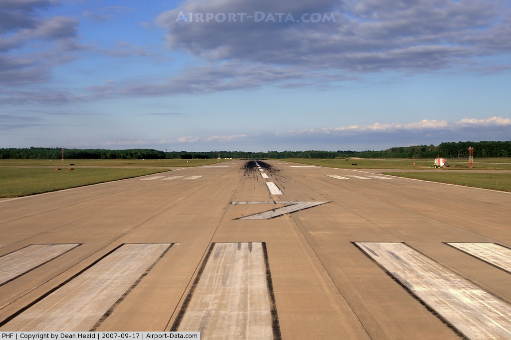
Runway InformationRunway 02/20
Runway 07/25
Radio Navigation Aids
Remarks
Images and information placed above are from We thank them for the data!
We don't guarantee the information is fresh and accurate. The data may
be wrong or outdated.
|
|||||||||||||||||||||||||||||||||||||||||||||||||||||||||||||||||||||||||||||||||||||||||||||||||||||||||||||||||||||||||||||||||||||||||||||||||||||||||||||||||||||||||||||||||||||||||||||||||||||||||||||||||||||||||||||||||||||||||||||||||||||||||||||||||||||||||||||||||||||||||||||||||||||||||||||||||||||||||||||||||||||||||||||||||||||||||||||||||||||||||||||||||||||||||||||||||||||||||||||||||||||||||||||||||||||||||||||||||||||||||||||

 |
|
Copyright 2004-2026 © by Airports-Worldwide.com, Vyshenskoho st. 36, Lviv 79010, Ukraine Legal Disclaimer |