 |
|
| New River Valley Airport |
| IATA: PSK – ICAO: KPSK – FAA LID: PSK |
| Summary |
| Airport type |
Public |
| Owner |
New River Valley Airport Commission |
| Serves |
New River Valley |
| Location |
Dublin, Virginia |
| Elevation AMSL |
2,105 ft / 642 m |
| Coordinates |
37°08′14″N 080°40′43″W / 37.13722°N 80.67861°W / 37.13722; -80.67861 |
| Runways |
| Direction |
Length |
Surface |
| ft |
m |
| 6/24 |
6,201 |
1,890 |
Asphalt |
| Statistics (2006) |
| Aircraft operations |
10,044 |
| Based aircraft |
34 |
| Source: Federal Aviation Administration |
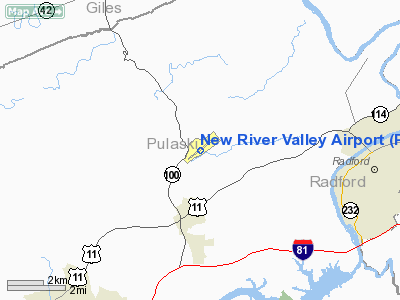
New River Valley Airport (IATA: PSK, ICAO: KPSK, FAA LID: PSK) is a public use airport located two nautical miles (4 km) north of the central business district of Dublin, in Pulaski County, Virginia, United States. It is owned by the New River Valley Airport Commission.
The facility serves primarily general aviation, but is also an official U.S. Customs Service port of entry as of 2006.
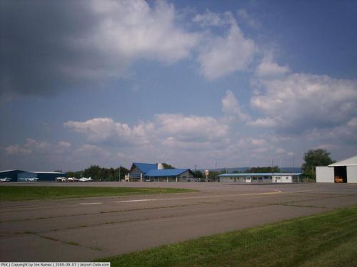
Facilities and aircraft
New River Valley Airport covers an area of 469 acres (190 ha) at an elevation of 2,105 feet (642 m) above mean sea level. It has one asphalt paved runway designated 6/24 which measures 6,201 by 150 feet (1,890 x 46 m).
For the 12-month period ending July 31, 2006, the airport had 10,044 aircraft operations, an average of 27 per day: 62% general aviation and 38% military. At that time there were 34 aircraft based at this airport: 79% single-engine, 18% multi-engine and 3% helicopter.
The above content comes from Wikipedia and is published under free licenses – click here to read more.
 |
(Click on the photo to enlarge) |
Location & QuickFacts
| FAA Information Effective: | 2008-09-25 |
| Airport Identifier: | PSK |
| Airport Status: | Operational |
| Longitude/Latitude: | 080-40-42.5340W/37-08-14.4430N
-80.678482/37.137345 (Estimated) |
| Elevation: | 2105 ft / 641.60 m (Surveyed) |
| Land: | 469 acres |
| From nearest city: | 2 nautical miles N of Dublin, VA |
| Location: | Pulaski County, VA |
| Magnetic Variation: | 06W (1985) |
Owner & Manager
| Ownership: | Publicly owned |
| Owner: | New River Valley Arpt Cmsn |
| Address: | 5391 C. V. Jackson Road
Dublin, VA 24084 |
| Phone number: | 540-674-4141 |
| Manager: | Bob Adkins |
| Address: | 5391 C. V. Jackson Road
Dublin, VA 24084 |
| Phone number: | 540-674-4141 |
Airport Operations and Facilities
| Airport Use: | Open to public |
| Wind indicator: | Yes |
| Segmented Circle: | Yes |
| Control Tower: | No |
| Lighting Schedule: | DUSK-DAWN
ACTVT HIRL RY 06/24; MALSR RY 06 - CTAF. |
| Beacon Color: | Clear-Green (lighted land airport) |
| Landing fee charge: | No |
| Sectional chart: | Cincinnati |
| Region: | AEA - Eastern |
| Boundary ARTCC: | ZTL - Atlanta |
| Responsible ARTCC: | ZDC - Washington |
| Tie-in FSS: | DCA - Leesburg |
| FSS on Airport: | No |
| FSS Toll Free: | 1-800-WX-BRIEF |
| NOTAMs Facility: | PSK (NOTAM-d service avaliable) |
| Federal Agreements: | NGY |
Airport Communications
| CTAF: | 122.700 |
| Unicom: | 122.700 |
Airport Services
| Fuel available: | 100LLA |
| Airframe Repair: | MINOR |
| Power Plant Repair: | MINOR |
| Bottled Oxygen: | NONE |
| Bulk Oxygen: | NONE |
Runway Information
Runway 06/24
| Dimension: | 6201 x 150 ft / 1890.1 x 45.7 m |
| Surface: | ASPH, Good Condition |
| Weight Limit: | Dual wheel: 60000 lbs. |
| Edge Lights: | High |
| |
Runway 06 |
Runway 24 |
| Longitude: | 080-41-12.7600W | 080-40-12.3190W |
| Latitude: | 37-07-55.6210N | 37-08-33.2660N |
| Elevation: | 2105.00 ft | 2073.00 ft |
| Alignment: | 52 | 127 |
| ILS Type: | ILS
| |
| Traffic Pattern: | Left | Left |
| Markings: | Precision instrument, Fair Condition | Precision instrument, Fair Condition |
| Crossing Height: | 0.00 ft | 44.00 ft |
| VASI: | | 4-light PAPI on left side |
| Visual Glide Angle: | 0.00° | 3.00° |
| Approach lights: | MALSR | |
| Runway End Identifier: | | Yes |
| Centerline Lights: | No | No |
| Touchdown Lights: | No | No |
| Obstruction: | 8 ft gnd, 200.0 ft from runway, 300 ft left of centerline
+10 FT ROAD 100 FT FM THLD ON CENTERLINE (SERVICE ROAD). | 10 ft tree, 270.0 ft from runway, 350 ft right of centerline, 7:1 slope to clear
+22 FT TREES 0-200 FT FM THLD 200 FT L, +15 FT TREES 0-200 FT FM THLD 350 FT R. |
|
Radio Navigation Aids
| ID |
Type |
Name |
Ch |
Freq |
Var |
Dist |
| TEC | NDB | Tech | | 368.00 | 06W | 13.9 nm |
| HLX | NDB | Hillsville | | 269.00 | 06W | 23.6 nm |
| CNQ | NDB | Callahan | | 379.00 | 05W | 26.0 nm |
| MK | NDB | Suzze | | 335.00 | 06W | 30.1 nm |
| VIT | NDB | Vinton | | 277.00 | 06W | 38.4 nm |
| LW | NDB | Bushi | | 346.00 | 06W | 40.0 nm |
| AZW | NDB | Mount Airy | | 223.00 | 07W | 45.9 nm |
| UV | NDB | Bales | | 396.00 | 07W | 49.2 nm |
| ZEF | NDB | Zephyr | | 326.00 | 05W | 49.6 nm |
| ODR | VOR | Woodrum | | 114.90 | 06W | 35.3 nm |
| LWB | VOR/DME | Greenbrier | 107Y | 116.05 | 08W | 45.8 nm |
| PSK | VORTAC | Pulaski | 115X | 116.80 | 06W | 3.4 nm |
| BLF | VORTAC | Bluefield | 037X | 110.00 | 03W | 26.7 nm |
| ROA | VORTAC | Roanoke | 031X | 109.40 | 04W | 31.6 nm |
| BKW | VORTAC | Beckley | 124X | 117.70 | 06W | 44.1 nm |
Remarks
- DEER ON & INVOF ARPT.
- CUSTOMS SERVICE ON AIRPORT.
Images and information placed above are from
http://www.airport-data.com/airport/PSK/
We thank them for the data!
| General Info
|
| Country |
United States
|
| State |
VIRGINIA
|
| FAA ID |
PSK
|
| Latitude |
37-08-14.443N
|
| Longitude |
080-40-42.534W
|
| Elevation |
2105 feet
|
| Near City |
DUBLIN
|
We don't guarantee the information is fresh and accurate. The data may
be wrong or outdated.
For more up-to-date information please refer to other sources.
|
|


