 |
|
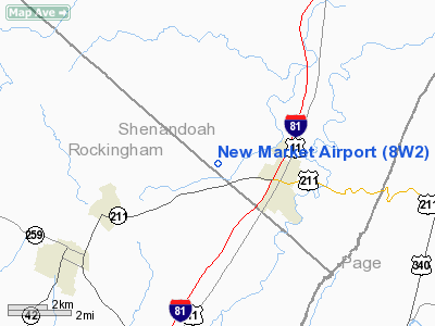
Location & QuickFacts
| FAA Information Effective: | 2008-09-25 |
| Airport Identifier: | 8W2 |
| Airport Status: | Operational |
| Longitude/Latitude: | 078-42-29.0680W/38-39-20.4240N
-78.708074/38.655673 (Estimated) |
| Elevation: | 975 ft / 297.18 m (Estimated) |
| Land: | 44 acres |
| From nearest city: | 2 nautical miles W of New Market, VA |
| Location: | Shenandoah County, VA |
| Magnetic Variation: | 08W (1985) |
Owner & Manager
| Ownership: | Privately owned |
| Owner: | Robert Thomas |
| Address: | Po Box 3190
Oakton, VA 22124 |
| Phone number: | 703-281-2300
FAX 703-281-2305 |
| Manager: | Robert Thomas |
| Address: | 20273 Unison Road
Roundhill, VA 20141 |
| Phone number: | 540-740-3949 |
Airport Operations and Facilities
| Airport Use: | Open to public |
| Wind indicator: | Yes |
| Segmented Circle: | No |
| Control Tower: | No |
| Lighting Schedule: | DUSK-2200 |
| Beacon Color: | Clear-Green (lighted land airport) |
| Sectional chart: | Washington |
| Region: | AEA - Eastern |
| Traffic Pattern Alt: | 825 ft |
| Boundary ARTCC: | ZDC - Washington |
| Tie-in FSS: | DCA - Leesburg |
| FSS on Airport: | No |
| FSS Toll Free: | 1-800-WX-BRIEF |
| NOTAMs Facility: | DCA (NOTAM-d service avaliable) |
Airport Communications
| CTAF: | 122.800 |
| Unicom: | 122.800 |
Airport Services
| Fuel available: | 100LL
24 HR CREDIT CARD SVC |
| Airframe Repair: | MINOR
BALLOON REPAIR STATION |
| Power Plant Repair: | MINOR |
| Bottled Oxygen: | NONE |
| Bulk Oxygen: | NONE |
Runway Information
Runway 06/24
| Dimension: | 2920 x 60 ft / 890.0 x 18.3 m |
| Surface: | ASPH, Fair Condition |
| Edge Lights: | Non-standard lighting system
NSTD LIRL; THLD LGTS ONE FIXTURE EACH SIDE. RY 06 LGTD THLD RELOCATED 100 FT & RY 24 LGTD THLD RELOCATED 930 FT FOR NGT OPNS; 2020 FT RY 06/24 LGTD AT NGT. |
| |
Runway 06 |
Runway 24 |
| Traffic Pattern: | Right | Left |
| Markings: | Basic, Fair Condition | Basic, Fair Condition |
| Displaced threshold: | 0.00 ft | 900.00 ft |
| Obstruction: | 170 ft trees, 2220.0 ft from runway, 300 ft right of centerline, 11:1 slope to clear | 25 ft tree, 0.0 ft from runway, 120 ft left of centerline
RY 24, 5 FT FENCE 110 FT FM THLD 0B, 15 FT ROAD 115 FT FM THLD 0B, PLINE 90 FT FM THR 90 FT R, 23 FT PLINE 114 FT FM THLD 117 FT L. |
|
Radio Navigation Aids
| ID |
Type |
Name |
Ch |
Freq |
Var |
Dist |
| LUA | NDB | Caverns | | 245.00 | 09W | 11.4 nm |
| VBW | NDB | Bridgewater | | 241.00 | 07W | 21.1 nm |
| TZ | NDB | Cogan | | 364.00 | 10W | 39.6 nm |
| MSQ | NDB | Nailr | | 351.00 | 10W | 39.6 nm |
| AZS | NDB | Azalea Park | | 336.00 | 08W | 39.8 nm |
| CJR | NDB | Culpeper | | 252.00 | 09W | 40.6 nm |
| GDX | NDB | Goodwin Lake | | 227.00 | 08W | 44.8 nm |
| ESL | VOR/DME | Kessel | 045X | 110.80 | 06W | 36.7 nm |
| MOL | VOR/DME | Montebello | 100X | 115.30 | 05W | 49.1 nm |
| LDN | VORTAC | Linden | 090X | 114.30 | 06W | 26.4 nm |
| CSN | VORTAC | Casanova | 110X | 116.30 | 06W | 39.6 nm |
| GVE | VORTAC | Gordonsville | 103X | 115.60 | 06W | 46.6 nm |
Remarks
- DEER AND BIRDS ON & INVOF RY.
- HOT AIR BALLOONS WEEKENDS EARLY MORNING & LATE AFTERNOON.
- RY 6/24 10' TREES ALONG FENCELINE PARALLEL TO RY ALONG SOUTH SIDE.
- RT TFC IS USED WHEN LNDG ON RWY 6.
Images and information placed above are from
http://www.airport-data.com/airport/8W2/
We thank them for the data!
| General Info
|
| Country |
United States
|
| State |
VIRGINIA
|
| FAA ID |
8W2
|
| Latitude |
38-39-20.424N
|
| Longitude |
078-42-29.068W
|
| Elevation |
975 feet
|
| Near City |
NEW MARKET
|
We don't guarantee the information is fresh and accurate. The data may
be wrong or outdated.
For more up-to-date information please refer to other sources.
|
|


