 |
|
Coordinates: 37°16′19″N 079°20′09″W / 37.27194°N 79.33583°W / 37.27194; -79.33583
| New London Airport |
| IATA: none – ICAO: none – FAA LID: W90 |
| Summary |
| Airport type |
Public |
| Owner |
Associated Wheels Inc. |
| Serves |
Forest, Virginia |
| Elevation AMSL |
849 ft / 259 m |
| Website |
NewLondonAirport.com |
| Runways |
| Direction |
Length |
Surface |
| ft |
m |
| 17/35 |
3,164 |
964 |
Asphalt |
| Statistics (2007) |
| Aircraft operations |
28,478 |
| Based aircraft |
76 |
| Source: Federal Aviation Administration |
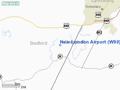
New London Airport (FAA LID: W90) is a public-use airport located six miles (10 km) southwest of the central business district of Forest, a city in Bedford County, Virginia, United States. It is privately owned by Associated Wheels Inc.
It is a public airport, but usually involves GA aircraft only. On Sundays during the summer and early fall, the runway is used as a dragstrip. History
Originally built in 1957 as a 1/4 mile dragstrip, airport operations were added in 1961 and the facility has served a dual-purpose since. Having been under the continued guidance of Rucker Tibbs, the airport changed hands in December 2005.
Facilities and aircraft
New London Airport covers an area of 133 acres (54 ha) which contains one asphalt paved runway (17/35) measuring 3,164 x 40 ft (964 x 12 m). For the 12-month period ending April 30, 2007, the airport had 28,478 aircraft operations, an average of 78 per day: 98% general aviation and 2% military. There are 76 aircraft based at this airport.
The above content comes from Wikipedia and is published under free licenses – click here to read more.
Location & QuickFacts
| FAA Information Effective: | 2008-09-25 |
| Airport Identifier: | W90 |
| Airport Status: | Operational |
| Longitude/Latitude: | 079-20-09.0940W/37-16-18.5180N
-79.335859/37.271811 (Estimated) |
| Elevation: | 849 ft / 258.78 m (Surveyed) |
| Land: | 133 acres |
| From nearest city: | 6 nautical miles SW of Forest, VA |
| Location: | Bedford County, VA |
| Magnetic Variation: | 07W (1985) |
Owner & Manager
| Ownership: | Privately owned |
| Owner: | Associated Wheels Inc |
| Address: | 1206 Wheels Drive
Forest, VA 24551 |
| Phone number: | 434-525-2988 |
| Manager: | David E. Miller |
| Address: | New London Airport, 2760 Bells Mill Road
Goode, VA 24556 |
| Phone number: | 540-586-5155 |
Airport Operations and Facilities
| Airport Use: | Open to public |
| Wind indicator: | Yes |
| Segmented Circle: | Yes |
| Control Tower: | No |
| Landing fee charge: | No |
| Sectional chart: | Cincinnati |
| Region: | AEA - Eastern |
| Boundary ARTCC: | ZDC - Washington |
| Tie-in FSS: | DCA - Leesburg |
| FSS on Airport: | No |
| FSS Toll Free: | 1-800-WX-BRIEF |
| NOTAMs Facility: | DCA (NOTAM-d service avaliable) |
Airport Communications
| CTAF: | 122.800 |
| Unicom: | 122.800 |
Airport Services
| Fuel available: | 100LLMOGAS |
| Airframe Repair: | MINOR |
| Power Plant Repair: | MINOR |
| Bottled Oxygen: | NONE |
| Bulk Oxygen: | NONE |
Runway Information
Runway 17/35
| Dimension: | 3164 x 40 ft / 964.4 x 12.2 m |
| Surface: | ASPH, Good Condition |
| |
Runway 17 |
Runway 35 |
| Traffic Pattern: | Left | Left |
| Markings: | Nonstandard, Poor Condition
NSTD RY NUMBERS; RY 34 NO RY NUMBERS. RY MARKINGS FADED. | Nonstandard, Poor Condition
NON-STD DIMENSIONS ON MARKINGS |
| Displaced threshold: | 115.00 ft | 0.00 ft |
| Obstruction: | 10 ft gnd, 200.0 ft from runway, 120 ft right of centerline, 1:1 slope to clear
APCH RATIO 8:1 TO DSPLCD THLD.
+26 FT ROAD 100 FT FM RY END 110 FT R CROSSING EXTDD CNTRLN; +4 FT GND 0-100 FT FM THLD 110-125 FT R; 37 FT TREE 131 FT FM RY END 118 R. | 114 ft trees, 2325.0 ft from runway, 38 ft right of centerline, 18:1 slope to clear
SVC ROAD AT RY END; SVC ROAD APRX 100 FT FM RY END. |
|
Radio Navigation Aids
| ID |
Type |
Name |
Ch |
Freq |
Var |
Dist |
| LY | NDB | Bojar | | 385.00 | 08W | 4.5 nm |
| VIT | NDB | Vinton | | 277.00 | 06W | 26.4 nm |
| CNQ | NDB | Callahan | | 379.00 | 05W | 39.3 nm |
| FVX | NDB | Farmville | | 367.00 | 07W | 43.2 nm |
| UV | NDB | Bales | | 396.00 | 07W | 49.6 nm |
| ODR | VOR | Woodrum | | 114.90 | 06W | 30.9 nm |
| DAN | VOR | Danville | | 113.10 | 06W | 42.3 nm |
| MOL | VOR/DME | Montebello | 100X | 115.30 | 05W | 39.3 nm |
| LYH | VORTAC | Lynchburg | 029X | 109.20 | 05W | 4.9 nm |
| ROA | VORTAC | Roanoke | 031X | 109.40 | 04W | 35.4 nm |
| SBV | VORTAC | South Boston | 041X | 110.40 | 05W | 39.0 nm |
Remarks
- STANDS; FENCE & TOWER IN PRIMARY AND/OR TRANSITIONAL SFCS WITH GUARDRAIL BOTH SIDES OF RY.
- RY USED AS DRAG STRIP ON SUNDAYS SUMMER MONTHS. NOTAMED WHEN ARPT CLSD.
- ULTRA-LGT ACFT ON & INVOF ARPT.
- PRIOR TO 1959
Images and information placed above are from
http://www.airport-data.com/airport/W90/
We thank them for the data!
| General Info
|
| Country |
United States
|
| State |
VIRGINIA
|
| FAA ID |
W90
|
| Latitude |
37-16-18.518N
|
| Longitude |
079-20-09.094W
|
| Elevation |
849 feet
|
| Near City |
FOREST
|
We don't guarantee the information is fresh and accurate. The data may
be wrong or outdated.
For more up-to-date information please refer to other sources.
|
|


