 |
|
Location & QuickFacts
| FAA Information Effective: | 2008-09-25 |
| Airport Identifier: | VA85 |
| Airport Status: | Operational |
| Longitude/Latitude: | 080-05-59.1700W/37-29-00.4650N
-80.099769/37.483463 (Estimated) |
| Elevation: | 1320 ft / 402.34 m (Estimated) |
| Land: | 0 acres |
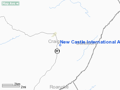
| From nearest city: | 2 nautical miles SE of New Castle, VA |
| Location: | Craig County, VA |
| Magnetic Variation: | 06W (1985) |
Owner & Manager
| Ownership: | Privately owned |
| Owner: | Lanier Frantz |
| Address: | Hc-34 Box 54
New Castle, VA 24127-9312 |
| Phone number: | 703-864-5800 |
| Manager: | Lanier Frantz |
| Address: | Hc-34 Box 54
New Castle, VA 24127 |
| Phone number: | 703-864-5542 |
Airport Operations and Facilities
| Airport Use: | Private |
| Wind indicator: | Yes |
| Segmented Circle: | No |
| Control Tower: | No |
| Landing fee charge: | No |
| Sectional chart: | Cincinnati |
| Region: | AEA - Eastern |
| Boundary ARTCC: | ZDC - Washington |
| Tie-in FSS: | DCA - Leesburg |
| FSS on Airport: | No |
| FSS Toll Free: | 1-800-WX-BRIEF |
Airport Services
| Airframe Repair: | NONE |
| Power Plant Repair: | NONE |
Runway Information
Runway 18/36
| Dimension: | 2400 x 100 ft / 731.5 x 30.5 m |
| Surface: | TURF, |
| |
Runway 18 |
Runway 36 |
| Traffic Pattern: | Left | Right |
|
Radio Navigation Aids
| ID |
Type |
Name |
Ch |
Freq |
Var |
Dist |
| CNQ | NDB | Callahan | | 379.00 | 05W | 13.6 nm |
| VIT | NDB | Vinton | | 277.00 | 06W | 19.8 nm |
| TEC | NDB | Tech | | 368.00 | 06W | 22.0 nm |
| LW | NDB | Bushi | | 346.00 | 06W | 25.1 nm |
| LY | NDB | Bojar | | 385.00 | 08W | 43.0 nm |
| ODR | VOR | Woodrum | | 114.90 | 06W | 11.2 nm |
| RNL | VOR | Rainelle | | 116.60 | 04W | 44.8 nm |
| LWB | VOR/DME | Greenbrier | 107Y | 116.05 | 08W | 26.8 nm |
| ROA | VORTAC | Roanoke | 031X | 109.40 | 04W | 8.5 nm |
| PSK | VORTAC | Pulaski | 115X | 116.80 | 06W | 37.8 nm |
| LYH | VORTAC | Lynchburg | 029X | 109.20 | 05W | 43.5 nm |
Remarks
Images and information placed above are from
http://www.airport-data.com/airport/VA85/
We thank them for the data!
| General Info
|
| Country |
United States
|
| State |
VIRGINIA
|
| FAA ID |
VA85
|
| Latitude |
37-29-00.465N
|
| Longitude |
080-05-59.170W
|
| Elevation |
1320 feet
|
| Near City |
NEW CASTLE
|
We don't guarantee the information is fresh and accurate. The data may
be wrong or outdated.
For more up-to-date information please refer to other sources.
|
|


