 |
|
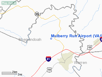
Location & QuickFacts
| FAA Information Effective: | 2008-09-25 |
| Airport Identifier: | VA17 |
| Airport Status: | Operational |
| Longitude/Latitude: | 078-23-32.0210W/39-02-09.3860N
-78.392228/39.035941 (Estimated) |
| Elevation: | 820 ft / 249.94 m (Estimated) |
| Land: | 25 acres |
| From nearest city: | 3 nautical miles NW of Strasburg, VA |
| Location: | Shenandoah County, VA |
| Magnetic Variation: | 08W (1985) |
Owner & Manager
| Ownership: | Privately owned |
| Owner: | George Phillips |
| Address: | 539 Hockman Rd
Strasburg, VA 22657 |
| Phone number: | 540-465-4379 |
| Manager: | George Phillips |
| Address: | 539 Hockman Rd
Strasburg, VA 22657 |
| Phone number: | 540-465-4379 |
Airport Operations and Facilities
| Airport Use: | Private |
| Wind indicator: | Yes |
| Segmented Circle: | No |
| Control Tower: | No |
| Sectional chart: | Washington |
| Region: | AEA - Eastern |
| Boundary ARTCC: | ZDC - Washington |
| Tie-in FSS: | DCA - Leesburg |
| FSS Toll Free: | 1-800-WX-BRIEF |
Runway Information
Runway 06/24
| Dimension: | 2000 x 75 ft / 609.6 x 22.9 m |
| Surface: | TURF, |
| |
Runway 06 |
Runway 24 |
| Traffic Pattern: | Right | Left |
| Displaced threshold: | 0.00 ft | 450.00 ft |
| Obstruction: | | 50 ft pline, 200.0 ft from runway |
|
Radio Navigation Aids
| ID |
Type |
Name |
Ch |
Freq |
Var |
Dist |
| TZ | NDB | Cogan | | 364.00 | 10W | 15.4 nm |
| LUA | NDB | Caverns | | 245.00 | 09W | 20.6 nm |
| GDX | NDB | Goodwin Lake | | 227.00 | 08W | 26.7 nm |
| CJR | NDB | Culpeper | | 252.00 | 09W | 39.3 nm |
| CBE | NDB | Cumberland | | 317.00 | 07W | 40.3 nm |
| MSQ | NDB | Nailr | | 351.00 | 10W | 41.7 nm |
| VBW | NDB | Bridgewater | | 241.00 | 07W | 48.3 nm |
| HGR | VOR | Hagerstown | | 109.80 | 07W | 46.9 nm |
| ESL | VOR/DME | Kessel | 045X | 110.80 | 06W | 30.1 nm |
| GRV | VOR/DME | Grantsville | 070X | 112.30 | 06W | 47.3 nm |
| LDN | VORTAC | Linden | 090X | 114.30 | 06W | 14.0 nm |
| MRB | VORTAC | Martinsburg | 058X | 112.10 | 07W | 32.9 nm |
| CSN | VORTAC | Casanova | 110X | 116.30 | 06W | 34.2 nm |
| AML | VORTAC | Armel | 082X | 113.50 | 08W | 43.7 nm |
Remarks
- VFR ONLY; RWY 24 THRESHOLD DISPLACED TO PROVIDE 20:1 APPROACH SURFACE
Images and information placed above are from
http://www.airport-data.com/airport/VA17/
We thank them for the data!
| General Info
|
| Country |
United States
|
| State |
VIRGINIA
|
| FAA ID |
VA17
|
| Latitude |
39-02-09.386N
|
| Longitude |
078-23-32.021W
|
| Elevation |
820 feet
|
| Near City |
STRASBURG
|
We don't guarantee the information is fresh and accurate. The data may
be wrong or outdated.
For more up-to-date information please refer to other sources.
|
|


