 |
|
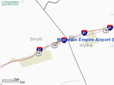
Location & QuickFacts
| FAA Information Effective: | 2008-09-25 |
| Airport Identifier: | MKJ |
| Airport Status: | Operational |
| Longitude/Latitude: | 081-20-59.8000W/36-53-41.5000N
-81.349944/36.894861 (Estimated) |
| Elevation: | 2558 ft / 779.68 m (Surveyed) |
| Land: | 120 acres |
| From nearest city: | 9 nautical miles NE of Marion/wytheville, VA |
| Location: | Smyth County, VA |
| Magnetic Variation: | 06W (1990) |
Owner & Manager
| Ownership: | Publicly owned |
| Owner: | Smyth Wythe Arpt Cmsn |
| Address: | Po Box 885
Marion, VA 24354 |
| Phone number: | 276-783-2000 |
| Manager: | Robert Dix
CHAIRMAN. |
| Address: | Po Box 885
Marion, VA 24354 |
| Phone number: | 276-783-2000
ALSO 276-783-8805. |
Airport Operations and Facilities
| Airport Use: | Open to public |
| Wind indicator: | Yes |
| Segmented Circle: | Yes |
| Control Tower: | No |
| Lighting Schedule: | DUSK-DAWN
MIRL RY 08/26 PRESET LOW INTST; ACTVT HIGHER INTST - CTAF. |
| Beacon Color: | Clear-Green (lighted land airport) |
| Landing fee charge: | No |
| Sectional chart: | Cincinnati |
| Region: | AEA - Eastern |
| Boundary ARTCC: | ZTL - Atlanta |
| Tie-in FSS: | DCA - Leesburg |
| FSS on Airport: | No |
| FSS Toll Free: | 1-800-WX-BRIEF |
| NOTAMs Facility: | MKJ (NOTAM-d service avaliable) |
| Federal Agreements: | NGY |
Airport Communications
| CTAF: | 122.700 |
| Unicom: | 122.700 |
Airport Services
| Fuel available: | 100LLA |
| Airframe Repair: | MAJOR |
| Power Plant Repair: | MAJOR |
| Bottled Oxygen: | NONE |
| Bulk Oxygen: | NONE |
Runway Information
Runway 08/26
| Dimension: | 5252 x 75 ft / 1600.8 x 22.9 m |
| Surface: | ASPH, Good Condition |
| Weight Limit: | Single wheel: 20000 lbs. |
| Edge Lights: | Medium |
| |
Runway 08 |
Runway 26 |
| Longitude: | 081-21-30.7499W | 081-20-28.8607W |
| Latitude: | 36-53-33.9593N | 36-53-48.9508N |
| Elevation: | 2558.00 ft | 2503.00 ft |
| Alignment: | 73 | 127 |
| ILS Type: | | LOCALIZER
|
| Traffic Pattern: | Left | Left |
| Markings: | Non-precision instrument, Fair Condition | Non-precision instrument, Fair Condition |
| Crossing Height: | 40.00 ft | 47.00 ft |
| VASI: | 2-light PAPI on left side | 2-light PAPI on left side |
| Visual Glide Angle: | 3.00° | 3.75° |
| Runway End Identifier: | Yes | Yes |
| Obstruction: | 14 ft tree, 455.0 ft from runway, 66 ft left of centerline, 18:1 slope to clear
8-10 FT TREES, 172 FT LEFT, 84-200 FT FM END OF RY. | 9 ft road, 200.0 ft from runway, 230 ft right of centerline
17' ROADWAY CLEARANCE PENETRATES APPROACH BY 9 FT. ROADWAY PENETRATES INTO PRIMARY SURFACE. |
|
Radio Navigation Aids
| ID |
Type |
Name |
Ch |
Freq |
Var |
Dist |
| MK | NDB | Suzze | | 335.00 | 06W | 5.3 nm |
| HLX | NDB | Hillsville | | 269.00 | 06W | 26.6 nm |
| JU | NDB | Ashee | | 410.00 | 07W | 27.7 nm |
| VJ | NDB | Whine | | 236.00 | 05W | 30.4 nm |
| JJO | NDB | Mountain City | | 396.00 | 04W | 36.7 nm |
| ZEF | NDB | Zephyr | | 326.00 | 05W | 46.2 nm |
| UKF | NDB | Wilki | | 209.00 | 06W | 48.6 nm |
| TEC | NDB | Tech | | 368.00 | 06W | 49.2 nm |
| AZW | NDB | Mount Airy | | 223.00 | 07W | 49.8 nm |
| GZG | VOR/DME | Glade Spring | 039X | 110.20 | 02W | 35.3 nm |
| BLF | VORTAC | Bluefield | 037X | 110.00 | 03W | 25.8 nm |
| PSK | VORTAC | Pulaski | 115X | 116.80 | 06W | 32.7 nm |
| HMV | VORTAC | Holston Mountain | 093X | 114.60 | 04W | 46.6 nm |
Remarks
Images and information placed above are from
http://www.airport-data.com/airport/MKJ/
We thank them for the data!
| General Info
|
| Country |
United States
|
| State |
VIRGINIA
|
| FAA ID |
MKJ
|
| Latitude |
36-53-41.469N
|
| Longitude |
081-20-59.838W
|
| Elevation |
2559 feet
|
| Near City |
MARION/WYTHEVILLE
|
We don't guarantee the information is fresh and accurate. The data may
be wrong or outdated.
For more up-to-date information please refer to other sources.
|
|


