 |
|
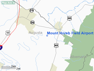
Mount Horeb Field Airport |
Location & QuickFacts
| FAA Information Effective: | 2008-09-25 |
| Airport Identifier: | 06VA |
| Airport Status: | Operational |
| Longitude/Latitude: | 078-51-19.0920W/38-14-56.4670N
-78.855303/38.249019 (Estimated) |
| Elevation: | 1160 ft / 353.57 m (Estimated) |
| Land: | 5 acres |
| From nearest city: | 3 nautical miles NE of Grottoes, VA |
| Location: | Augusta County, VA |
| Magnetic Variation: | 09W (1995) |
Owner & Manager
| Ownership: | Privately owned |
| Owner: | A.l. Wonderley |
| Address: | Route 1, P.o. Box 294
Grottoes, VA 24441 |
| Phone number: | 540-249-5407 |
| Manager: | A.l. Wonderley |
| Address: | Route 1, P.o. Box 294
Grottoes, VA 24441 |
| Phone number: | 540-249-5407 |
Airport Operations and Facilities
| Airport Use: | Private |
| Segmented Circle: | No |
| Control Tower: | No |
| Sectional chart: | Washington |
| Region: | AEA - Eastern |
| Boundary ARTCC: | ZDC - Washington |
| Tie-in FSS: | DCA - Leesburg |
| FSS on Airport: | No |
| FSS Toll Free: | 1-800-WX-BRIEF |
Runway Information
Runway 05/23
| Dimension: | 2000 x 100 ft / 609.6 x 30.5 m |
| Surface: | TURF, Good Condition |
| |
Runway 05 |
Runway 23 |
| Traffic Pattern: | Left | Left |
| Obstruction: | 15 ft road, 2500.0 ft from runway | 30 ft plines, 1230.0 ft from runway |
|
Radio Navigation Aids
| ID |
Type |
Name |
Ch |
Freq |
Var |
Dist |
| VBW | NDB | Bridgewater | | 241.00 | 07W | 8.6 nm |
| AZS | NDB | Azalea Park | | 336.00 | 08W | 21.5 nm |
| LUA | NDB | Caverns | | 245.00 | 09W | 32.5 nm |
| MSQ | NDB | Nailr | | 351.00 | 10W | 46.4 nm |
| IQK | NDB | Louisa | | 382.00 | 09W | 49.1 nm |
| CJR | NDB | Culpeper | | 252.00 | 09W | 49.9 nm |
| MOL | VOR/DME | Montebello | 100X | 115.30 | 05W | 24.1 nm |
| GVE | VORTAC | Gordonsville | 103X | 115.60 | 06W | 36.1 nm |
| LDN | VORTAC | Linden | 090X | 114.30 | 06W | 47.5 nm |
Remarks
- PRVDD DALGT OPNS ONLY; IFR OPNS ARE NOT CONDUCTED; PLINES N OF ARPT ARE MKD; TRANSITIONAL SFCS SHOULD BE KEPT BELOW THE 7:1 SLOPE.
Images and information placed above are from
http://www.airport-data.com/airport/06VA/
We thank them for the data!
| General Info
|
| Country |
United States
|
| State |
VIRGINIA
|
| FAA ID |
06VA
|
| Latitude |
38-14-56.467N
|
| Longitude |
078-51-19.092W
|
| Elevation |
1160 feet
|
| Near City |
GROTTOES
|
We don't guarantee the information is fresh and accurate. The data may
be wrong or outdated.
For more up-to-date information please refer to other sources.
|
|


