 |
|
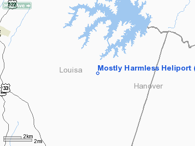
Location & QuickFacts
| FAA Information Effective: | 2008-09-25 |
| Airport Identifier: | 0VA0 |
| Airport Status: | Operational |
| Longitude/Latitude: | 077-46-38.9720W/37-57-55.5030N
-77.777492/37.965418 (Estimated) |
| Elevation: | 330 ft / 100.58 m (Estimated) |
| Land: | 0 acres |
| From nearest city: | 1 nautical miles NW of Bumpass, VA |
| Location: | Louisa County, VA |
| Magnetic Variation: | 08W (1985) |
Owner & Manager
| Ownership: | Privately owned |
| Owner: | Mostly Harmless Inc. |
| Address: | 1130 Rt 4
Bumpass, VA 23024 |
| Phone number: | 703-872-7081 |
| Manager: | Steve Shergold |
| Address: | 1130 Rt 4
Bumpass, VA 23024 |
| Phone number: | 703-872-7081 |
Airport Operations and Facilities
| Airport Use: | Private |
| Wind indicator: | Yes |
| Segmented Circle: | No |
| Control Tower: | No |
| Sectional chart: | Washington |
| Region: | AEA - Eastern |
| Boundary ARTCC: | ZDC - Washington |
| Tie-in FSS: | DCA - Leesburg |
| FSS on Airport: | No |
| FSS Toll Free: | 1-800-WX-BRIEF |
Runway Information
Helipad H1
| Dimension: | 40 x 40 ft / 12.2 x 12.2 m |
| Surface: | TURF, |
| |
Runway H1 |
Runway |
| Traffic Pattern: | Left | Left |
|
Radio Navigation Aids
| ID |
Type |
Name |
Ch |
Freq |
Var |
Dist |
| IQK | NDB | Louisa | | 382.00 | 09W | 5.1 nm |
| LJK | NDB | Ashey | | 280.00 | 09W | 18.3 nm |
| APH | NDB | A P Hill | | 396.00 | 10W | 22.7 nm |
| EZF | NDB | Shannon | | 237.00 | 10W | 23.8 nm |
| MSQ | NDB | Nailr | | 351.00 | 10W | 30.0 nm |
| CJR | NDB | Culpeper | | 252.00 | 09W | 34.2 nm |
| AZS | NDB | Azalea Park | | 336.00 | 08W | 35.2 nm |
| CF | NDB | Pubbs | | 392.00 | 09W | 41.0 nm |
| FVX | NDB | Farmville | | 367.00 | 07W | 48.4 nm |
| GVE | VORTAC | Gordonsville | 103X | 115.60 | 06W | 18.0 nm |
| FAK | VORTAC | Flat Rock | 080X | 113.30 | 06W | 26.4 nm |
| BRV | VORTAC | Brooke | 092X | 114.50 | 09W | 30.0 nm |
| RIC | VORTAC | Richmond | 088X | 114.10 | 09W | 35.3 nm |
| CSN | VORTAC | Casanova | 110X | 116.30 | 06W | 40.8 nm |
| HPW | VORTAC | Hopewell | 057X | 112.00 | 06W | 49.6 nm |
Remarks
- PRVDD IT IS USED FOR VFR DALGT OPNS ONLY. PRVDD PRIVATE USE ONLY.
Images and information placed above are from
http://www.airport-data.com/airport/0VA0/
We thank them for the data!
| General Info
|
| Country |
United States
|
| State |
VIRGINIA
|
| FAA ID |
0VA0
|
| Latitude |
37-57-55.503N
|
| Longitude |
077-46-38.972W
|
| Elevation |
330 feet
|
| Near City |
BUMPASS
|
We don't guarantee the information is fresh and accurate. The data may
be wrong or outdated.
For more up-to-date information please refer to other sources.
|
|


