 |
|
Location & QuickFacts
| FAA Information Effective: | 2008-09-25 |
| Airport Identifier: | VA21 |
| Airport Status: | Operational |
| Longitude/Latitude: | 078-30-31.0410W/37-56-24.5080N
-78.508623/37.940141 (Estimated) |
| Elevation: | 615 ft / 187.45 m (Estimated) |
| Land: | 0 acres |
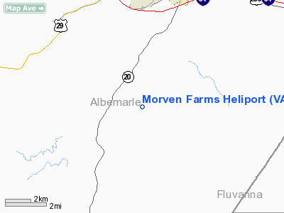
| From nearest city: | 12 nautical miles S of Charlottesville, VA |
| Location: | Albemarle County, VA |
| Magnetic Variation: | 08W (1985) |
Owner & Manager
| Ownership: | Privately owned |
| Owner: | John W Kluge |
| Address: | Rt 6 Box 69
Charlottesville, VA 22902 |
| Phone number: | 804-293-3978 |
| Manager: | Curry A. Roberts |
| Address: |
|
| Phone number: | 804-293-3978 |
Airport Operations and Facilities
| Airport Use: | Private |
| Wind indicator: | Yes |
| Segmented Circle: | No |
| Control Tower: | No |
| Sectional chart: | Washington |
| Region: | AEA - Eastern |
| Boundary ARTCC: | ZDC - Washington |
| Tie-in FSS: | DCA - Leesburg |
| FSS Toll Free: | 1-800-WX-BRIEF |
Runway Information
Helipad H1
| Dimension: | 50 x 50 ft / 15.2 x 15.2 m |
| Surface: | CONC, |
| |
Runway H1 |
Runway |
| Traffic Pattern: | Left | Left |
|
Radio Navigation Aids
| ID |
Type |
Name |
Ch |
Freq |
Var |
Dist |
| AZS | NDB | Azalea Park | | 336.00 | 08W | 4.2 nm |
| IQK | NDB | Louisa | | 382.00 | 09W | 31.1 nm |
| VBW | NDB | Bridgewater | | 241.00 | 07W | 33.3 nm |
| FVX | NDB | Farmville | | 367.00 | 07W | 35.5 nm |
| MSQ | NDB | Nailr | | 351.00 | 10W | 42.0 nm |
| LUA | NDB | Caverns | | 245.00 | 09W | 45.7 nm |
| CJR | NDB | Culpeper | | 252.00 | 09W | 47.0 nm |
| LJK | NDB | Ashey | | 280.00 | 09W | 49.9 nm |
| MOL | VOR/DME | Montebello | 100X | 115.30 | 05W | 28.5 nm |
| GVE | VORTAC | Gordonsville | 103X | 115.60 | 06W | 17.4 nm |
| FAK | VORTAC | Flat Rock | 080X | 113.30 | 06W | 40.7 nm |
Images and information placed above are from
http://www.airport-data.com/airport/VA21/
We thank them for the data!
| General Info
|
| Country |
United States
|
| State |
VIRGINIA
|
| FAA ID |
VA21
|
| Latitude |
37-56-24.508N
|
| Longitude |
078-30-31.041W
|
| Elevation |
615 feet
|
| Near City |
CHARLOTTESVILLE
|
We don't guarantee the information is fresh and accurate. The data may
be wrong or outdated.
For more up-to-date information please refer to other sources.
|
|


