 |
|
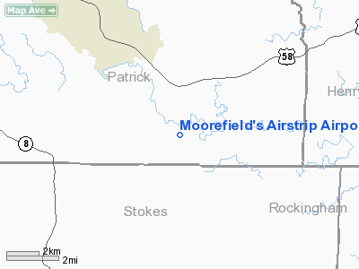
Moorefield's Airstrip Airport |
Location & QuickFacts
| FAA Information Effective: | 2008-09-25 |
| Airport Identifier: | VA27 |
| Airport Status: | Operational |
| Longitude/Latitude: | 080-08-16.1750W/36-33-35.4950N
-80.137826/36.559860 (Estimated) |
| Elevation: | 1110 ft / 338.33 m (Estimated) |
| Land: | 0 acres |
| From nearest city: | 4 nautical miles S of Critz, VA |
| Location: | Patrick County, VA |
| Magnetic Variation: | 06W (1985) |
Owner & Manager
| Ownership: | Privately owned |
| Owner: | James B. Williams, Jr |
| Address: | Rt 2, Box 667
Ridgeway, VA 24140 |
| Phone number: | 703-957-1052 |
| Manager: | Virgina M. Williams |
| Address: | Rt 1, Box 446
Spencer, VA 24165 |
| Phone number: | 703-694-6740 |
Airport Operations and Facilities
| Airport Use: | Private |
| Wind indicator: | Yes |
| Segmented Circle: | No |
| Control Tower: | No |
| Landing fee charge: | No |
| Sectional chart: | Cincinnati |
| Region: | AEA - Eastern |
| Boundary ARTCC: | ZDC - Washington |
| Tie-in FSS: | DCA - Leesburg |
| FSS Toll Free: | 1-800-WX-BRIEF |
Airport Services
| Airframe Repair: | NONE |
| Power Plant Repair: | NONE |
Runway Information
Runway 01/19
| Dimension: | 2100 x 75 ft / 640.1 x 22.9 m |
| Surface: | TURF, |
| |
Runway 01 |
Runway 19 |
| Traffic Pattern: | Left | Left |
| Obstruction: | | 20 ft trees, 600.0 ft from runway |
|
Radio Navigation Aids
| ID |
Type |
Name |
Ch |
Freq |
Var |
Dist |
| OQA | FAN MARKER | Rockingham County | | | | 16.9 nm |
| UV | NDB | Bales | | 396.00 | 07W | 10.8 nm |
| SIF | NDB | Slammer | | 423.00 | 07W | 21.0 nm |
| AZW | NDB | Mount Airy | | 223.00 | 07W | 22.2 nm |
| ZEF | NDB | Zephyr | | 326.00 | 05W | 32.0 nm |
| HLX | NDB | Hillsville | | 269.00 | 06W | 35.2 nm |
| VIT | NDB | Vinton | | 277.00 | 06W | 40.6 nm |
| TEC | NDB | Tech | | 368.00 | 06W | 41.0 nm |
| DVZ | NDB | Davie | | 354.00 | 06W | 41.8 nm |
| CNQ | NDB | Callahan | | 379.00 | 05W | 42.2 nm |
| HB | NDB | Himun | | 361.00 | 08W | 44.1 nm |
| SEN | NDB | Swearing/dcmsnd | | 260.00 | 06W | 47.5 nm |
| DAN | VOR | Danville | | 113.10 | 06W | 38.7 nm |
| ODR | VOR | Woodrum | | 114.90 | 06W | 46.6 nm |
| GSO | VORTAC | Greensboro | 109X | 116.20 | 03W | 31.9 nm |
| PSK | VORTAC | Pulaski | 115X | 116.80 | 06W | 42.1 nm |
| ROA | VORTAC | Roanoke | 031X | 109.40 | 04W | 47.2 nm |
Remarks
- PLINE 500 FT FM RY 19 END.
Images and information placed above are from
http://www.airport-data.com/airport/VA27/
We thank them for the data!
| General Info
|
| Country |
United States
|
| State |
VIRGINIA
|
| FAA ID |
VA27
|
| Latitude |
36-33-35.495N
|
| Longitude |
080-08-16.175W
|
| Elevation |
1110 feet
|
| Near City |
CRITZ
|
We don't guarantee the information is fresh and accurate. The data may
be wrong or outdated.
For more up-to-date information please refer to other sources.
|
|


