 |
|
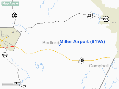
Location & QuickFacts
| FAA Information Effective: | 2008-09-25 |
| Airport Identifier: | 91VA |
| Airport Status: | Operational |
| Longitude/Latitude: | 079-24-17.1040W/37-19-39.5120N
-79.404751/37.327642 (Estimated) |
| Elevation: | 760 ft / 231.65 m (Estimated) |
| Land: | 72 acres |
| From nearest city: | 6 nautical miles E of Bedford, VA |
| Location: | Bedford County, VA |
| Magnetic Variation: | 07W (1990) |
Owner & Manager
| Ownership: | Privately owned |
| Owner: | David Eugene Miller |
| Address: | 2760 Bells Mill Rd
Goode, VA 24556 |
| Phone number: | 540-586-5155 |
| Manager: | David Eugene Miller |
| Address: | 2760 Bells Mill Rd
Goode, VA 24556 |
| Phone number: | 540-586-5155 |
Airport Operations and Facilities
| Airport Use: | Private |
| Wind indicator: | Yes |
| Segmented Circle: | No |
| Control Tower: | No |
| Sectional chart: | Cincinnati |
| Region: | AEA - Eastern |
| Boundary ARTCC: | ZDC - Washington |
| Tie-in FSS: | DCA - Leesburg |
| FSS on Airport: | No |
| FSS Toll Free: | 1-800-WX-BRIEF |
Runway Information
Runway 05/23
| Dimension: | 1850 x 70 ft / 563.9 x 21.3 m |
| Surface: | TURF, |
| |
Runway 05 |
Runway 23 |
| Traffic Pattern: | Left | Left |
|
Radio Navigation Aids
| ID |
Type |
Name |
Ch |
Freq |
Var |
Dist |
| LY | NDB | Bojar | | 385.00 | 08W | 8.7 nm |
| VIT | NDB | Vinton | | 277.00 | 06W | 24.0 nm |
| CNQ | NDB | Callahan | | 379.00 | 05W | 36.2 nm |
| FVX | NDB | Farmville | | 367.00 | 07W | 46.2 nm |
| TEC | NDB | Tech | | 368.00 | 06W | 48.3 nm |
| ODR | VOR | Woodrum | | 114.90 | 06W | 27.4 nm |
| DAN | VOR | Danville | | 113.10 | 06W | 45.7 nm |
| MOL | VOR/DME | Montebello | 100X | 115.30 | 05W | 37.2 nm |
| LYH | VORTAC | Lynchburg | 029X | 109.20 | 05W | 9.2 nm |
| ROA | VORTAC | Roanoke | 031X | 109.40 | 04W | 31.8 nm |
| SBV | VORTAC | South Boston | 041X | 110.40 | 05W | 43.5 nm |
Remarks
- ACFT LIMITED 7000 LBS OR LESS; TREES TO BE REMOVED; LNDG ON RY 05 & TKOF ON RY 23.
Images and information placed above are from
http://www.airport-data.com/airport/91VA/
We thank them for the data!
| General Info
|
| Country |
United States
|
| State |
VIRGINIA
|
| FAA ID |
91VA
|
| Latitude |
37-19-39.512N
|
| Longitude |
079-24-17.104W
|
| Elevation |
760 feet
|
| Near City |
BEDFORD
|
We don't guarantee the information is fresh and accurate. The data may
be wrong or outdated.
For more up-to-date information please refer to other sources.
|
|


