 |
|
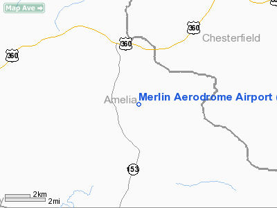
Location & QuickFacts
| FAA Information Effective: | 2008-09-25 |
| Airport Identifier: | 2VA3 |
| Airport Status: | Operational |
| Longitude/Latitude: | 077-51-58.0000W/37-18-54.0000N
-77.866111/37.315000 (Estimated) |
| Elevation: | 235 ft / 71.63 m (Estimated) |
| Land: | 50 acres |
| From nearest city: | 6 nautical miles N of Amelia Court House, VA |
| Location: | Chesapeake County, VA |
| Magnetic Variation: | 09W (1995) |
Owner & Manager
| Ownership: | Privately owned |
| Owner: | Walhalla Ent Inc |
| Address: | 2210 Walhala Dr
Richmond, VA 23236 |
| Phone number: | 804-276-3571 |
| Manager: | Richard S Kavanaugh Sr |
| Address: | 2210 Walhala Dr
Richmond, VA 23236 |
| Phone number: | 804-276-3571 |
Airport Operations and Facilities
| Airport Use: | Private |
| Wind indicator: | Yes |
| Segmented Circle: | No |
| Control Tower: | No |
| Sectional chart: | Washington |
| Region: | AEA - Eastern |
| Boundary ARTCC: | ZDC - Washington |
| Tie-in FSS: | DCA - Leesburg |
| FSS Toll Free: | 1-800-WX-BRIEF |
Airport Communications
Runway Information
Runway 14/32
| Dimension: | 3200 x 100 ft / 975.4 x 30.5 m |
| Surface: | TURF, Good Condition |
| |
Runway 14 |
Runway 32 |
| Traffic Pattern: | Left | Left |
|
Radio Navigation Aids
| ID |
Type |
Name |
Ch |
Freq |
Var |
Dist |
| BKT | NDB | Blackstone | | 326.00 | 09W | 14.1 nm |
| PTB | NDB | Petersburg | | 284.00 | 08W | 17.8 nm |
| CF | NDB | Pubbs | | 392.00 | 09W | 19.8 nm |
| FVX | NDB | Farmville | | 367.00 | 07W | 27.4 nm |
| LJK | NDB | Ashey | | 280.00 | 09W | 33.1 nm |
| MBV | NDB | Mecklenburg/dcmsnd | | 356.00 | 08W | 38.5 nm |
| IQK | NDB | Louisa | | 382.00 | 09W | 42.4 nm |
| AEA | NDB | Jones | | 373.00 | 09W | 43.1 nm |
| AKQ | NDB | Wakefield | | 274.00 | 09W | 46.0 nm |
| ELQ | NDB | Emporia | | 261.00 | 10W | 46.9 nm |
| FAK | VORTAC | Flat Rock | 080X | 113.30 | 06W | 13.0 nm |
| RIC | VORTAC | Richmond | 088X | 114.10 | 09W | 28.4 nm |
| LVL | VORTAC | Lawrenceville | 076X | 112.90 | 08W | 29.9 nm |
| HPW | VORTAC | Hopewell | 057X | 112.00 | 06W | 35.9 nm |
| GVE | VORTAC | Gordonsville | 103X | 115.60 | 06W | 44.2 nm |
Remarks
- PRVDD VFR ONLY, OTHER ARPT OWNERS/OPERATORS IN VICINITY MADE AWARE OF LEFT TFC, & CLEAR 20;1 APCH/DEP PATH EACH RY.
Images and information placed above are from
http://www.airport-data.com/airport/2VA3/
We thank them for the data!
| General Info
|
| Country |
United States
|
| State |
VIRGINIA
|
| FAA ID |
2VA3
|
| Latitude |
37-18-54.000N
|
| Longitude |
077-51-58.000W
|
| Elevation |
235 feet
|
| Near City |
AMELIA COURT HOUSE
|
We don't guarantee the information is fresh and accurate. The data may
be wrong or outdated.
For more up-to-date information please refer to other sources.
|
|


