 |
|
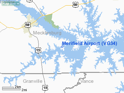
Location & QuickFacts
| FAA Information Effective: | 2008-09-25 |
| Airport Identifier: | VG34 |
| Airport Status: | Operational |
| Longitude/Latitude: | 078-30-02.9960W/36-35-04.5090N
-78.500832/36.584586 (Estimated) |
| Elevation: | 355 ft / 108.20 m (Surveyed) |
| Land: | 10 acres |
| From nearest city: | 3 nautical miles SE of Clarksville, VA |
| Location: | Mecklenburg County, VA |
| Magnetic Variation: | 07W (1985) |
Owner & Manager
| Ownership: | Privately owned |
| Owner: | Merifield Acres Landowners |
| Address: | 515 Meriwether Dr.
Clarksville, VA 23927 |
| Phone number: | 919-787-4965 |
| Manager: | Francis J, Hale, Iii |
| Address: | 1329 Duplin Rd.
Raleigh, NC 27607 |
| Phone number: | 434-374-9922 |
Airport Operations and Facilities
| Airport Use: | Private |
| Wind indicator: | Yes |
| Segmented Circle: | No |
| Control Tower: | No |
| Landing fee charge: | No |
| Sectional chart: | Washington |
| Region: | AEA - Eastern |
| Traffic Pattern Alt: | 800 ft |
| Boundary ARTCC: | ZDC - Washington |
| Tie-in FSS: | DCA - Leesburg |
| FSS on Airport: | No |
| FSS Toll Free: | 1-800-WX-BRIEF |
Airport Services
| Airframe Repair: | NONE |
| Power Plant Repair: | NONE |
Runway Information
Runway 15/33
| Dimension: | 2375 x 75 ft / 723.9 x 22.9 m |
| Surface: | TURF, Good Condition |
| |
Runway 15 |
Runway 33 |
| Traffic Pattern: | Left | Left |
| Obstruction: | 100 ft trees, 150.0 ft from runway | 10 ft fence, 700.0 ft from runway |
|
Radio Navigation Aids
| ID |
Type |
Name |
Ch |
Freq |
Var |
Dist |
| HXO | NDB | Huntsboro | | 271.00 | 07W | 18.0 nm |
| AEA | NDB | Jones | | 373.00 | 09W | 21.7 nm |
| MBV | NDB | Mecklenburg/dcmsnd | | 356.00 | 08W | 22.4 nm |
| HUR | NDB | Person | | 220.00 | 08W | 34.5 nm |
| RZZ | NDB | Rapids | | 407.00 | 08W | 39.2 nm |
| BKT | NDB | Blackstone | | 326.00 | 09W | 39.3 nm |
| LE | NDB | Leevy | | 350.00 | 07W | 40.9 nm |
| FVX | NDB | Farmville | | 367.00 | 07W | 46.3 nm |
| DAN | VOR | Danville | | 113.10 | 06W | 40.4 nm |
| SBV | VORTAC | South Boston | 041X | 110.40 | 05W | 25.4 nm |
| LVL | VORTAC | Lawrenceville | 076X | 112.90 | 08W | 32.0 nm |
| RDU | VORTAC | Raleigh/durham | 119X | 117.20 | 04W | 44.9 nm |
Remarks
Images and information placed above are from
http://www.airport-data.com/airport/VG34/
We thank them for the data!
| General Info
|
| Country |
United States
|
| State |
VIRGINIA
|
| FAA ID |
VG34
|
| Latitude |
36-35-04.509N
|
| Longitude |
078-30-02.996W
|
| Elevation |
355 feet
|
| Near City |
CLARKSVILLE
|
We don't guarantee the information is fresh and accurate. The data may
be wrong or outdated.
For more up-to-date information please refer to other sources.
|
|


