 |
|
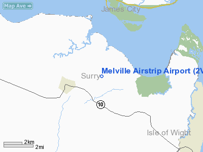
Melville Airstrip Airport |
Location & QuickFacts
| FAA Information Effective: | 2008-09-25 |
| Airport Identifier: | 2VA2 |
| Airport Status: | Operational |
| Longitude/Latitude: | 076-47-23.8540W/37-08-45.5340N
-76.789959/37.145982 (Estimated) |
| Elevation: | 90 ft / 27.43 m (Surveyed) |
| Land: | 0 acres |
| From nearest city: | 2 nautical miles E of Surry, VA |
| Location: | Surry County, VA |
| Magnetic Variation: | 09W (1985) |
Owner & Manager
| Ownership: | Privately owned |
| Owner: | Randolph Savedge |
| Address: | 416 Melville Drive
Surry, VA 23883 |
| Phone number: | 757-294-0315 |
| Manager: | Randolph Savedge |
| Address: | 416 Melville Drive
Surry, VA 23883 |
| Phone number: | 757-294-0315 |
Airport Operations and Facilities
| Airport Use: | Private |
| Wind indicator: | Yes |
| Segmented Circle: | No |
| Control Tower: | No |
| Landing fee charge: | No |
| Sectional chart: | Washington |
| Region: | AEA - Eastern |
| Boundary ARTCC: | ZDC - Washington |
| Tie-in FSS: | DCA - Leesburg |
| FSS on Airport: | No |
| FSS Toll Free: | 1-800-WX-BRIEF |
Airport Services
| Airframe Repair: | NONE |
| Power Plant Repair: | NONE |
Runway Information
Runway 03/21
| Dimension: | 2900 x 60 ft / 883.9 x 18.3 m |
| Surface: | TURF, |
| |
Runway 03 |
Runway 21 |
| Traffic Pattern: | Left | Left |
|
Radio Navigation Aids
| ID |
Type |
Name |
Ch |
Freq |
Var |
Dist |
| FAF | NDB | Felker | | 226.00 | 08W | 8.2 nm |
| AKQ | NDB | Wakefield | | 274.00 | 09W | 14.1 nm |
| PJS | NDB | Henry | | 375.00 | 09W | 14.2 nm |
| PVG | NDB | Portsmouth | | 241.00 | 10W | 27.5 nm |
| RK | NDB | Waley | | 249.00 | 10W | 33.6 nm |
| CF | NDB | Pubbs | | 392.00 | 09W | 33.7 nm |
| PTB | NDB | Petersburg | | 284.00 | 08W | 37.6 nm |
| EY | NDB | Chesi | | 233.00 | 09W | 38.2 nm |
| ELQ | NDB | Emporia | | 261.00 | 10W | 44.1 nm |
| LFI | TACAN | Langley | 070X | | 10W | 21.0 nm |
| NGU | TACAN | Chambers | 048X | | 10W | 27.5 nm |
| NTU | TACAN | Oceana | 113X | | 10W | 41.0 nm |
| HCM | VORTAC | Harcum | 025X | 108.80 | 07W | 18.6 nm |
| HPW | VORTAC | Hopewell | 057X | 112.00 | 06W | 19.1 nm |
| FKN | VORTAC | Franklin | 043X | 110.60 | 09W | 28.1 nm |
| ORF | VORTAC | Norfolk | 116X | 116.90 | 07W | 32.2 nm |
| RIC | VORTAC | Richmond | 088X | 114.10 | 09W | 33.2 nm |
| CCV | VORTAC | Cape Charles | 059X | 112.20 | 10W | 39.8 nm |
| CVI | VORTAC | Cofield | 093X | 114.60 | 09W | 46.6 nm |
Remarks
- VFR ONLY AND REMAIN CLEAR OF MW TWRS TO THE SW.
Images and information placed above are from
http://www.airport-data.com/airport/2VA2/
We thank them for the data!
| General Info
|
| Country |
United States
|
| State |
VIRGINIA
|
| FAA ID |
2VA2
|
| Latitude |
37-08-45.534N
|
| Longitude |
076-47-23.854W
|
| Elevation |
90 feet
|
| Near City |
SURRY
|
We don't guarantee the information is fresh and accurate. The data may
be wrong or outdated.
For more up-to-date information please refer to other sources.
|
|


