 |
|
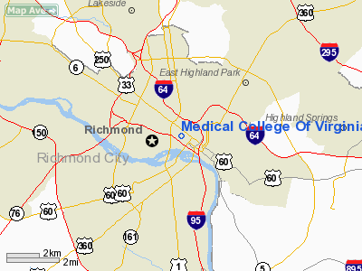
Medical College Of Virginia Heliport |
Location & QuickFacts
| FAA Information Effective: | 2008-09-25 |
| Airport Identifier: | VG45 |
| Airport Status: | Operational |
| Longitude/Latitude: | 077-26-30.0000W/37-32-30.0000N
-77.441667/37.541667 (Estimated) |
| Elevation: | 343 ft / 104.55 m () |
| Land: | 0 acres |
| From nearest city: | 0 nautical miles N of Richmond, VA |
| Location: | Henrico County, VA |
| Magnetic Variation: | 10W (2000) |
Owner & Manager
| Ownership: | Privately owned |
| Owner: | Virginia Commonwealth University |
| Address: | 401 North 12th Street
Richmond, VA 23298 |
| Manager: | Tom W Young
CONSTRUCTION MANAGER. |
| Address: | 100b E. Clay Street, Grant House
Richmond, VA 23298 |
Airport Operations and Facilities
| Airport Use: | Private
MEDICAL. |
| Wind indicator: | Yes |
| Segmented Circle: | No |
| Control Tower: | No |
| Lighting Schedule: | RDO-CTL
ACTVT PERIMETER LGTS ON 123.05. |
| Sectional chart: | Washington |
| Region: | AEA - Eastern |
| Boundary ARTCC: | ZDC - Washington |
| Tie-in FSS: | DCA - Leesburg |
| FSS Toll Free: | 1-800-WX-BRIEF |
Runway Information
Helipad H1
| Dimension: | 53 x 53 ft / 16.2 x 16.2 m |
| Surface: | MATS, |
| |
Runway H1 |
Runway |
| Traffic Pattern: | Left | Left |
|
Radio Navigation Aids
| ID |
Type |
Name |
Ch |
Freq |
Var |
Dist |
| CF | NDB | Pubbs | | 392.00 | 09W | 12.5 nm |
| LJK | NDB | Ashey | | 280.00 | 09W | 14.0 nm |
| PTB | NDB | Petersburg | | 284.00 | 08W | 25.5 nm |
| APH | NDB | A P Hill | | 396.00 | 10W | 33.3 nm |
| IQK | NDB | Louisa | | 382.00 | 09W | 34.9 nm |
| BKT | NDB | Blackstone | | 326.00 | 09W | 38.1 nm |
| AKQ | NDB | Wakefield | | 274.00 | 09W | 39.6 nm |
| EZF | NDB | Shannon | | 237.00 | 10W | 43.6 nm |
| FAF | NDB | Felker | | 226.00 | 08W | 46.2 nm |
| FVX | NDB | Farmville | | 367.00 | 07W | 48.9 nm |
| RIC | VORTAC | Richmond | 088X | 114.10 | 09W | 6.3 nm |
| FAK | VORTAC | Flat Rock | 080X | 113.30 | 06W | 18.4 nm |
| HPW | VORTAC | Hopewell | 057X | 112.00 | 06W | 20.1 nm |
| HCM | VORTAC | Harcum | 025X | 108.80 | 07W | 35.3 nm |
| GVE | VORTAC | Gordonsville | 103X | 115.60 | 06W | 44.1 nm |
| BRV | VORTAC | Brooke | 092X | 114.50 | 09W | 47.9 nm |
| LVL | VORTAC | Lawrenceville | 076X | 112.90 | 08W | 48.8 nm |
Remarks
Images and information placed above are from
http://www.airport-data.com/airport/VG45/
We thank them for the data!
| General Info
|
| Country |
United States
|
| State |
VIRGINIA
|
| FAA ID |
VG45
|
| Latitude |
37-32-30.000N
|
| Longitude |
077-26-30.000W
|
| Elevation |
343 feet
|
| Near City |
RICHMOND
|
We don't guarantee the information is fresh and accurate. The data may
be wrong or outdated.
For more up-to-date information please refer to other sources.
|
|


