 |
|
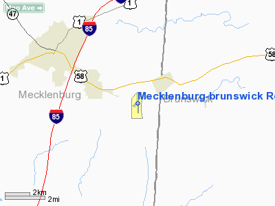
Mecklenburg-brunswick Rgnl Airport |
Location & QuickFacts
| FAA Information Effective: | 2008-09-25 |
| Airport Identifier: | AVC |
| Airport Status: | Operational |
| Longitude/Latitude: | 078-03-16.1000W/36-41-17.8000N
-78.054472/36.688278 (Estimated) |
| Elevation: | 442 ft / 134.72 m (Surveyed) |
| Land: | 360 acres |
| From nearest city: | 4 nautical miles SE of South Hill, VA |
| Location: | Mecklenburg County, VA |
| Magnetic Variation: | 09W (2000) |
Owner & Manager
| Ownership: | Publicly owned |
| Owner: | Mecklenburg-brunswick Arpt Commissi
MECKLENBURG-BRUNSWICK REGIONAL AIRPORT COMMISSION |
| Address: | Po Box 445
South Hill, VA 23970-0445 |
| Phone number: | 434-447-4016 |
| Manager: | Dan Middleton |
| Address: | 1495 Regional Airport Rd.
Broadnax, VA 23920-3520 |
| Phone number: | 434-729-2591 |
Airport Operations and Facilities
| Airport Use: | Open to public |
| Wind indicator: | Yes |
| Segmented Circle: | Yes |
| Control Tower: | No |
| Lighting Schedule: | DUSK-DAWN
MIRL RY 01/19 & REIL RYS 01 & 19 PRESET LOW INTST; FOR HIGHER INTST ACTVT - CTAF. |
| Beacon Color: | Clear-Green (lighted land airport) |
| Sectional chart: | Washington |
| Region: | AEA - Eastern |
| Traffic Pattern Alt: | 1400 ft |
| Boundary ARTCC: | ZDC - Washington |
| Tie-in FSS: | DCA - Leesburg |
| FSS on Airport: | No |
| FSS Toll Free: | 1-800-WX-BRIEF |
| NOTAMs Facility: | AVC (NOTAM-d service avaliable) |
| Federal Agreements: | NGY |
Airport Communications
| CTAF: | 122.800 |
| Unicom: | 122.800 |
Airport Services
| Fuel available: | 100LLA |
| Airframe Repair: | NONE |
| Power Plant Repair: | NONE |
| Bottled Oxygen: | NONE |
| Bulk Oxygen: | NONE |
Runway Information
Runway 01/19
| Dimension: | 5002 x 75 ft / 1524.6 x 22.9 m |
| Surface: | ASPH, Good Condition |
| Weight Limit: | Single wheel: 12500 lbs. |
| Edge Lights: | Medium |
| |
Runway 01 |
Runway 19 |
| Longitude: | 078-03-14.8026W | 078-03-17.3677W |
| Latitude: | 36-40-53.1289N | 36-41-42.5397N |
| Elevation: | 378.00 ft | 442.00 ft |
| Alignment: | 127 | 127 |
| ILS Type: | LOCALIZER
| |
| Traffic Pattern: | Left | Left |
| Markings: | Non-precision instrument, Good Condition | Non-precision instrument, Good Condition |
| Crossing Height: | 40.00 ft | 40.00 ft |
| VASI: | 2-light PAPI on left side | 2-light PAPI on left side |
| Visual Glide Angle: | 3.00° | 3.00° |
| Runway End Identifier: | Yes | Yes |
| Obstruction: | 76 ft trees, 2148.0 ft from runway, 158 ft right of centerline, 25:1 slope to clear | 6 ft ant, 300.0 ft from runway, 30 ft right of centerline, 16:1 slope to clear |
|
Radio Navigation Aids
| ID |
Type |
Name |
Ch |
Freq |
Var |
Dist |
| MBV | NDB | Mecklenburg/dcmsnd | | 356.00 | 08W | 0.3 nm |
| AEA | NDB | Jones | | 373.00 | 09W | 4.4 nm |
| RZZ | NDB | Rapids | | 407.00 | 08W | 22.4 nm |
| BKT | NDB | Blackstone | | 326.00 | 09W | 26.4 nm |
| ELQ | NDB | Emporia | | 261.00 | 10W | 30.6 nm |
| PTB | NDB | Petersburg | | 284.00 | 08W | 35.2 nm |
| HXO | NDB | Huntsboro | | 271.00 | 07W | 35.9 nm |
| FVX | NDB | Farmville | | 367.00 | 07W | 44.0 nm |
| CF | NDB | Pubbs | | 392.00 | 09W | 48.3 nm |
| ASJ | NDB | Ahoskie | | 415.00 | 10W | 48.5 nm |
| LVL | VORTAC | Lawrenceville | 076X | 112.90 | 08W | 10.7 nm |
| TYI | VORTAC | Tar River | 125X | 117.80 | 05W | 46.0 nm |
| SBV | VORTAC | South Boston | 041X | 110.40 | 05W | 46.3 nm |
Images and information placed above are from
http://www.airport-data.com/airport/AVC/
We thank them for the data!
| General Info
|
| Country |
United States
|
| State |
VIRGINIA
|
| FAA ID |
AVC
|
| Latitude |
36-41-17.800N
|
| Longitude |
078-03-16.100W
|
| Elevation |
442 feet
|
| Near City |
SOUTH HILL
|
We don't guarantee the information is fresh and accurate. The data may
be wrong or outdated.
For more up-to-date information please refer to other sources.
|
|


