 |
|
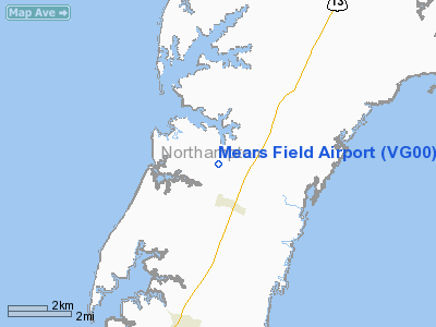
Location & QuickFacts
| FAA Information Effective: | 2008-09-25 |
| Airport Identifier: | VG00 |
| Airport Status: | Operational |
| Longitude/Latitude: | 075-56-48.7400W/37-22-11.4800N
-75.946872/37.369856 (Estimated) |
| Elevation: | 22 ft / 6.71 m (Estimated) |
| Land: | 5 acres |
| From nearest city: | 1 nautical miles N of Eastville, VA |
| Location: | Northampton County, VA |
| Magnetic Variation: | 11W (1995) |
Owner & Manager
| Ownership: | Privately owned |
| Owner: | Benjamin W. Mears, Iii |
| Address: | P.o. Box 128
Eastville, VA 23347 |
| Phone number: | 757-678-7851 |
| Manager: | Benjamin W. Mears, Iii |
| Address: | P.o. Box 128
Eastville, VA 23347 |
| Phone number: | 757-678-7851 |
Airport Operations and Facilities
| Airport Use: | Private |
| Wind indicator: | Yes |
| Segmented Circle: | No |
| Control Tower: | No |
| Sectional chart: | Washington |
| Region: | AEA - Eastern |
| Boundary ARTCC: | ZDC - Washington |
| Tie-in FSS: | DCA - Leesburg |
| FSS on Airport: | No |
| FSS Toll Free: | 1-800-WX-BRIEF |
Runway Information
Runway 04/22
| Dimension: | 2000 x 90 ft / 609.6 x 27.4 m |
| Surface: | TURF, Good Condition |
| |
Runway 04 |
Runway 22 |
| Traffic Pattern: | Left | Right |
| Obstruction: | 50 ft trees, 100.0 ft from runway | 15 ft road, 200.0 ft from runway |
|
Radio Navigation Aids
| ID |
Type |
Name |
Ch |
Freq |
Var |
Dist |
| BDB | NDB | Accomack | | 336.00 | 11W | 14.0 nm |
| PJS | NDB | Henry | | 375.00 | 09W | 29.8 nm |
| FAF | NDB | Felker | | 226.00 | 08W | 35.0 nm |
| PVG | NDB | Portsmouth | | 241.00 | 10W | 42.8 nm |
| LFI | TACAN | Langley | 070X | | 10W | 26.1 nm |
| NGU | TACAN | Chambers | 048X | | 10W | 30.3 nm |
| NTU | TACAN | Oceana | 113X | | 10W | 33.1 nm |
| CCV | VORTAC | Cape Charles | 059X | 112.20 | 10W | 2.8 nm |
| ORF | VORTAC | Norfolk | 116X | 116.90 | 07W | 31.2 nm |
| HCM | VORTAC | Harcum | 025X | 108.80 | 07W | 36.8 nm |
| SWL | VORTAC | Snow Hill | 071X | 112.40 | 08W | 47.2 nm |
Remarks
- PRVDD AIR OPNS RESTRICTED TO W OF ARPT; PROVIDE 15 FT CLNC OVER VEHICLES ON SW END OF RWY; RY 22 DSPLCD TO PROVIDE 20:1 APCH.
Images and information placed above are from
http://www.airport-data.com/airport/VG00/
We thank them for the data!
| General Info
|
| Country |
United States
|
| State |
VIRGINIA
|
| FAA ID |
VG00
|
| Latitude |
37-22-11.480N
|
| Longitude |
075-56-48.740W
|
| Elevation |
22 feet
|
| Near City |
EASTVILLE
|
We don't guarantee the information is fresh and accurate. The data may
be wrong or outdated.
For more up-to-date information please refer to other sources.
|
|


