 |
|
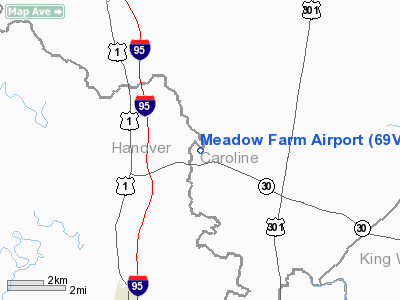
Location & QuickFacts
| FAA Information Effective: | 2008-09-25 |
| Airport Identifier: | 69VA |
| Airport Status: | Operational |
| Longitude/Latitude: | 077-25-13.9330W/37-51-25.5030N
-77.420537/37.857084 (Estimated) |
| Elevation: | 75 ft / 22.86 m (Estimated) |
| Land: | 0 acres |
| From nearest city: | 7 nautical miles NE of Ashland, VA |
| Location: | Caroline County, VA |
| Magnetic Variation: | 09W (1985) |
Owner & Manager
| Ownership: | Privately owned |
| Owner: | Eric Freedlander |
| Address: | Rt 1 Box 61
Doswell, VA 23047 |
| Phone number: | 804-222-0396 |
| Manager: | Brad Lindley |
| Address: | 5745 Huntsman Rd
Sandston, VA 23150 |
Airport Operations and Facilities
| Airport Use: | Private |
| Wind indicator: | Yes |
| Segmented Circle: | No |
| Control Tower: | No |
| Landing fee charge: | No |
| Sectional chart: | Washington |
| Region: | AEA - Eastern |
| Boundary ARTCC: | ZDC - Washington |
| Tie-in FSS: | DCA - Leesburg |
| FSS Toll Free: | 1-800-WX-BRIEF |
| NOTAMs Facility: | DCA |
Runway Information
Runway 02/20
| Dimension: | 3000 x 80 ft / 914.4 x 24.4 m |
| Surface: | ASPH, |
| |
Runway 02 |
Runway 20 |
| Traffic Pattern: | Left | Left |
| Obstruction: | | 25 ft trees, 65.0 ft from runway |
|
Radio Navigation Aids
| ID |
Type |
Name |
Ch |
Freq |
Var |
Dist |
| LJK | NDB | Ashey | | 280.00 | 09W | 5.8 nm |
| APH | NDB | A P Hill | | 396.00 | 10W | 14.6 nm |
| IQK | NDB | Louisa | | 382.00 | 09W | 23.0 nm |
| EZF | NDB | Shannon | | 237.00 | 10W | 24.6 nm |
| CF | NDB | Pubbs | | 392.00 | 09W | 31.5 nm |
| MSQ | NDB | Nailr | | 351.00 | 10W | 42.6 nm |
| PTB | NDB | Petersburg | | 284.00 | 08W | 44.3 nm |
| CJR | NDB | Culpeper | | 252.00 | 09W | 45.5 nm |
| RIC | VORTAC | Richmond | 088X | 114.10 | 09W | 21.8 nm |
| FAK | VORTAC | Flat Rock | 080X | 113.30 | 06W | 27.7 nm |
| BRV | VORTAC | Brooke | 092X | 114.50 | 09W | 29.0 nm |
| HPW | VORTAC | Hopewell | 057X | 112.00 | 06W | 34.9 nm |
| GVE | VORTAC | Gordonsville | 103X | 115.60 | 06W | 36.0 nm |
| HCM | VORTAC | Harcum | 025X | 108.80 | 07W | 41.7 nm |
Images and information placed above are from
http://www.airport-data.com/airport/69VA/
We thank them for the data!
| General Info
|
| Country |
United States
|
| State |
VIRGINIA
|
| FAA ID |
69VA
|
| Latitude |
37-51-25.503N
|
| Longitude |
077-25-13.933W
|
| Elevation |
75 feet
|
| Near City |
ASHLAND
|
We don't guarantee the information is fresh and accurate. The data may
be wrong or outdated.
For more up-to-date information please refer to other sources.
|
|


