 |
|
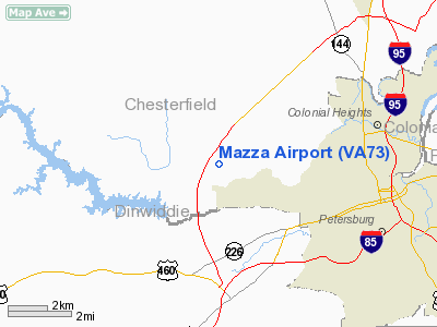
Location & QuickFacts
| FAA Information Effective: | 2008-09-25 |
| Airport Identifier: | VA73 |
| Airport Status: | Operational |
| Longitude/Latitude: | 077-29-38.9500W/37-14-40.5420N
-77.494153/37.244595 (Estimated) |
| Elevation: | 190 ft / 57.91 m (Estimated) |
| Land: | 30 acres |
| From nearest city: | 2 nautical miles NW of Matoaca, VA |
| Location: | Chesterfield County, VA |
| Magnetic Variation: | 08W (1985) |
Owner & Manager
| Ownership: | Privately owned |
| Owner: | John V. Mazza |
| Address: | 20109 Little Road
Matoaca, VA 23803 |
| Phone number: | 804-590-2211 |
| Manager: | John V. Mazza |
| Address: | 20109 Little Road
Matoaca, VA 23803 |
| Phone number: | 804-590-2211 |
Airport Operations and Facilities
| Airport Use: | Private |
| Wind indicator: | Yes |
| Segmented Circle: | No |
| Control Tower: | No |
| Lighting Schedule: | PHONE REQ
FOR LIRL RWY 09/27 CALL 804-590-2211. |
| Landing fee charge: | No |
| Sectional chart: | Washington |
| Region: | AEA - Eastern |
| Boundary ARTCC: | ZDC - Washington |
| Tie-in FSS: | DCA - Leesburg |
| FSS on Airport: | No |
| FSS Toll Free: | 1-800-WX-BRIEF |
Airport Services
| Airframe Repair: | NONE |
| Power Plant Repair: | NONE |
Runway Information
Runway 09/27
| Dimension: | 3100 x 250 ft / 944.9 x 76.2 m |
| Surface: | TURF, |
| Edge Lights: | Low |
| |
Runway 09 |
Runway 27 |
| Traffic Pattern: | Left | Left |
| Centerline Lights: | No | No |
| Touchdown Lights: | No | |
| Obstruction: | 50 ft trees, 500.0 ft from runway | |
|
Radio Navigation Aids
| ID |
Type |
Name |
Ch |
Freq |
Var |
Dist |
| CF | NDB | Pubbs | | 392.00 | 09W | 5.7 nm |
| PTB | NDB | Petersburg | | 284.00 | 08W | 7.9 nm |
| BKT | NDB | Blackstone | | 326.00 | 09W | 27.3 nm |
| AKQ | NDB | Wakefield | | 274.00 | 09W | 28.4 nm |
| LJK | NDB | Ashey | | 280.00 | 09W | 31.8 nm |
| ELQ | NDB | Emporia | | 261.00 | 10W | 37.8 nm |
| FAF | NDB | Felker | | 226.00 | 08W | 42.4 nm |
| MBV | NDB | Mecklenburg/dcmsnd | | 356.00 | 08W | 42.8 nm |
| FVX | NDB | Farmville | | 367.00 | 07W | 45.6 nm |
| AEA | NDB | Jones | | 373.00 | 09W | 46.4 nm |
| PJS | NDB | Henry | | 375.00 | 09W | 48.4 nm |
| RZZ | NDB | Rapids | | 407.00 | 08W | 49.4 nm |
| IQK | NDB | Louisa | | 382.00 | 09W | 49.8 nm |
| RIC | VORTAC | Richmond | 088X | 114.10 | 09W | 17.6 nm |
| HPW | VORTAC | Hopewell | 057X | 112.00 | 06W | 18.8 nm |
| FAK | VORTAC | Flat Rock | 080X | 113.30 | 06W | 23.4 nm |
| LVL | VORTAC | Lawrenceville | 076X | 112.90 | 08W | 32.3 nm |
| HCM | VORTAC | Harcum | 025X | 108.80 | 07W | 39.4 nm |
| FKN | VORTAC | Franklin | 043X | 110.60 | 09W | 39.4 nm |
Remarks
Images and information placed above are from
http://www.airport-data.com/airport/VA73/
We thank them for the data!
| General Info
|
| Country |
United States
|
| State |
VIRGINIA
|
| FAA ID |
VA73
|
| Latitude |
37-14-40.542N
|
| Longitude |
077-29-38.950W
|
| Elevation |
190 feet
|
| Near City |
MATOACA
|
We don't guarantee the information is fresh and accurate. The data may
be wrong or outdated.
For more up-to-date information please refer to other sources.
|
|


