|
|
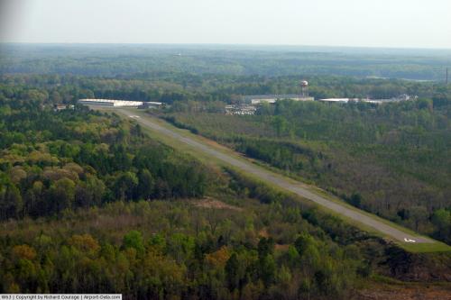 |
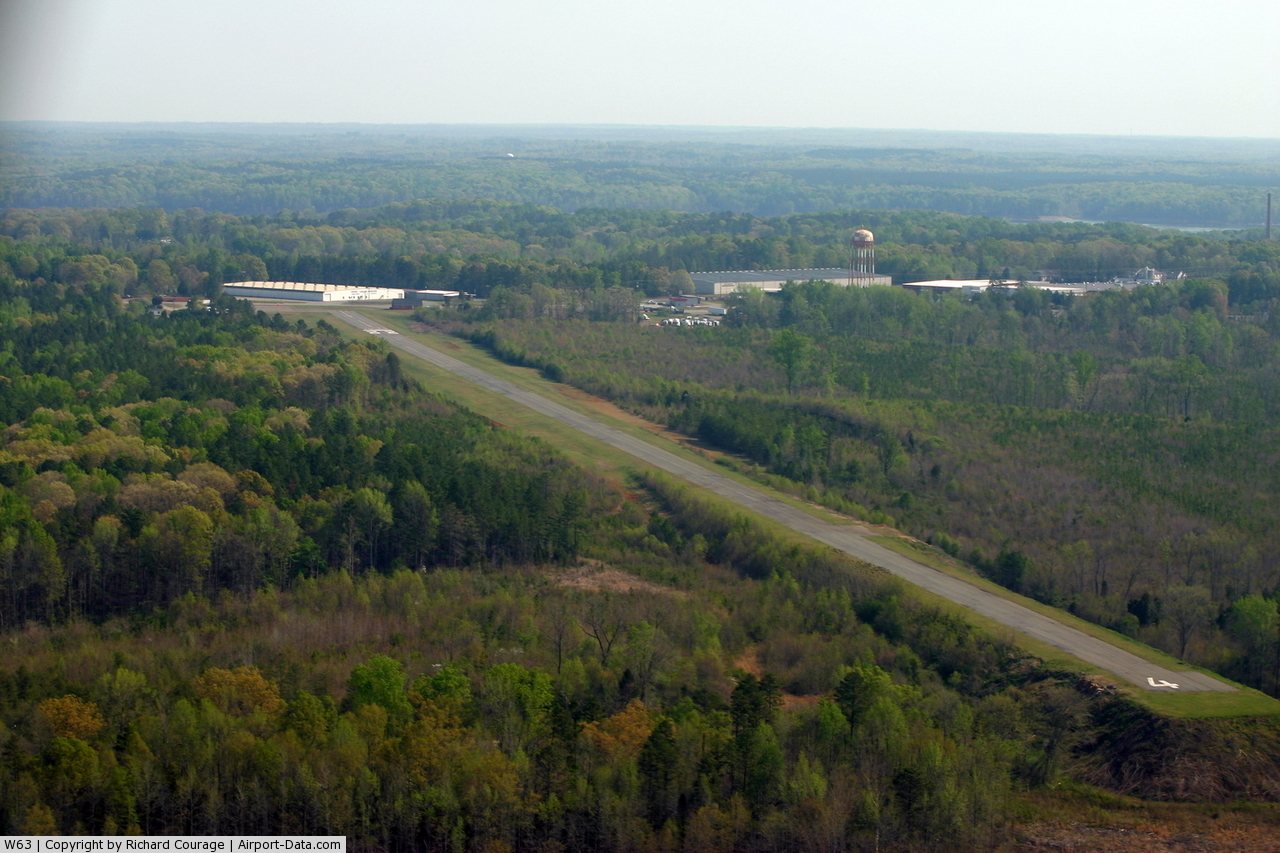
(Click on the photo to enlarge) |
Location & QuickFacts
| FAA Information Effective: | 2008-09-25 |
| Airport Identifier: | W63 |
| Airport Status: | Operational |
| Longitude/Latitude: | 078-33-36.5000W/36-35-44.7000N
-78.560139/36.595750 (Estimated) |
| Elevation: | 421 ft / 128.32 m (Estimated) |
| Land: | 50 acres |
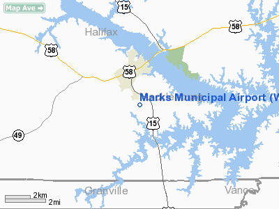
| From nearest city: | 2 nautical miles S of Clarksville, VA |
| Location: | Mecklenburg County, VA |
| Magnetic Variation: | 08W (1995) |
Owner & Manager
| Ownership: | Publicly owned |
| Owner: | Clarksville-boydton Airport Commiss |
| Address: | Marks Municipal Airport, Post Office Box 1047
Clarksville, VA 23927 |
| Phone number: | 434-374-8028 |
| Manager: | Michael Denton |
| Address: | Marks Municipal Airport, Post Office Box 1047
Clarksville, VA 23927 |
| Phone number: | 434-374-8028 |
Airport Operations and Facilities
| Airport Use: | Open to public |
| Wind indicator: | Yes |
| Segmented Circle: | No |
| Control Tower: | No |
| Lighting Schedule: | DUSK-DAWN |
| Beacon Color: | Clear-Green (lighted land airport) |
| Landing fee charge: | No |
| Sectional chart: | Washington |
| Region: | AEA - Eastern |
| Traffic Pattern Alt: | 800 ft |
| Boundary ARTCC: | ZDC - Washington |
| Tie-in FSS: | DCA - Leesburg |
| FSS on Airport: | No |
| FSS Toll Free: | 1-800-WX-BRIEF |
| NOTAMs Facility: | DCA (NOTAM-d service avaliable) |
Airport Communications
Airport Services
| Bottled Oxygen: | NONE |
| Bulk Oxygen: | NONE |
Runway Information
Runway 04/22
| Dimension: | 4488 x 50 ft / 1367.9 x 15.2 m |
| Surface: | ASPH, Fair Condition |
| Weight Limit: | Single wheel: 12500 lbs. |
| Edge Lights: | Medium |
| |
Runway 04 |
Runway 22 |
| Longitude: | 078-33-49.3016W | 078-33-23.7138W |
| Latitude: | 36-35-25.0137N | 36-36-04.2963N |
| Elevation: | 367.00 ft | 419.00 ft |
| Alignment: | 28 | 127 |
| Traffic Pattern: | Left | Left |
| Markings: | Nonstandard, Poor Condition
RY 04 HAS BSC MKGS AND BADLY FADED. | Basic, Poor Condition |
| Displaced threshold: | 0.00 ft | 460.00 ft |
| Obstruction: | 74 ft tree, 1760.0 ft from runway, 406 ft right of centerline, 22:1 slope to clear
RY 04 HAS +20 FT TREES 100 FT OFF THE END FM THLD, BOTH SIDES OF RY WITHIN 200 FT OF CTRLN. | 18 ft road, 200.0 ft from runway
APCH SLOPE 5:1 TO DSPLCD THLD FM +44 FT TREE 458 FT FM DSPLCD THLD, 218 FT L.
HAS +50 TREES 100-170 FT OFF THE END OF RY FM THE THLD, 220 FT R. |
|
Radio Navigation Aids
| ID |
Type |
Name |
Ch |
Freq |
Var |
Dist |
| HXO | NDB | Huntsboro | | 271.00 | 07W | 18.0 nm |
| AEA | NDB | Jones | | 373.00 | 09W | 24.5 nm |
| MBV | NDB | Mecklenburg/dcmsnd | | 356.00 | 08W | 25.0 nm |
| HUR | NDB | Person | | 220.00 | 08W | 32.8 nm |
| BKT | NDB | Blackstone | | 326.00 | 09W | 40.5 nm |
| LE | NDB | Leevy | | 350.00 | 07W | 40.9 nm |
| RZZ | NDB | Rapids | | 407.00 | 08W | 42.2 nm |
| FVX | NDB | Farmville | | 367.00 | 07W | 45.9 nm |
| DAN | VOR | Danville | | 113.10 | 06W | 37.5 nm |
| SBV | VORTAC | South Boston | 041X | 110.40 | 05W | 22.4 nm |
| LVL | VORTAC | Lawrenceville | 076X | 112.90 | 08W | 34.4 nm |
| RDU | VORTAC | Raleigh/durham | 119X | 117.20 | 04W | 44.8 nm |
Images and information placed above are from
http://www.airport-data.com/airport/W63/
We thank them for the data!
| General Info
|
| Country |
United States
|
| State |
VIRGINIA
|
| FAA ID |
W63
|
| Latitude |
36-35-44.705N
|
| Longitude |
078-33-36.480W
|
| Elevation |
421 feet
|
| Near City |
CLARKSVILLE
|
We don't guarantee the information is fresh and accurate. The data may
be wrong or outdated.
For more up-to-date information please refer to other sources.
|
|