 |
|
Location & QuickFacts
| FAA Information Effective: | 2008-09-25 |
| Airport Identifier: | 3VG2 |
| Airport Status: | Operational |
| Longitude/Latitude: | 075-53-33.0000W/37-23-18.0000N
-75.892500/37.388333 (Estimated) |
| Elevation: | 36 ft / 10.97 m (Estimated) |
| Land: | 176 acres |
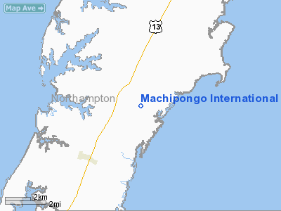
| From nearest city: | 2 nautical miles SE of Machipongo, VA |
| Location: | Northampton County, VA |
| Magnetic Variation: | () |
Owner & Manager
| Ownership: | Privately owned |
| Owner: | Patrick Hand |
| Address: | 2242 Arlington Chase
Cape Charles, VA 23310 |
| Phone number: | 757-331-1959 |
| Manager: | Patrick Hand |
| Address: | 2242 Arlington Chase
Cape Charles, VA 23310 |
| Phone number: | 757-331-1959 |
Airport Operations and Facilities
| Airport Use: | Private |
| Control Tower: | No |
| Sectional chart: | Washington |
| Region: | AEA - Eastern |
| Boundary ARTCC: | ZDC - Washington |
| Tie-in FSS: | DCA - Leesburg |
| FSS Toll Free: | 1-800-WX-BRIEF |
Runway Information
Runway 10/28
| Dimension: | 2800 x 60 ft / 853.4 x 18.3 m |
| Surface: | TURF, |
| |
Runway 10 |
Runway 28 |
| Traffic Pattern: | Left | Left |
|
Radio Navigation Aids
| ID |
Type |
Name |
Ch |
Freq |
Var |
Dist |
| BDB | NDB | Accomack | | 336.00 | 11W | 11.8 nm |
| PJS | NDB | Henry | | 375.00 | 09W | 32.6 nm |
| FAF | NDB | Felker | | 226.00 | 08W | 37.8 nm |
| PVG | NDB | Portsmouth | | 241.00 | 10W | 45.2 nm |
| LFI | TACAN | Langley | 070X | | 10W | 28.8 nm |
| NGU | TACAN | Chambers | 048X | | 10W | 32.6 nm |
| NTU | TACAN | Oceana | 113X | | 10W | 34.6 nm |
| CCV | VORTAC | Cape Charles | 059X | 112.20 | 10W | 5.6 nm |
| ORF | VORTAC | Norfolk | 116X | 116.90 | 07W | 33.3 nm |
| HCM | VORTAC | Harcum | 025X | 108.80 | 07W | 39.3 nm |
| SWL | VORTAC | Snow Hill | 071X | 112.40 | 08W | 45.0 nm |
Remarks
- 30 FT PLINE 300 FT WEST OF RY.
- PRVDD VFR OPS, PVT USE.
Images and information placed above are from
http://www.airport-data.com/airport/3VG2/
We thank them for the data!
|
|


